CORPUS CHRISTI, Texas — 10AM UPDATE
Delta's landfall in Western Louisiana Friday, 13 miles east of where Laura hit in late August, set a few records.
1) It was the first Greek Alphabet hurricane to strike the U.S.
2) It was the 10th landfalling tropical storm or hurricane (named storm) to hit the U.S., breaking the old record of 9 (1916).
Wild that Louisiana has been hit FOUR TIMES this year, while Florida has not had any landfalls (impacts from Sally). Florida has over three times the amount of coastline and in a much more vulnerable spot.
6 PM Update:
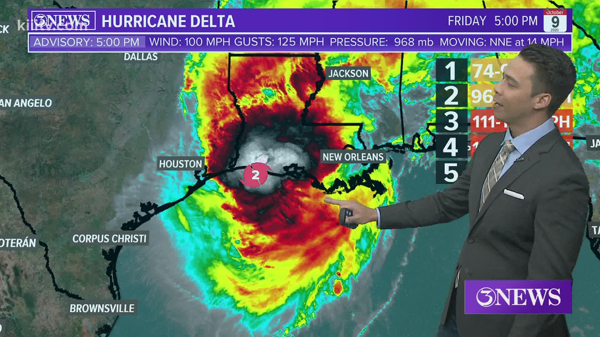
Hurricane Delta makes landfall near Creole, Louisiana as a Category 2 Hurricane. Damaging winds and storm surge continue over the coast of Louisiana.
RELATED: Lubbock man dies after family is swept from Packery Channel's North Jetty, rescued from rough waters
10AM Update:
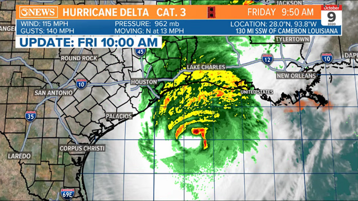
Hurricane Delta has weakened a touch, but is maintaining category 3 status with 115 mph sustained winds. Moving north at 13 mph and about 130 miles away from the Louisiana coastline.

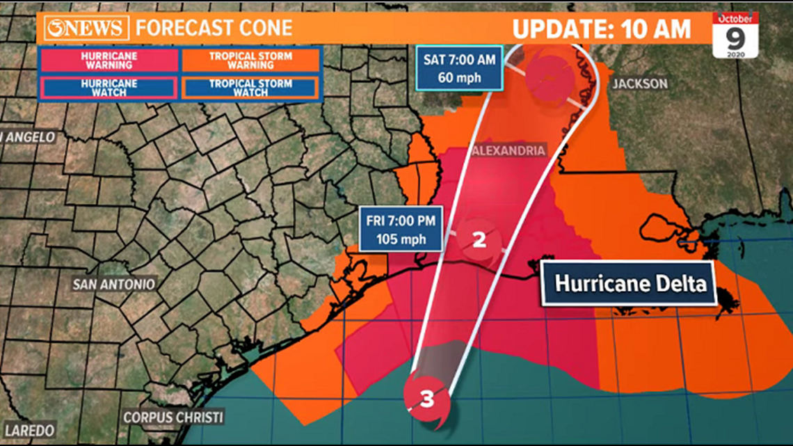
Delta will interact with some wind shear and weaken, slightly between now and landfall late afternoon/early evening. Forecast to be a category 2 with 105 mph winds at landfall.

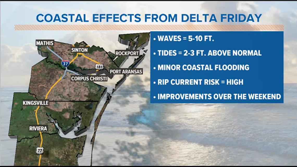
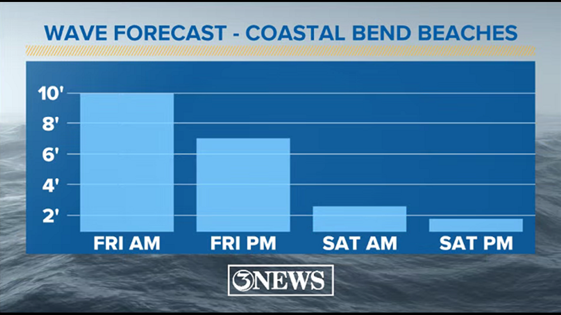
For the Coastal Bend, only a stray shower or two in coastal counties from the outer fringes of the storm today. Coastal side effects = 5-10 ft. waves, 2-3 ft. above normal tides, coastal flooding, and a high risk for rip currents. Surf settles down this weekend.


Holt, out
9AM UPDATE:
Wave heights are currently running between 6 and 8 ft. in the Coastal Bend. Over 20ft. waves off-shore, closer to the center of Delta. Wave heights will return to normal levels, Saturday.
4AM Update:
Hurricane Delta is a category 3 storm, producing 120 mph sustained winds; gusts to 150 mph. The center is about 200 miles off shore from Corpus Christi. North movement is noted.

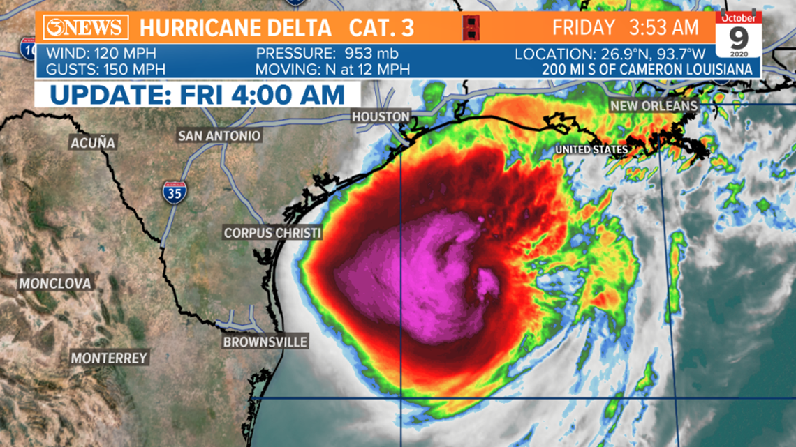
A north, to northeast track will take place today, making landfall in Western Louisiana. Wind shear and slightly cooler SSTs will weaken Delta to a category 2 storm prior to landfall. This will be a powerful and dangerous storm.

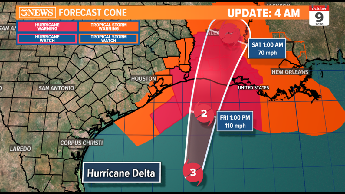
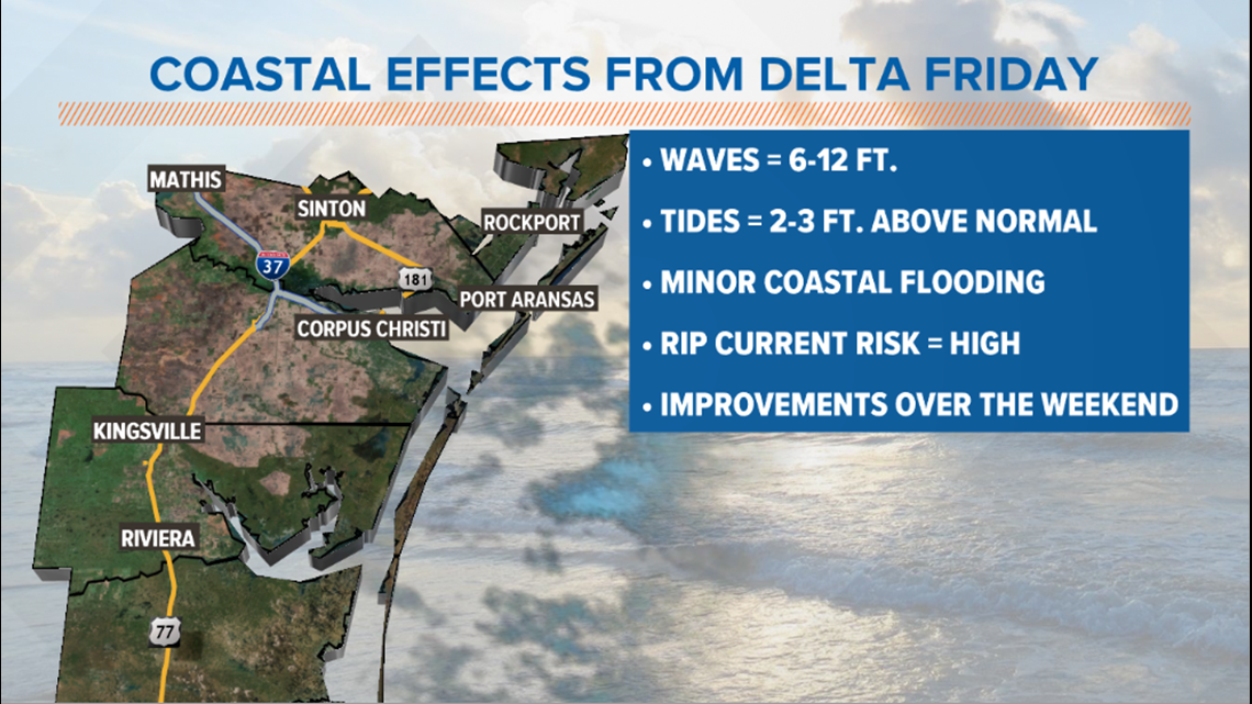
Effects in the Coastal Bend will be in coastal areas. Higher waves & tides will lead to coastal flooding. High risk for dangerous rip currents. A few stray showers possible Friday morning.

Holt, out.
10 PM UPDATE
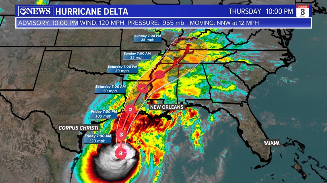
Some strengthening from Hurricane Delta in this last update. Drop in pressure and an increase in sustained wind speed.
MAXIMUM SUSTAINED WINDS - 120 MPH
MOVEMENT - N-NW AT 12 MPH
MINIMUM CENTRAL PRESSURE - 955 MB

4 PM UPDATE
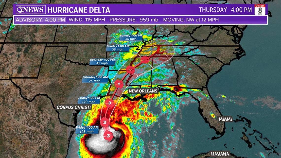
Delta is now a major hurricane at Category 3 strength. Max winds at 115 MPH with higher wind gusts. Forecast track with no major change focusing on western Louisiana. Movement is 12 MPH to the Northwest. A trough of low pressure is still expected to guide Delta to the north and away from the Coastal Bend.

10AM Update
Hurricane Delta continues to re-strengthen in the Western Gulf of Mexico. An eye is developing and wind speeds are at 105mph, sustained - category 2. Moving northwest at 14 mph.

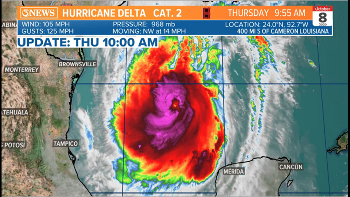
Delta will reach major hurricane strength (category 3), then weaken Friday on approach to the Western Louisiana coastline. Forecast to make landfall Friday evening as a category 2 hurricane. Wind shear and SSTs<80 the factors weakening Delta, slightly.

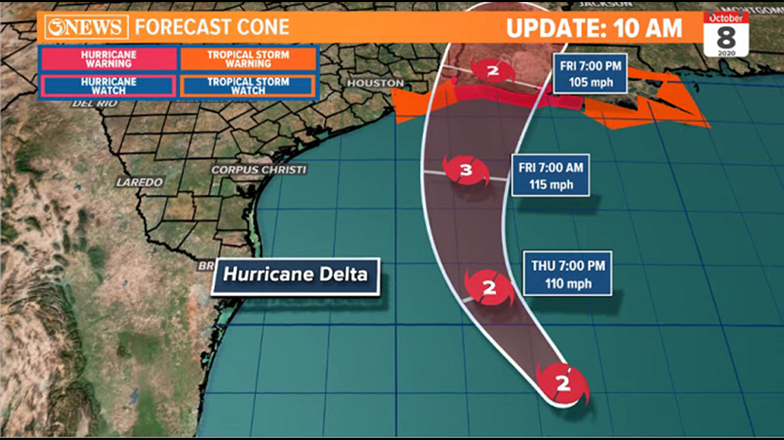
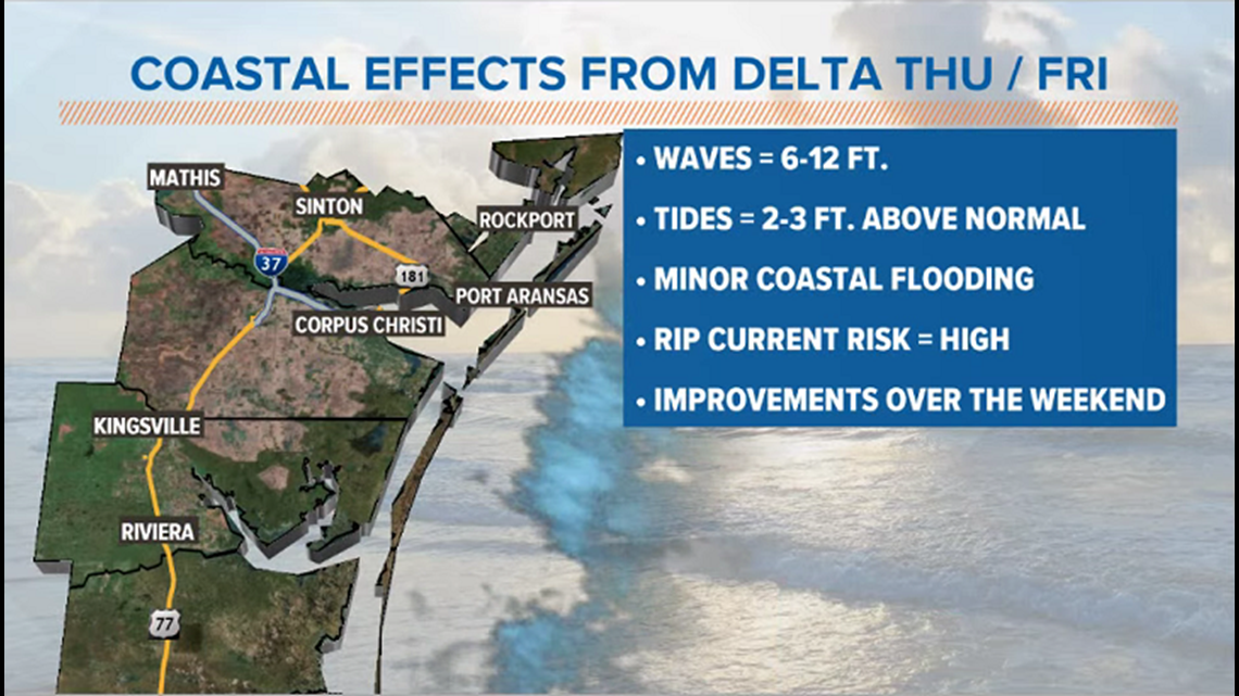
For the Coastal Bend, effects will be coastal as Delta stays about 200 miles off-shore. Expect 6-12 ft. waves, higher than normal tides (2-3 ft.). and coastal flooding. Dangerous rip current risk is high. Beach conditions will gradually improve over the weekend

Holt out
4AM Tropical Update (Oct. 8)

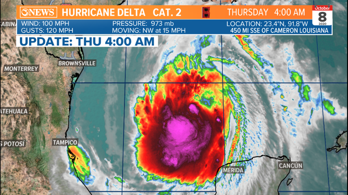
Delta is a growing category 2 hurricane in the Bay of Campeche. 100 mph sustained winds and moving northwest at 15 mph.
Delta will move northwest and strengthen to major hurricane status tonight. High pressure to the east and a low pressure feature over Texas will bend Delta toward Louisiana Friday. SSTs < 80 and some wind shear in the northern gulf are forecast to weaken Delta to a category 2 prior to landfall in Louisiana, Friday afternoon. It'll still be a dangerous storm.

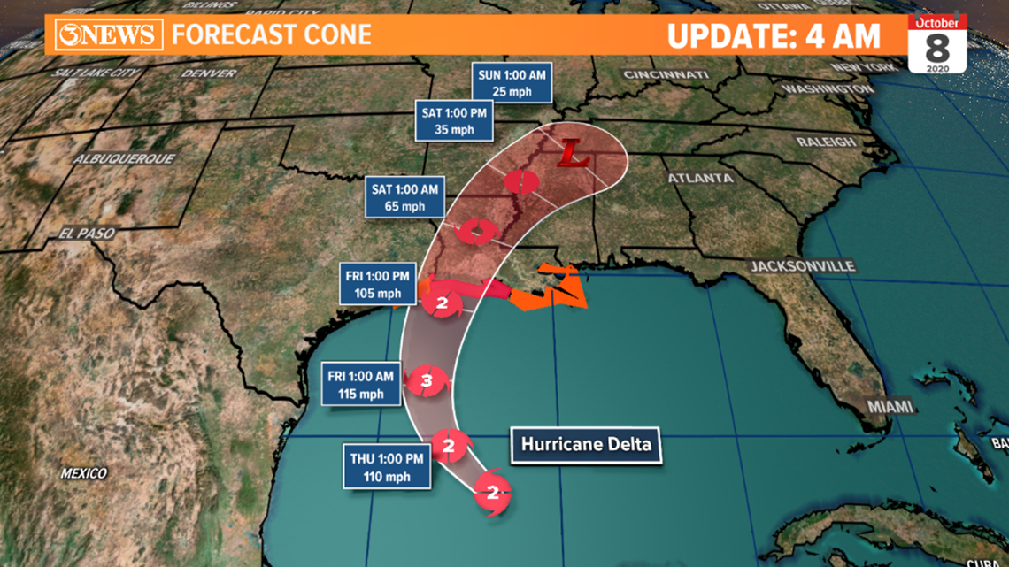

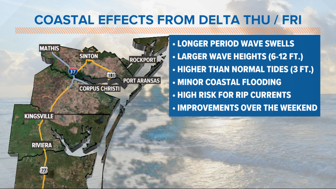
In the Coastal Bend, impacts will be limited to coastal areas. Tropical storm force wind speeds will stay off-shore. North winds at 10-20 mph with gusts up to 30 mph will be possible Thursday and Friday. Waves will run 6-12 ft on area beaches (they over 20 ft. at the storm's center). Couple that with higher than normal tides (3ft) and water will be up to the dunes on beaches. Lower lying coastal areas may experience inundation, too. High risk for dangerous rip currents.

Holt, out
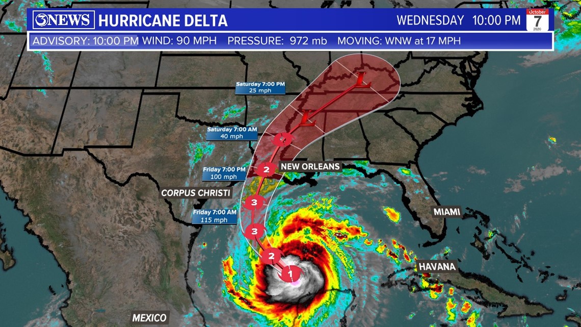
UPDATE - 10 PM
MAXIMUM SUSTAINED WINDS - 90 MPH
MOVEMENT - WNW AT 17 MPH
MINIMUM CENTRAL PRESSURE - 972 MB
Delta is a strong-end Category 1 Hurricane tonight.
Aircraft recon showing a drop in pressure in Hurricane Delta indicating strengthening tonight. Sustained wind speeds near Category 2 strength at 90 MPH as of the 10 PM update. In addition, strong thunderstorm activity building on the northern side with a small eye starting to show in the latest satellite scans. Will continue to watch trends of Delta as it traverses through the gulf.

UPDATE - 4 PM
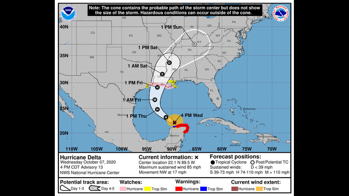
Earlier land interaction this morning has brought Delta down to a Category 1 this evening. However, expected to strengthen through Friday as it aims its sights on Louisiana.
MAXIMUM SUSTAINED WINDS - 85 MPH
MOVEMENT - NORTHWEST AT 17 MPH
CENTRAL PRESSURE - 977 MB

UPDATE - 10AM
Delta is a category 2 hurricane over the northern Yucatan Peninsula; 105 mph sustained winds. It's moving northwest at 17mph.

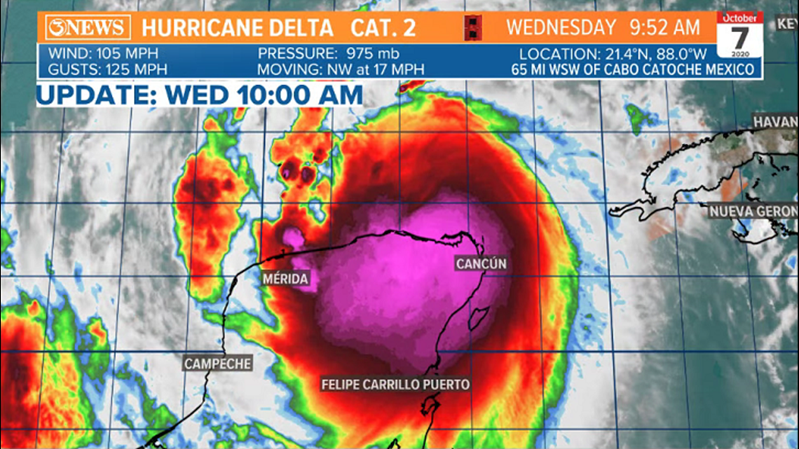
Delta will move into the Gulf of Mexico later today, where re-intensification will take place. Back to major hurricane status by Thursday. Delta will turn north and then slightly east of north on Thursday and Friday. As Delta approaches Louisiana, wind shear and SSTs<80 should weak Delta by landfall. Still, a dangerous category 2/3 storm in Louisiana. Parts of SE Texas are included in the cone.

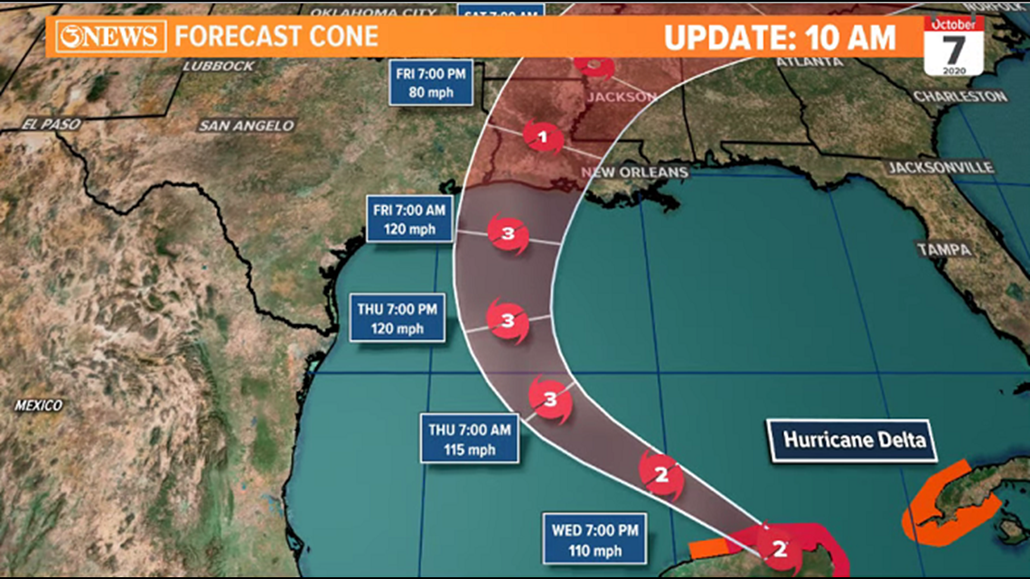
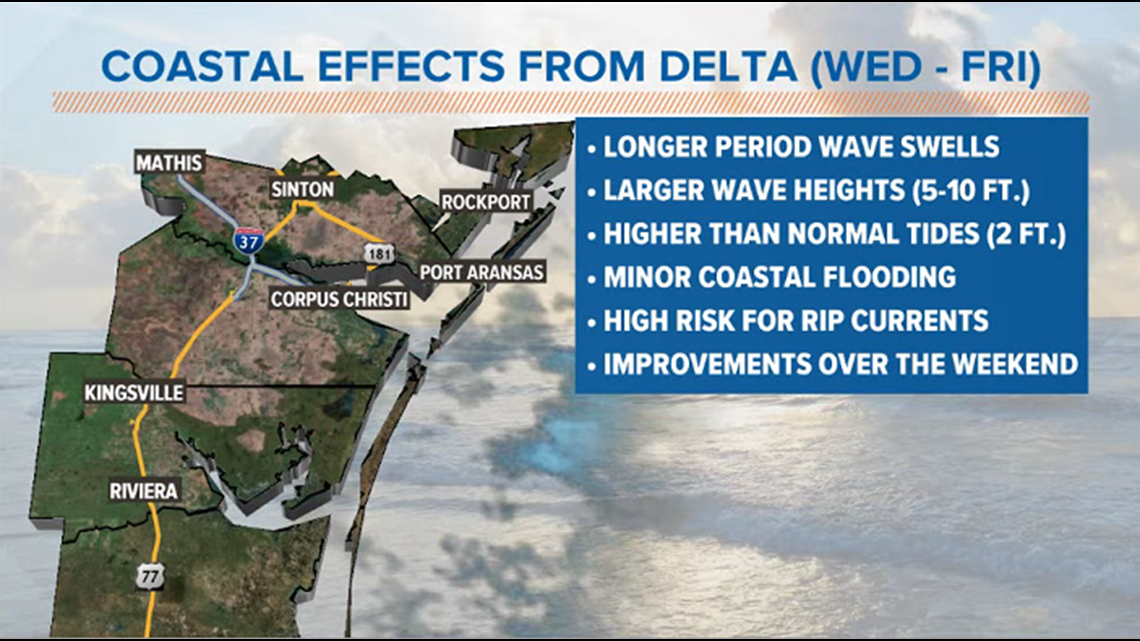
As Delta passes by the South Texas Gulf Coast, impacts will be confined to the coast. Rough surf, high risk for rip currents, 5-10 ft waves (10-20 ft. off-shore), higher than normal tides, and coastal flooding all expected. Gradual improvements over the weekend. Outside of a stray shower Thursday/Friday, rain chances are low, locally.

UPDATE - 4AM
Hurricane Delta is a major hurricane with 115 mph winds,striking the Northern Yucatan this morning. It's moving NW at 17 mph.

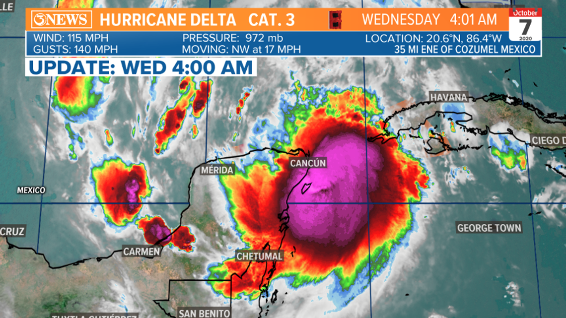
Delta will be downgraded to a category 2 as it works over the Yucatan today, regaining strength as it re-emerges back over warm gulf waters. It'll re-gain major hurricane status Thursday/Friday as it works around high pressure over Florida. A trough over Texas will help guide/turn Delta toward Louisiana Friday. SSTs in the upper 70s and some wind shear will weaken Delta prior to landfall, Friday - could still be category 2/3, which is still plenty dangerous.

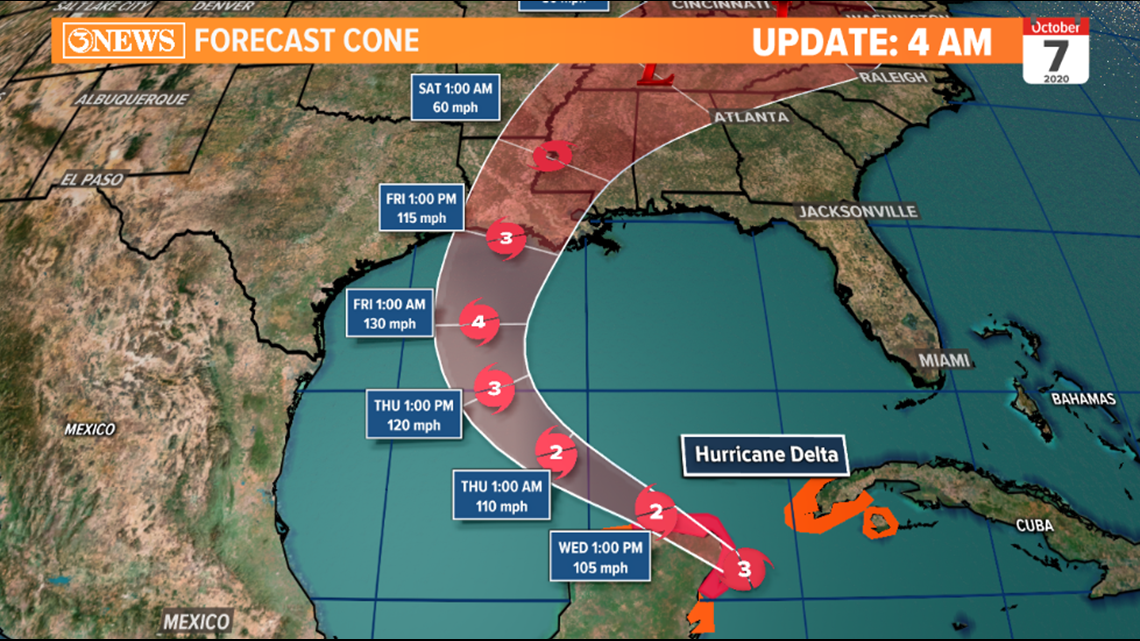

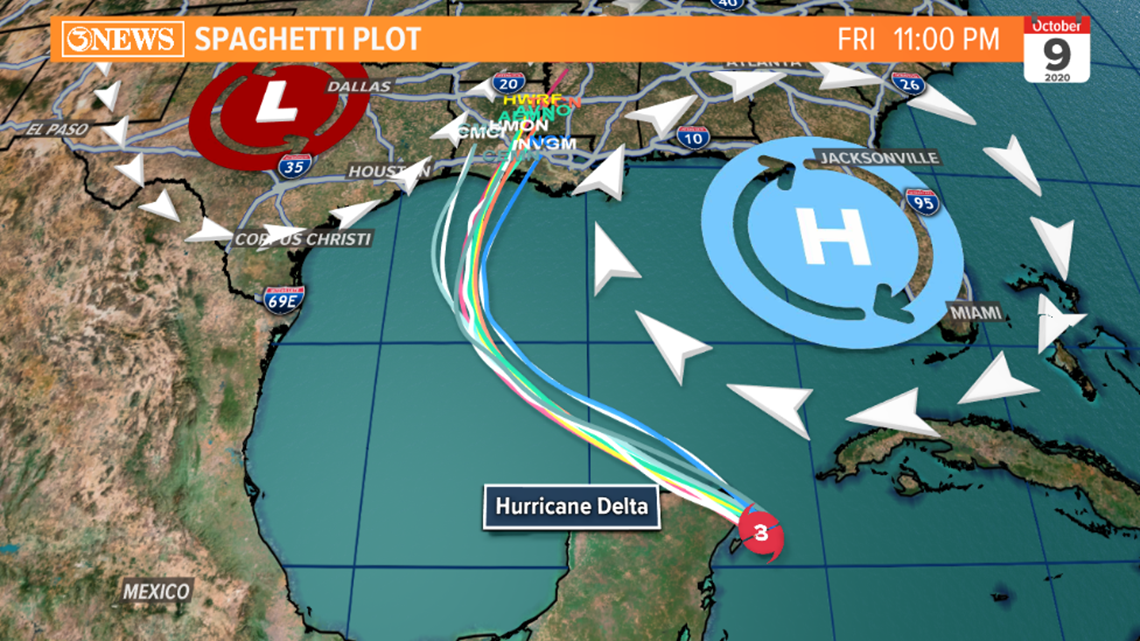
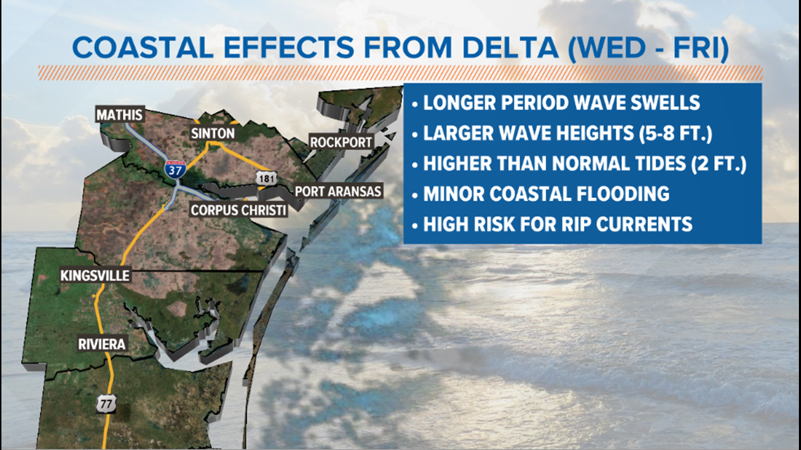
Delta's impacts to the Coastal Bend will be confined to coastal low lying areas and beaches. Minor coastal flooding due to higher than normal tides and waves. High risk for rip currents in area waters. Gulf settles down gradually over the weekend, post landfall. We'll also see a few more clouds between now and Friday...a slim shot a stray shower working in from the north, but rain will be hard to come by, locally.

- Holt, out
UPDATE 4:00 PM
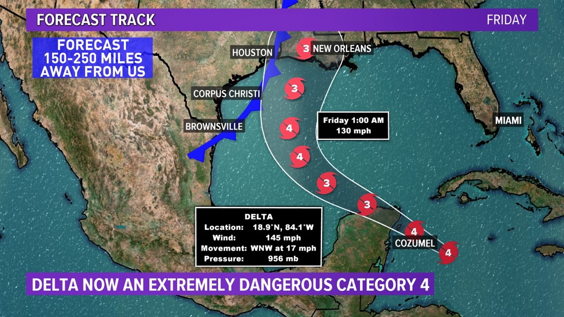
Hurricane Delta now an extremely dangerous category 4 with 145 mph winds. Tight 4 mile wide eye. Thunderstorms in the eyewall. Heading for northern Gulf coast (in the Mississippi Delta region & not far from Laura landfall.) Forecast track keeps it 150-300 miles to our east (average track error this far out is 120 miles) with a 10% chance of tropical storm force winds here.
Texas Coastal Bend impacts remain bigger waves, higher tides, minor coastal flooding, and strong rip currents.

UPDATE: 10:20AM
Delta is now a category 4 hurricane

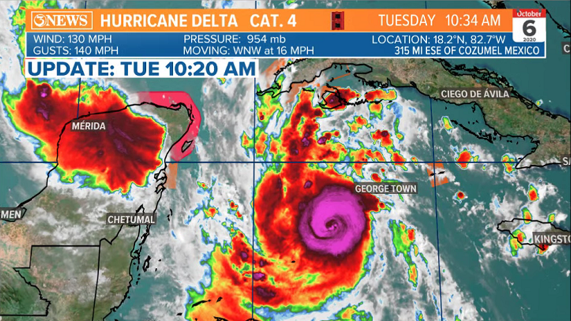
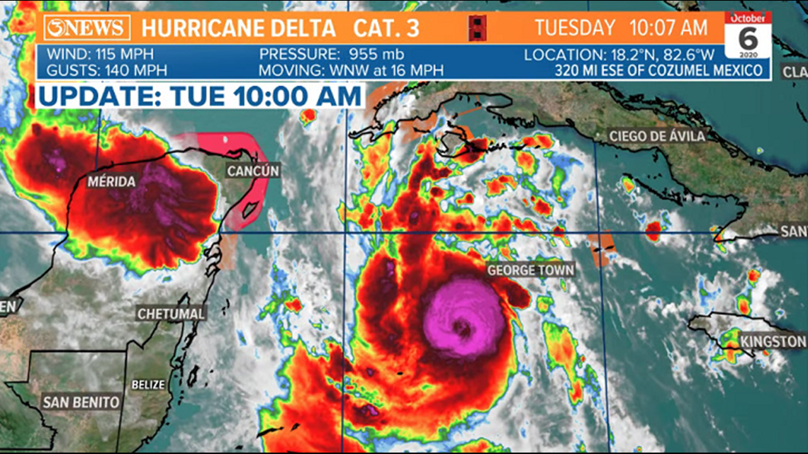
UPDATE: 10AM, Oct. 6
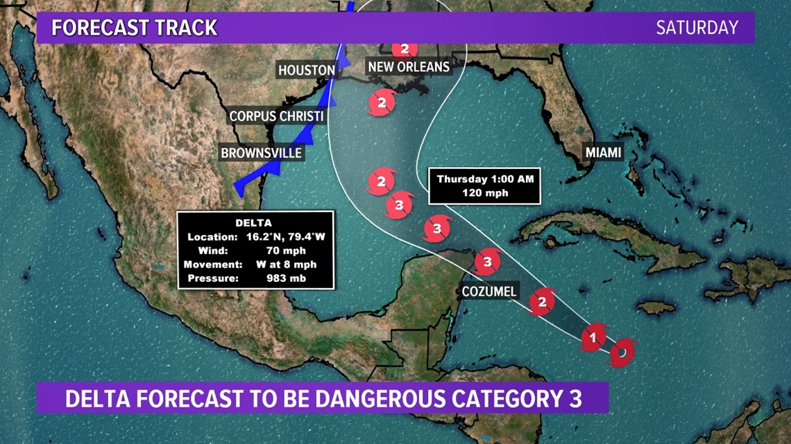
Hurricane Delta is now a major hurricane. A category 3 storm with 115 mph winds. Delta has rapidly strengthened over the last 24 hours and will continue today. Delta is moving WNW at 16mph, about 300 miles away from Cozumel, MX. Gamma has fallen apart.

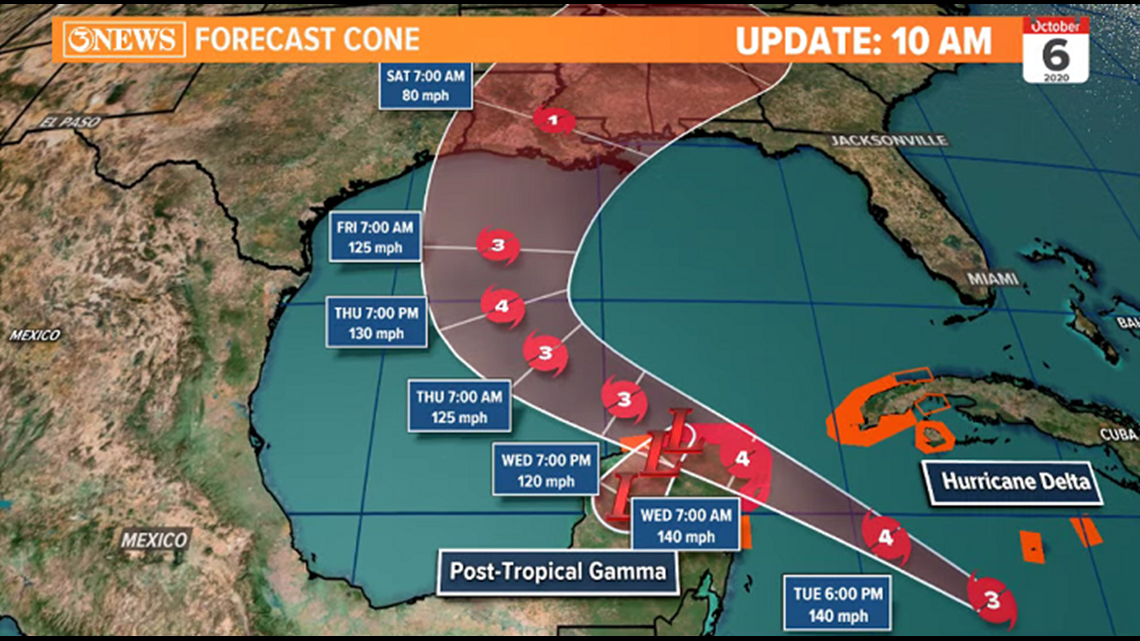
Delta is forecast to clip the northern Yucatan, near Cancun, as a major, category 4 hurricane. Slight weakening with interaction over the Yucatan, but maintaining major hurricane status in the Central and Western Gulf of Mexico. As Delta moves north, bending around high pressure over Florida and getting picked up by a weak trough to the north, it'll start to interact with wind shear in the northern Gulf. That, and SSTs in the 70s thanks to early season cold fronts should have a weakening effect on Delta. However, a category 2 at landfall Friday night would still be dangerous. Looks like it'll be somewhere in Louisiana (4th storm in that state this year if it happens).

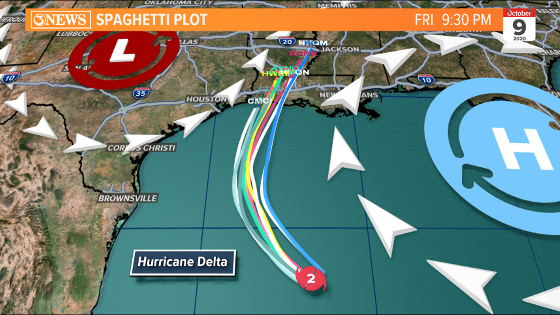
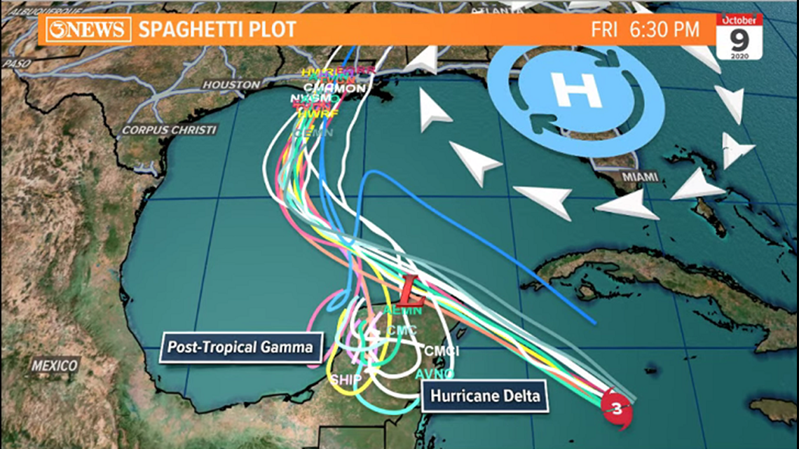
With this storm on a path toward the Coastal Bend and turning north several hundred miles off-shore, it seems like a precarious situation locally, but forecast track guidance has been in good agreement with this storm. You can see continued congruency on the spaghetti plot.

Side effects like higher than normal waves/tides, minor coastal flooding, and a high risk for rip currents will all be in play Wednesday through Friday. Settling down over the weekend, after landfall Friday night.
Holt, out.
UPDATE: 4AM, Oct. 6

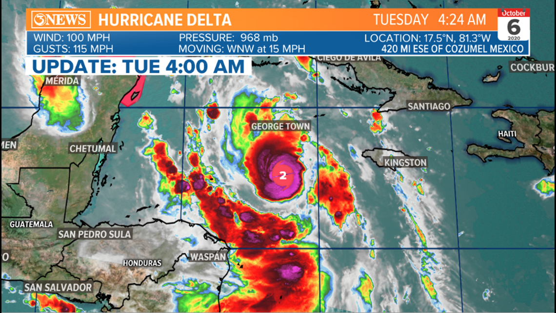
Hurricane Delta is a rapidly intensifying storm in the Caribbean Sea. A category 2 producing 100 mph winds. It's moving WNW at 15 mph. Delta may strike the Yucatan, near Cancun, as a major hurricane tonight, before getting into the Gulf of Mexico. Gamma is now a post tropical, remnant low.

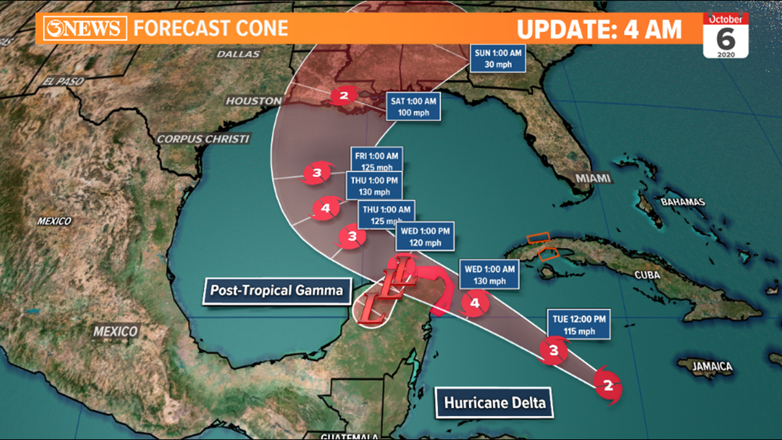
Delta is forecast to move northwest, then bend around high pressure over Florida as it moves north, through the remainder of the week. Current forecast cone brings Delta into the Northern Gulf States Friday night as a category 2 hurricane. Water temperatures in the 70s and increasing wind shear will hopefully weak Delta a little prior to landfall.

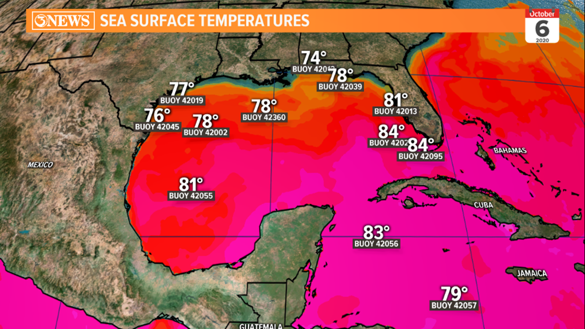
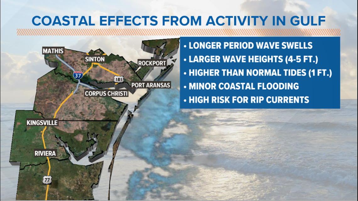
As Hurricane Delta scoots through the middle of the Gulf of Mexico, it'll pass by about 200-300 miles off our coast line. This will send in some clouds Wednesday through Friday. It'll also churn gulf waters, causing some flooding on area beaches and coastal low lying areas. Larger waves and longer period swells will also create a high risk for rip currents. Effects should settle after landfall, Friday. It's mainly sunny, hot, humid, and breezy into the weekend for the Coastal Bend.

- Holt, out
10 PM UPDATE
Hurricane Delta continues to rapidly strengthen with winds now at 80 mph. At least a dangerous Category 3 by Tuesday night. It's heading for the Northern Gulf Coast. No direct impacts are expected for the Coastal Bend.
7 PM UPDATE
We now have Hurricane Delta after Hurricane Hunters report #Delta has a closed eye. Thunderstorms are firing up on the east side of the eyewall. Pressure dropping. Wind speed up to 75 mph. Rapid intensification will continue tonight.
4 PM UPDATE
Tropical Storm #Delta is rapidly strengthening with sustained winds at 70 mph. It's forecast to be a dangerous Category 3 Hurricane by midweek, heading for northern Gulf coast. No direct impacts are expected for the Coastal Bend.
Delta has had a significant drop in pressure indicating signs of strength this afternoon. In addition, the structure of the storm looks healthy from above. It's getting that 'look' with a stronger circulation. With warm water ahead, rapid intensification may be underway.

10 AM Tropical Update (Oct. 5)

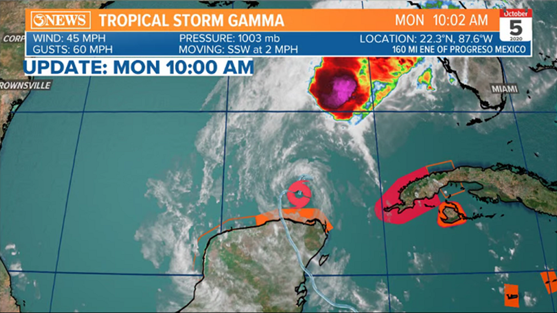
Tropical Storm Gamma is an unhealthy storm, getting torn up by wind shear. Now a 45 mph tropical storm and drifting southwest at 2mph. Delta is a storm becoming more organized and prime for strengthening/intensification. While both storms currently have 45 mph sustained winds, Delta will be the dominant storm as it moves NW.

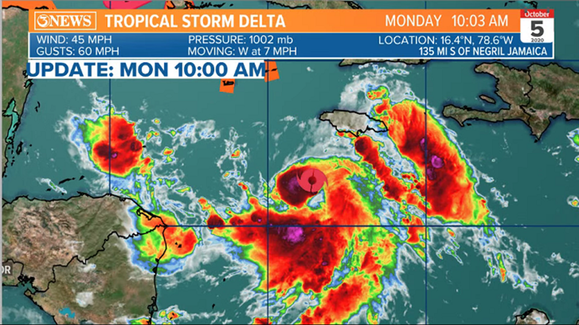
Tropical Storm Delta will move northwest and could be a hurricane as early as today, or Tuesday. Delta will enter the Gulf of Mexico and curve north, around high pressure over Florida. An interesting interaction with the remnants of Gamma, where Gamma could get absorbed into Delta as it passes by. If not, Gamma just falls apart over the Yucatan. Either way, Delta is forecast to strengthen to a category 2 hurricane prior to making landfall in the northern gulf, Friday.

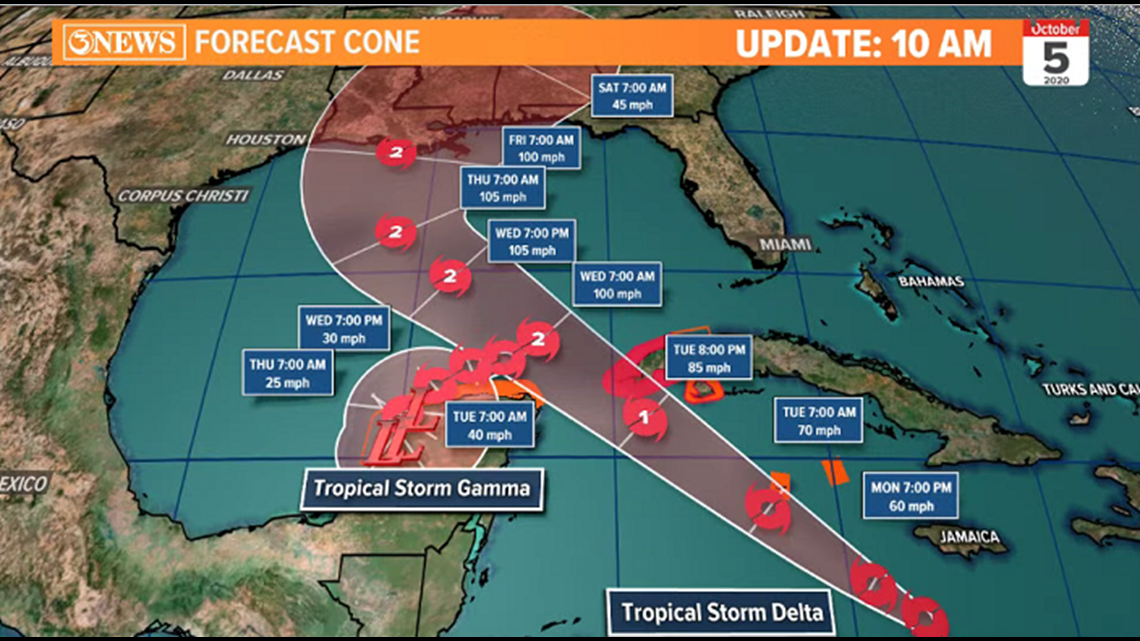

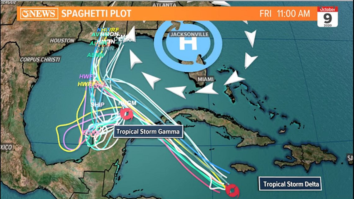
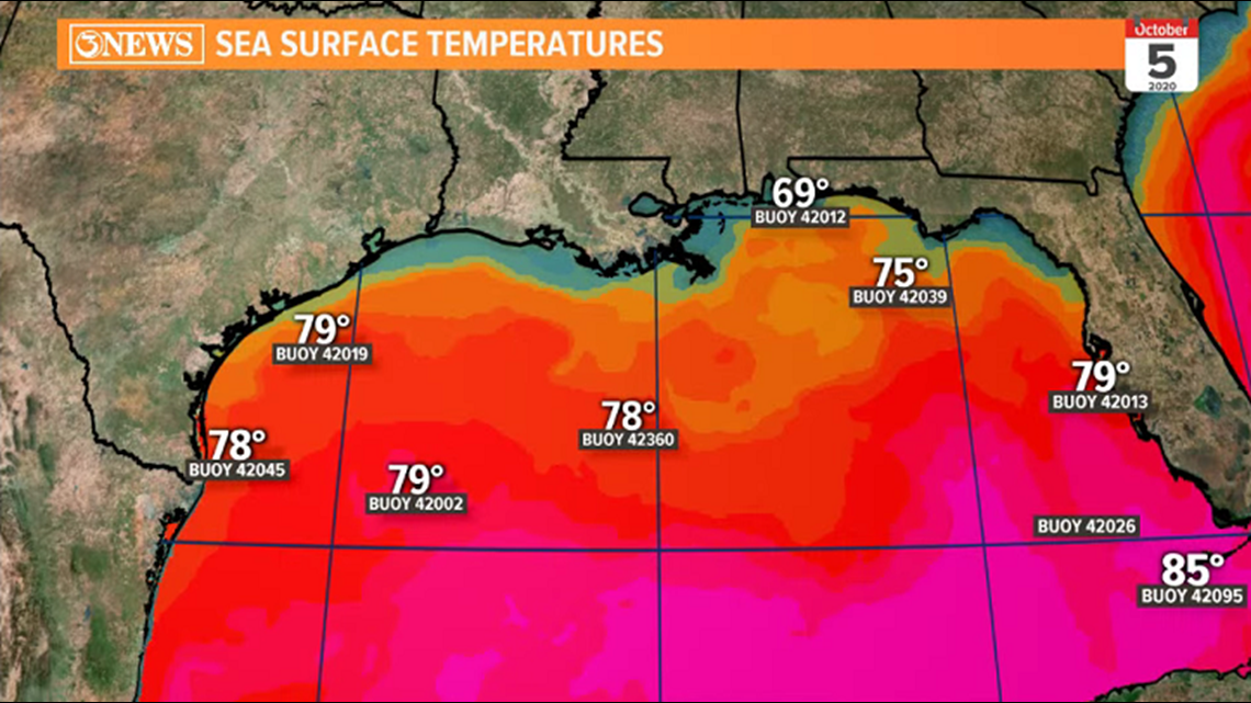
Sea surface temperatures in the northern gulf have cooled into the 70s, thanks to some early fall cold fronts. This may prevent Delta from rapidly strengthening prior to landfall later this week.

These storms do not pose a threat to the Coastal Bend, other than minor coastal impacts. larger than normal swells, tides, and some minor coastal flooding. High risk for rip currents, too. We will continue to update as needed with any changes.
Holt, out
UPDATE: 7AM, Oct. 5
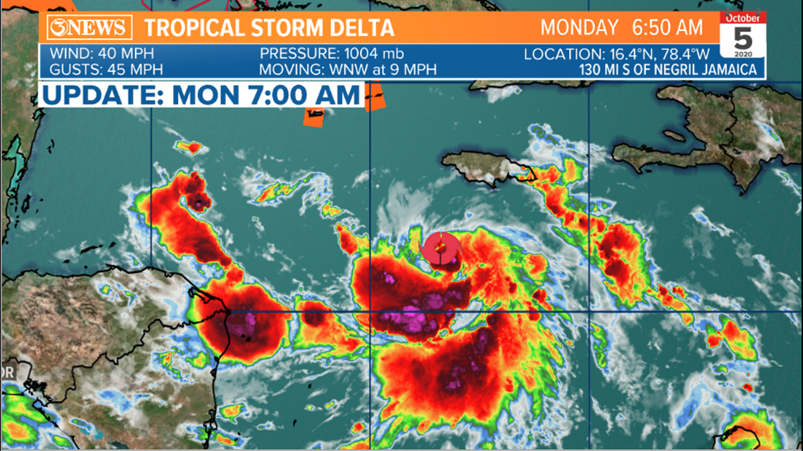
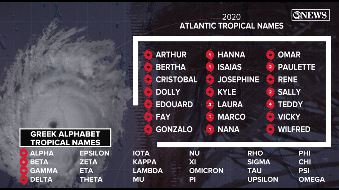
7AM - TROPICAL STORM DELTA develops in the Caribbean Sea. This is the 25th named storm in the 2020 season. The farthest we've been into the Greek Alphabet is Zeta (27 named storms in 2005).


Holt, out
UPDATE: 5AM - Oct. 5
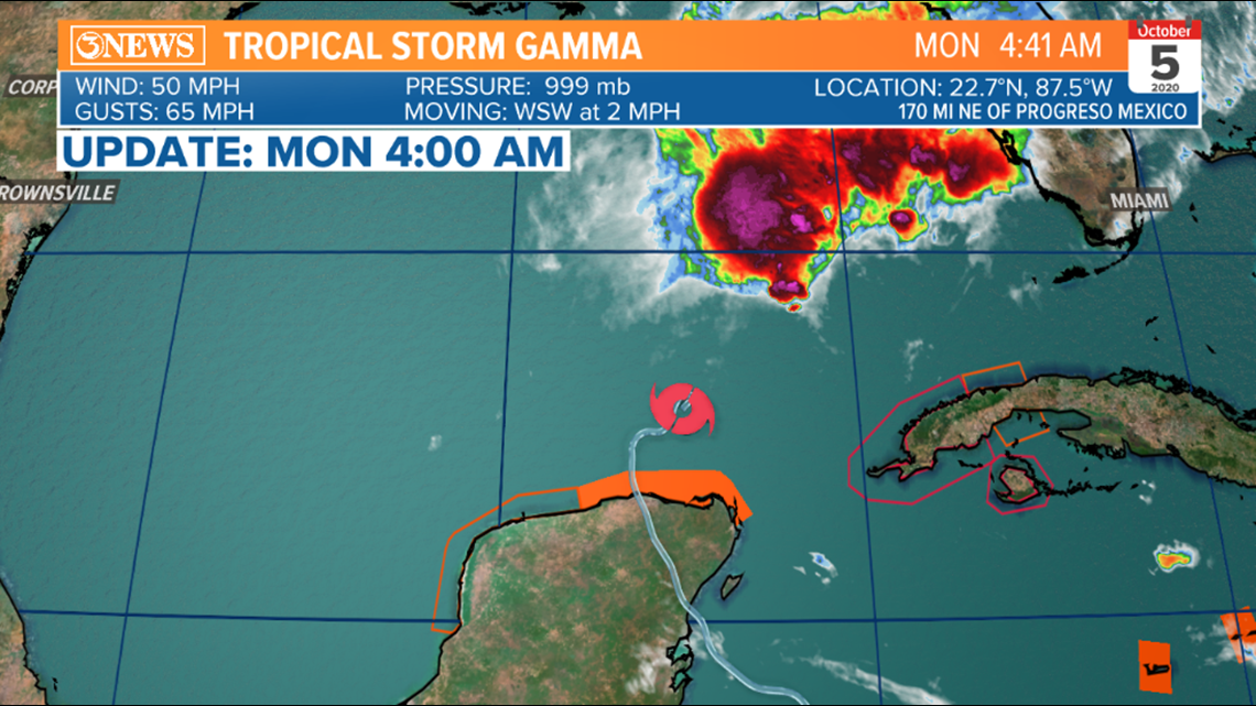
Tropical Storm Gamma is a 50 mph tropical storm, resting just north of the Yucatan Peninsula in the Southern Gulf of Mexico. This storm will drift west or southwest over the coming days and will likely not strengthen as it interacts with wind shear coming in from the southwest.


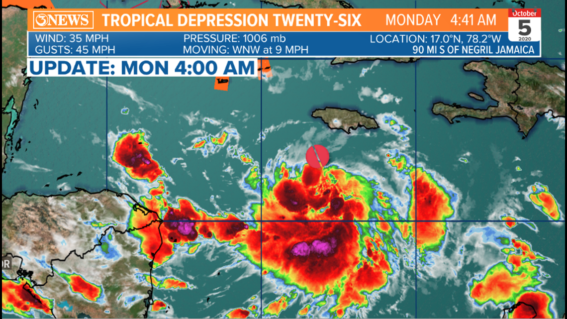
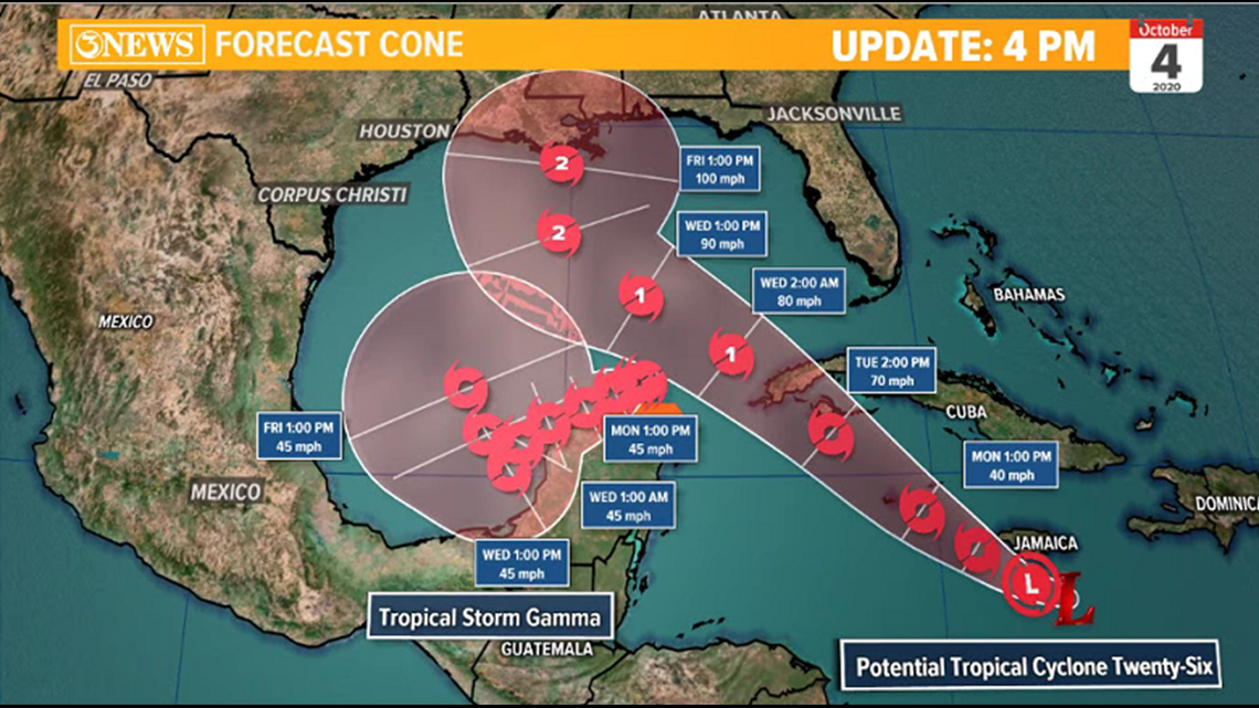
Tropical Depression 26 is a budding tropical system and is forecast to be the stronger of the two. It's in the Central Caribbean this morning and has 35 mph. Moving WNW at 9 mph.

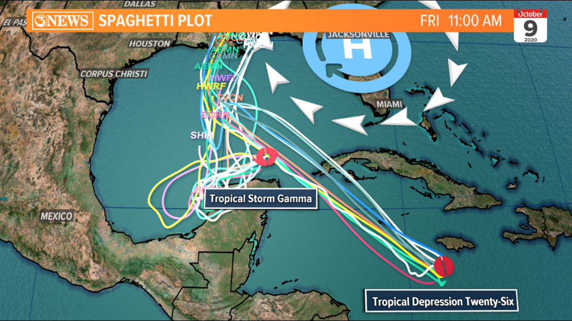

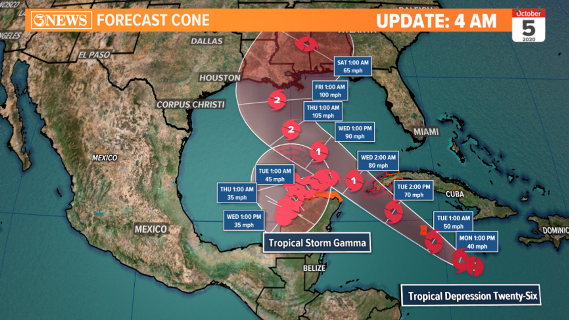
Tropical Depression 26 will continue to the northwest, reaching tropical storm status Monday (Delta) and eventually strengthen to a category 1 hurricane as it enters the gulf on Wednesday. As Delta enters the gulf, forecast models are indicating an interaction with a weakening Tropical Storm Gamma. As this happens, Delta may veer west and 'absorb' a weakening Gamma. This wouldn't cause Delta to strengthen, explicitly, but Delta is forecast to reach category 2 hurricane status en route to the northern gulf states Friday.
Note: Sea-surface temperatures have cooled into the upper 70s in the northern gulf.

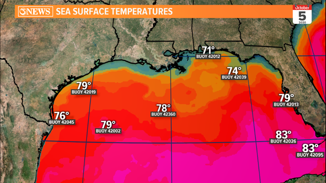


For the Coastal Bend, this forecast would mean minor side effects. Longer period swells and larger waves leading to minor coastal flooding and increased risk for rip currents.
Holt, out
10 PM UPDATE
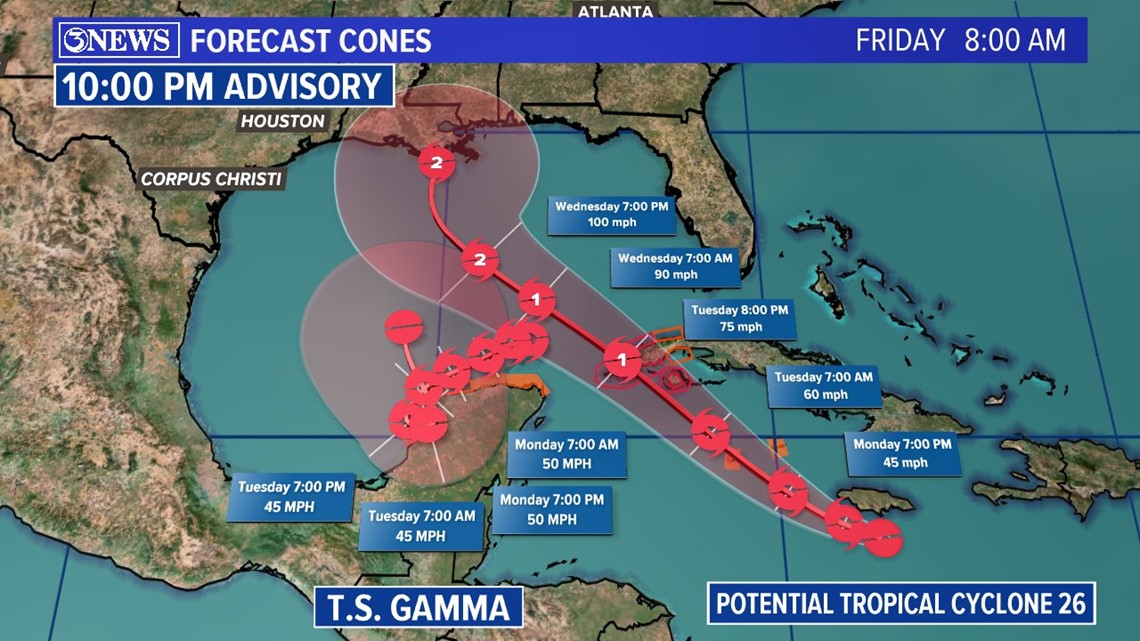
Tropical Depression 26
Maximum sustained winds are near 35 mph with higher gusts. Strengthening is expected during the next few days and the system is forecast to be a tropical storm when it nears the Cayman Islands on Monday, and a hurricane when it moves near or over western Cuba on Tuesday.
Tropical Storm Gamma
Maximum sustained winds are near 60 mph with higher gusts. Some weakening is forecast during the next 48 hours. Gradual weakening is anticipated to begin on Monday and continue into Tuesday. Afterward, little change in strength is forecast.

4 PM UPDATE
National Hurricane Center will initiate advisories on Potential Tropical Cyclone 26, located in the Central Caribbean Sea.
Computer models have this system moving closer to the northern gulf states through next Friday. Depending on the strength and placement of steering currents will dictate the exact path and track of PTC 26.

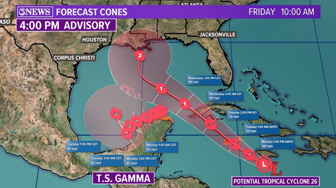

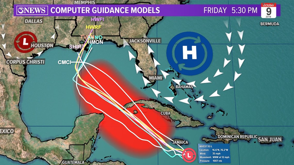
It looks like we'll have two named storms in the Gulf next week, Gamma in the Bay of Campeche and what should be Delta running through the Central Gulf. I would say Delta looks like the Alpha of the two, but that's now confusing; so, suffice to say, Delta will be the stronger storm, reaching Category 2 hurricane status prior to a possible landfall in the Northern Gulf late next week.
With two named systems in the gulf, uncertainty beyond Wednesday is high. We'll have to see how this unfolds the next few days. If the spaghetti plot in previous post is correct, neither of these would be a threat to the Coastal Bend, directly. Will have to stay up to date on these storms as the forecast will undoubtedly shift around in the coming days.

7 PM UPDATE
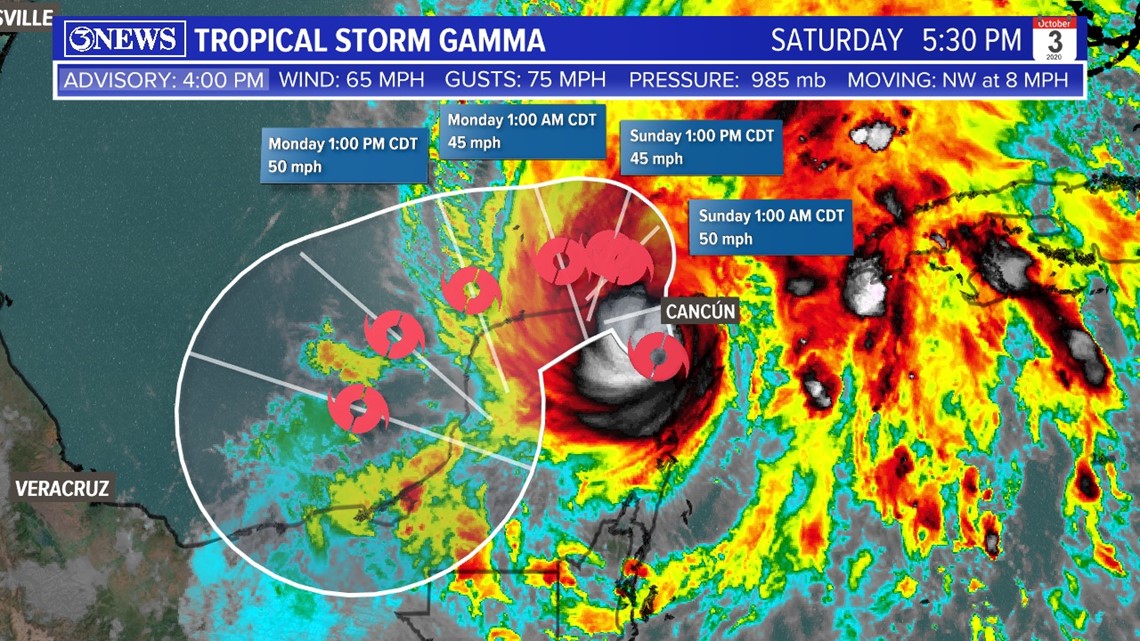
Gamma continues to interact with land tonight over the Yucatan keeping it weak. Max winds at 65 MPH. Expected to push closer to southern Mexico and Bay of Campeche through next week.

Tropical Wave in the Central Caribbean now has a 70% at formation over the next 5 days. This will continue to be monitored closely as it moves into the Gulf of Mexico next week.

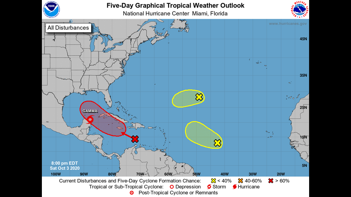
October 3
In addition to Tropical Storm Gamma moving into the Yucatán, we’re watching three tropical waves. The wave in the Central Caribbean Sea will be watched closely through next week. It has a medium chance at development over the next five days.
Next name on the list? Delta.
Tropical Storm Gamma now has a 50% chance of developing. It could get big next week anywhere from Louisiana to Florida.
7 PM UPDATE:
Tropical depression in NW Caribbean Sea has been upgraded to Tropical Storm Gamma.
6 PM UPDATE:
Tropical Depression 25 continues to get better organized this evening over the western Caribbean Sea. Due to a stalled frontal boundary in the Gulf of Mexico, this will slow down the storm a lot as it pushes near the Yucatan Peninsula. The front will also introduce a hostile environment which should keep it fairly weak as it pushes west.
10 AM UPDATE:
Tropical Depression 25 has formed in the Western Caribbean.
TD 25 is forecast to drift slowly north and west, with some interaction with the Yucatan, stunting development over the weekend. Still, forecast is to reach tropical storm status this weekend...Gamma is the next name on the list.
As TD25 gets farther north, into the Southern Gulf, it'll likely turn west and approach a stalled front, which will introduce wind shear and keep some strengthening from taking place. Into the middle of next week, a slow drift west and maybe south of west. High pressure building into the Northern Gulf will help guide this storm west.
As of writing, 3News Meteorologist Alan Holt does not see this as a threat for Texas.

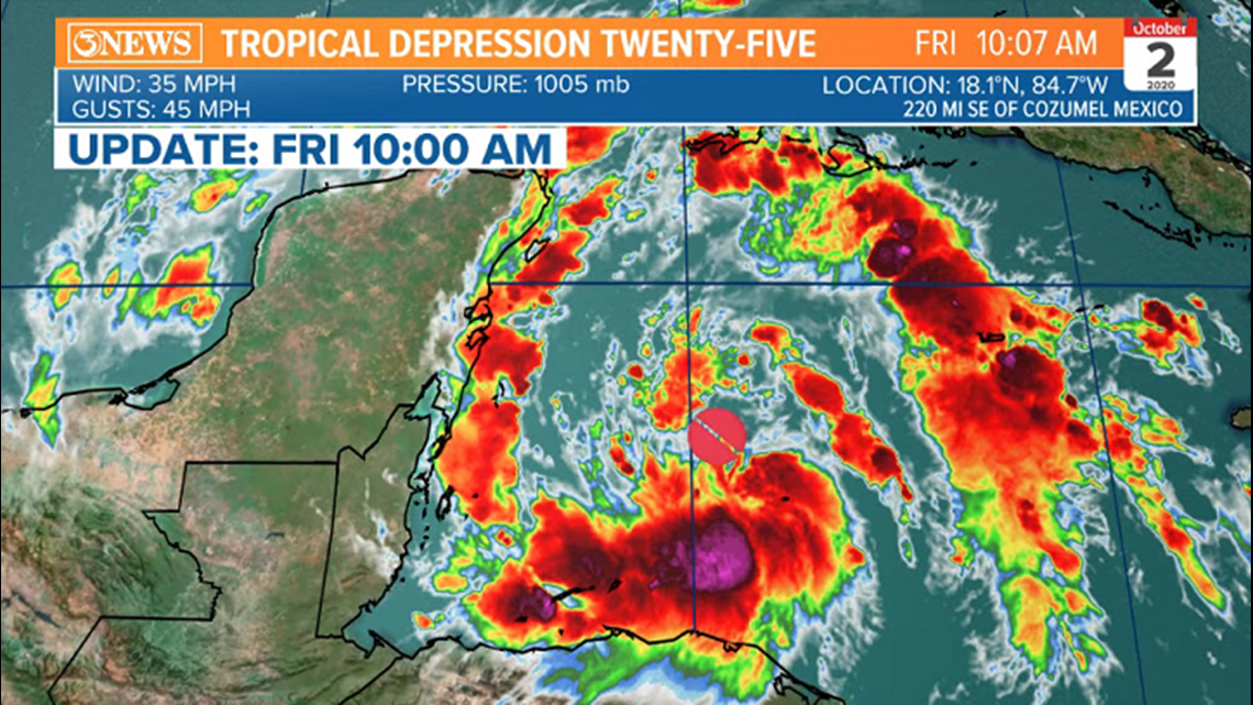

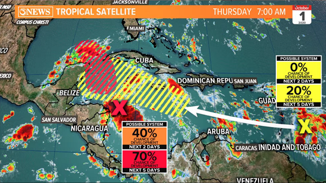
The tropical wave near Central America has a high (70%) chance to develop over the weekend, per the NHC. This feature will drift northwest, interacting with a stalled cold front and the development of something called the 'Central American Gyre (CAG). The CAG is a broad circulation of counter-clockwise flow over Central America and can aid in tropical spin-ups and even steer systems. Given the CAG and the stalled front, which will introduce shear/dry air to the system, I'm not expecting much development from this feature and I'd expect it to move west or even SW once in the Gulf. Should be noted that confidence is still low beyond the weekend on both systems...

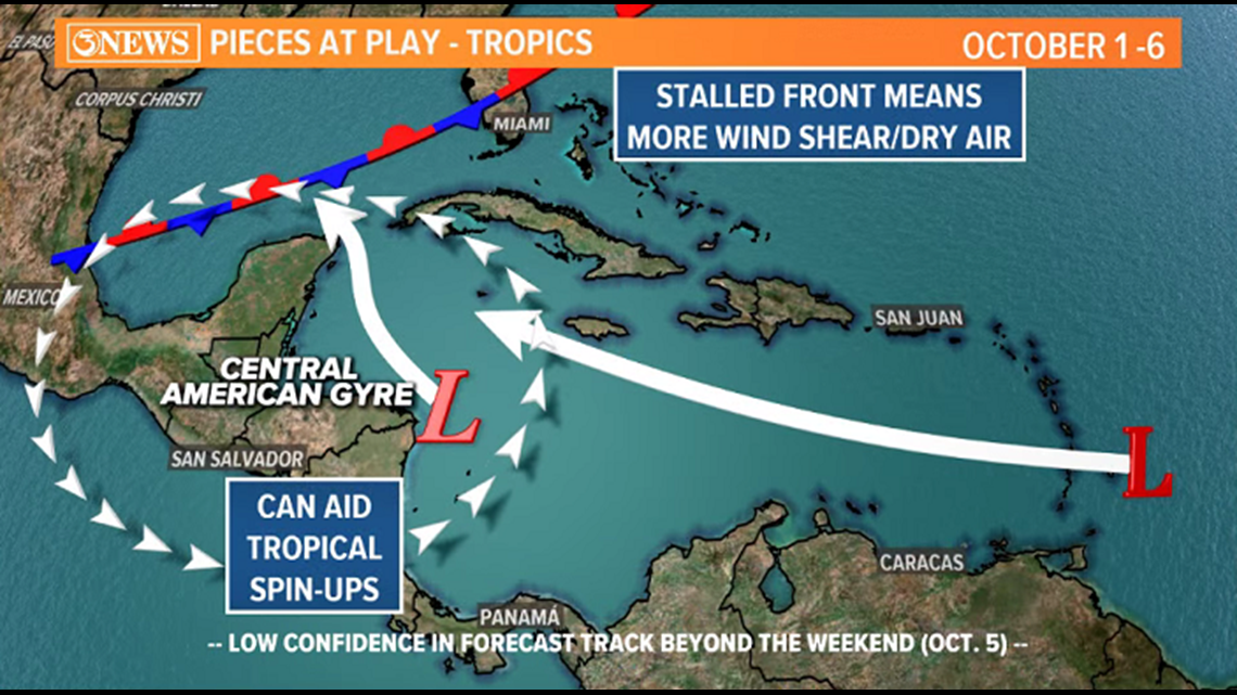
The tropical wave entering the Caribbean has a lower likelihood of developing at this time. This feature will trail the one near Central America and will also bend north after the weekend, if it can develop.
I do not see either of these as a threat to Texas at this time. Something to watch, not worry about.
-----------------------------MORE INFO----------------------------
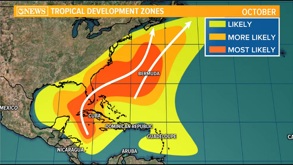
The Western Caribbean is one of the more common spots for tropical systems to develop in October. Storms that do develop here tend to drift north or northeast, historically.

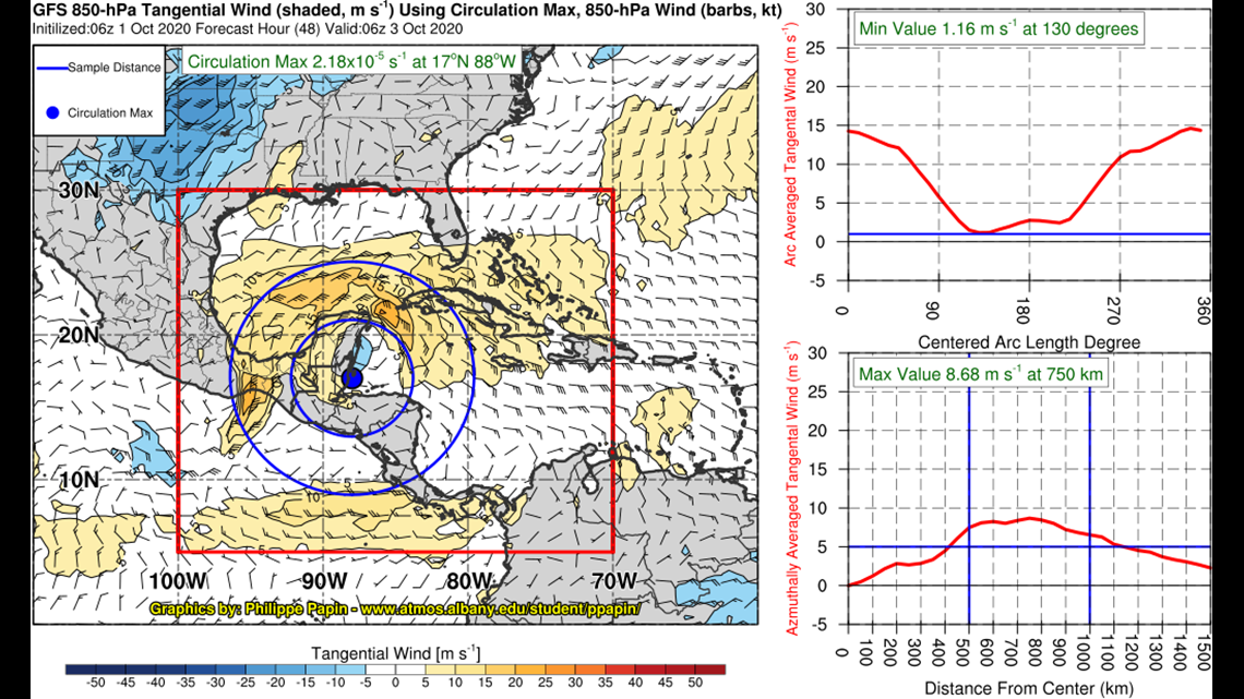
Here's a more detailed look at the developing Central American Gyre this weekend from the GFS.

