
CORPUS CHRISTI, Texas — UP FRONT - Yes, there is a snow chance in the Texas Hill County, Wednesday/Thursday. No, I don't see the snow making it into the Coastal Bend. Here's the why...

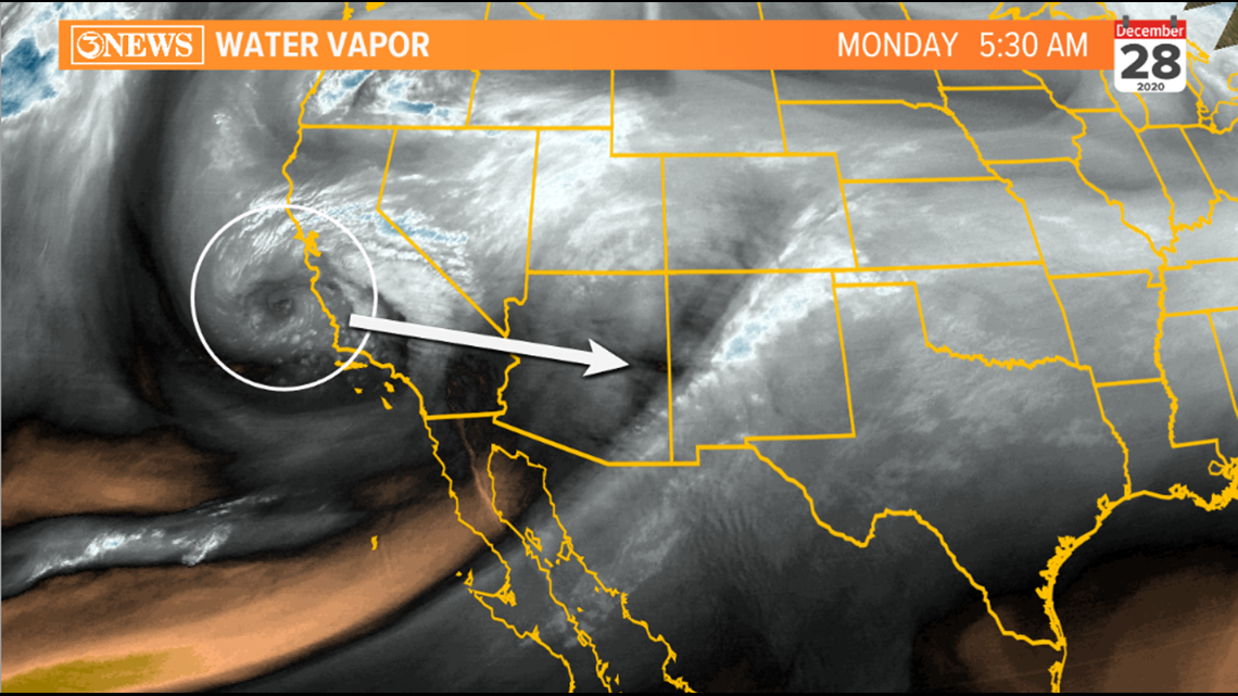
A disturbance currently in the Pacific, just west of California will approach Texas today and Tuesday, moving through the state Wednesday and Thursday. As it approaches, south winds will become strong and rain chances will gradually increase. Stray showers Tuesday, isolated showers Wednesday.

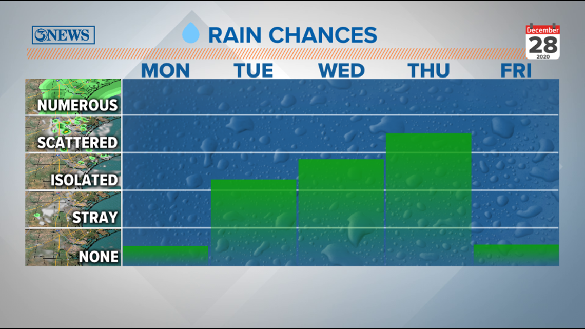
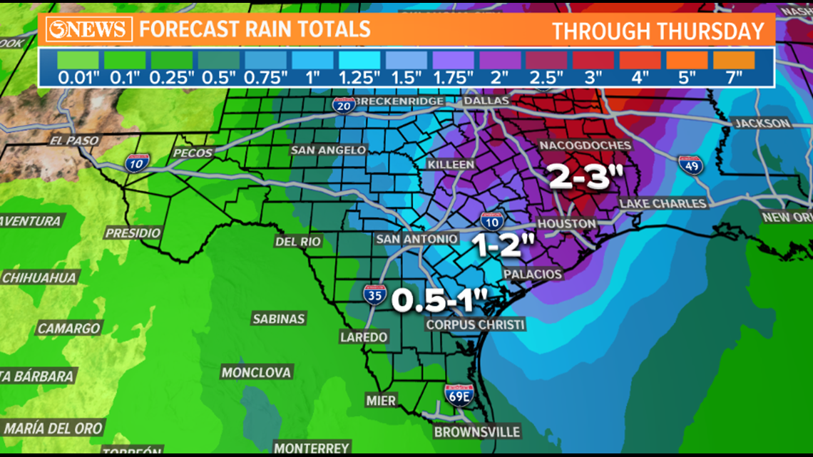
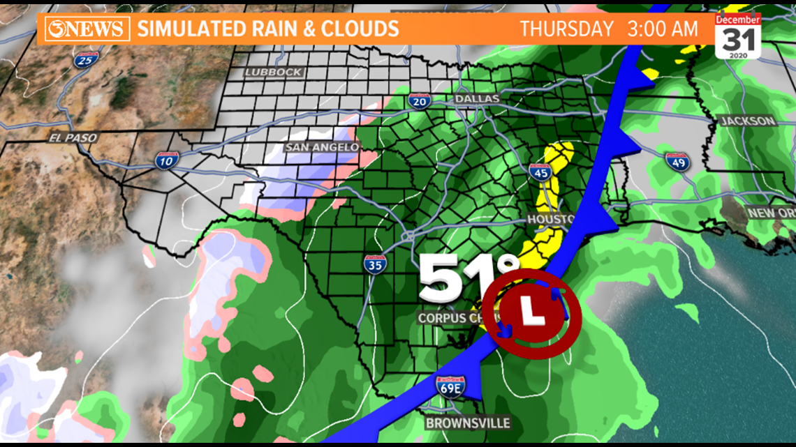
Best rain chances for the Coastal Bend will arrive with the arrival of the cold front Wednesday night/Thursday morning. Look for scattered showers, totaling between half an inch to an inch in the Coastal Bend through Thursday.

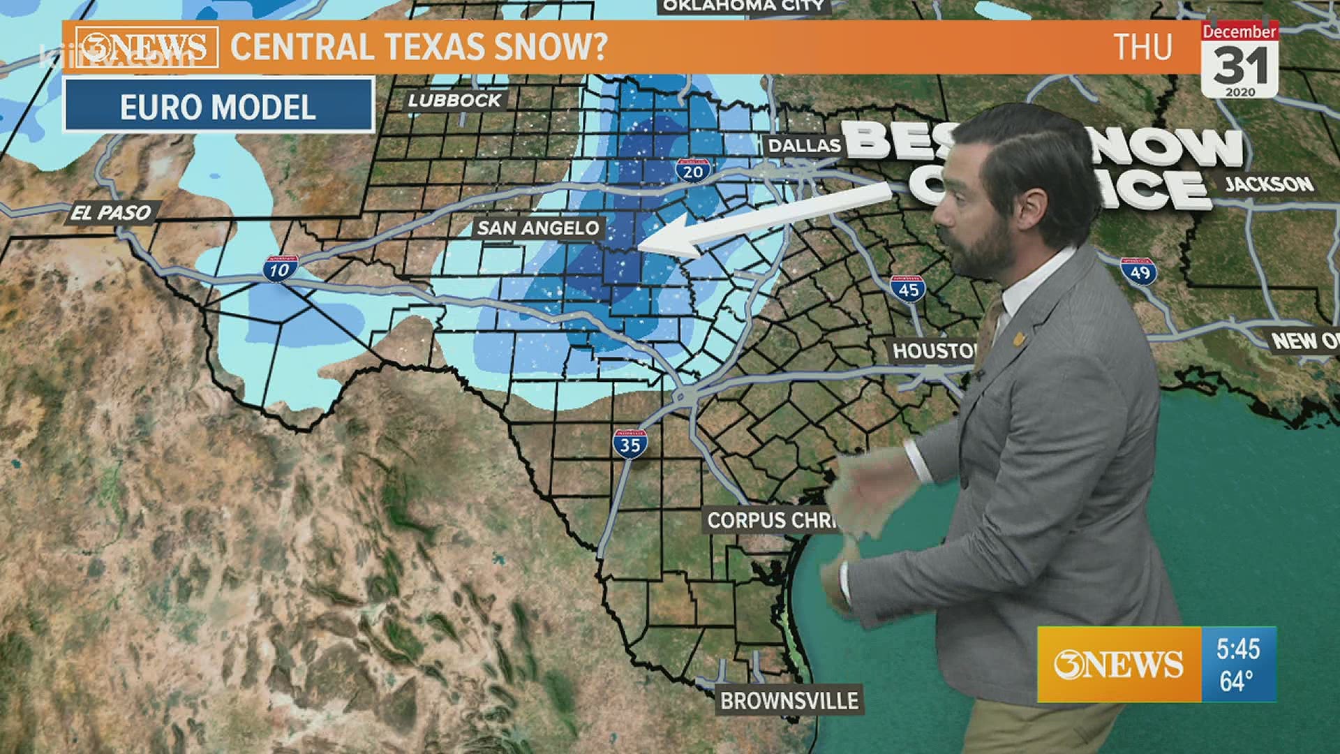
Now for the snow. There will be a chance for rain, transitioning to snow in the Texas Hill Country. But that's where it looks like it's going to stay. The reason is two-fold:
REASON 1:
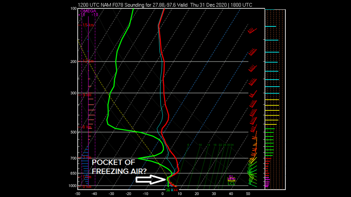
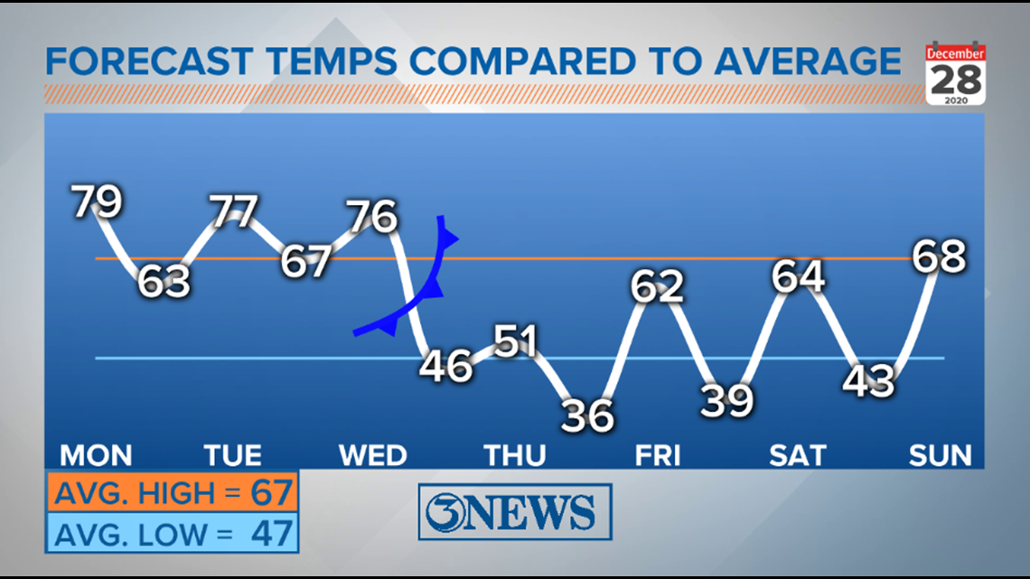
Temperatures will not be cold enough to support a transition to snow while rain chances are in place in the Coastal Bend. So, precip will likely be all rain. There is a small possibility that a few ice pellets (sleet) mix in with the rain Thursday in the Coastal Bend, but this will not be a big deal. The chart below showers temperatures near 50 with rain in the area, Thursday morning. By the time temperatures fall into the 30s (Friday morning), rain chances will be over.

The possibility of isolated sleet or graupel mixing in with the rain in the Coastal Bend Thursday morning has to do with the air just above the surface, which may be freezing, but not cold enough, high enough in the atmosphere to produce snow. So, while most of the precip will be rain, it would be smart of me to include a mention of isolated sleet/graupel because of this sounding:

REASON 2:
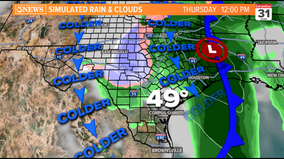
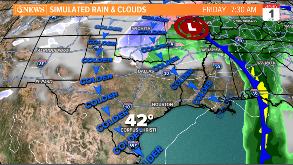
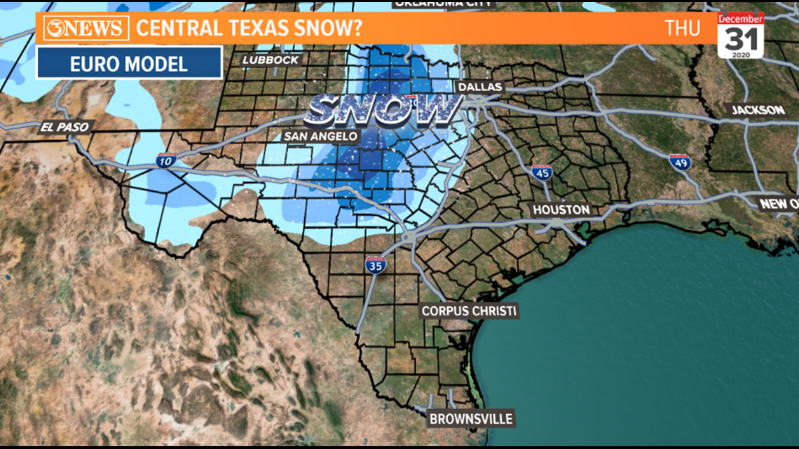
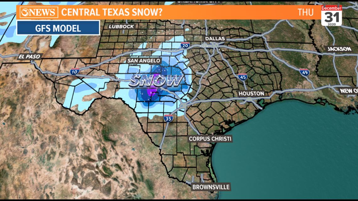
The track of the low pressure that develops along a cold front over the Coastal Bend will move north/northeast. That movement will pull snow north, away from the Coastal Bend. You can see that happen in the two images below. If this feature continued east or south of east, it would be a different story, but this look is not a look for snow in the Coastal Bend, in my opinion.


WHERE TO FIND THE WINTRY WEATHER:
The best shot for snow will be in the Texas Hill Country, north of I-10 and west of I-35. Accumulations are still TBD, but if you're looking to find wintry precip, that'll be the place to go. The two longer range forecast models (GFS/EURO) are both suggesting snow in the Texas Hill Country Wednesday night/Thursday morning. We'll get more clarity on accumulations over the next 24-48 hours.


Temperatures in the wake of the cold front Thursday morning will be cold Thursday and seasonally cool into 2021.

We are 3 days out from this event, so there is still some wiggle room on exact placement of where the best shot at snow will be, but I don't think any shifts in the forecast will be dramatic enough to introduce snow in South Texas. Of course, if anything changes, we will adjust the forecast. This is the latest as of Monday morning.
- Holt, out