

A couple waves are being watched over the Atlantic. One in particular, the National Hurricane Center is keeping a close eye on.


This disturbance currently has a medium chance at tropical development as of Sunday afternoon.
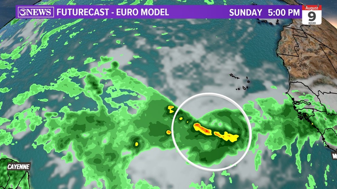
Here's a look at a reliable global model we use frequently. This is the European forecast model and what it thinks about this disturbance.
The first snapshot is Sunday evening at 5:00 PM.
At this time, the model is keeping thunderstorms strong on the southern side of this tropical wave. Let's fast forward.


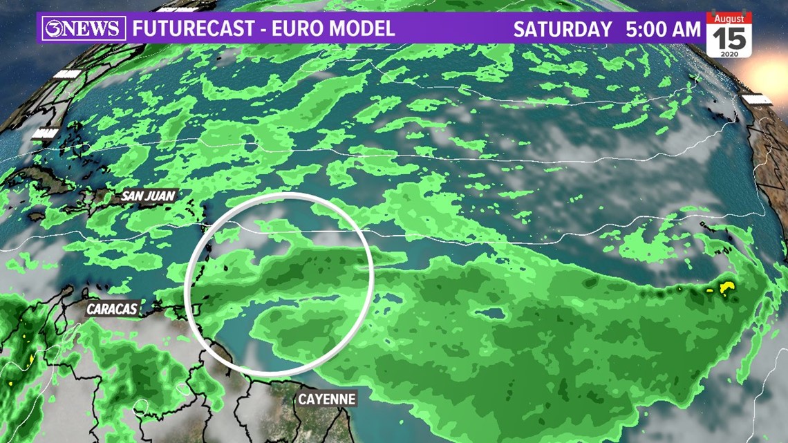
By next week. it keeps it somewhat disorganized. Just a plume of tropical moisture that is struggling to close a circulation as it nears the Caribbean. Why is it struggling?
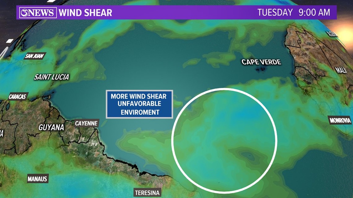
From what I can see, this tropical wave may have to battle wind shear as it travels across the Atlantic this upcoming week.
Wind shear is the increase in wind speed with height.

Something that 'may' help is the lack of dust. There is less Saharan dust across this region. This is probably why the National Hurricane Center is giving it a 50% chance through Thursday. Also, the sea surface temperatures of the Atlantic are plenty warm. We will keep an eye on it and see how it interacts.
Getting into the long range forecast in this next model. Remember, the farther we go in time on these models, the less accurate they get.
This is important because accounts of Facebook and Twitter will post these same model runs 10-14 days out. It's pivotal you take these model runs with a grain of salt. Environmental conditions that these systems go through change every day.
Weather prediction models can't account for every little change in the atmosphere. A small change can shift the track and intensity of it.
This is from the GFS ensemble model (GEFS). Take a look below.

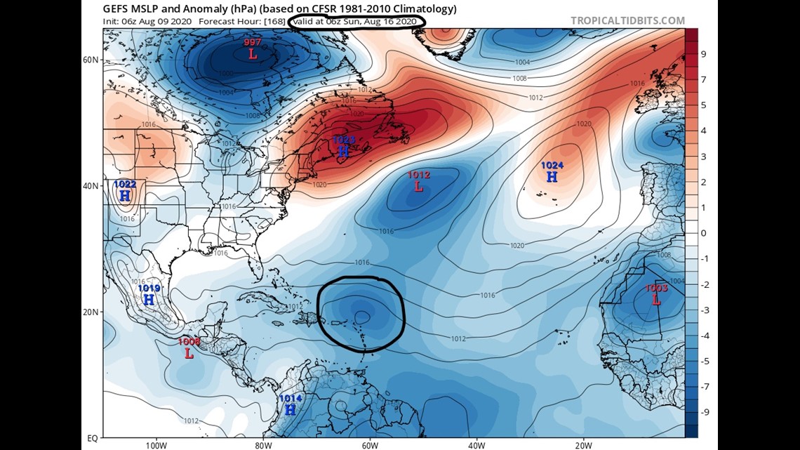
You'll notice, this tropical wave moving north of the Caribbean. In this particular model run, it looks like it's being influenced by steering currents. The "Low" and "High" to the north. This would be a similar path that Isaias took. Again, this is subject to change in the coming days.
The Big Takeaways
• Tropical wave over the Atlantic is still disorganized and is heading into a slightly unfavorable environment for development this upcoming week. Will have to watch how it interacts with wind shear, sea temperatures and lack of dust.
• National Hurricane Center is giving it a medium chance for development. If this wave gets better organized, this would be named Josephine.
• This tropical wave does not look like an immediate threat for South Texas.
• Question model runs you see on social media. Be skeptical. These change each and every day.