

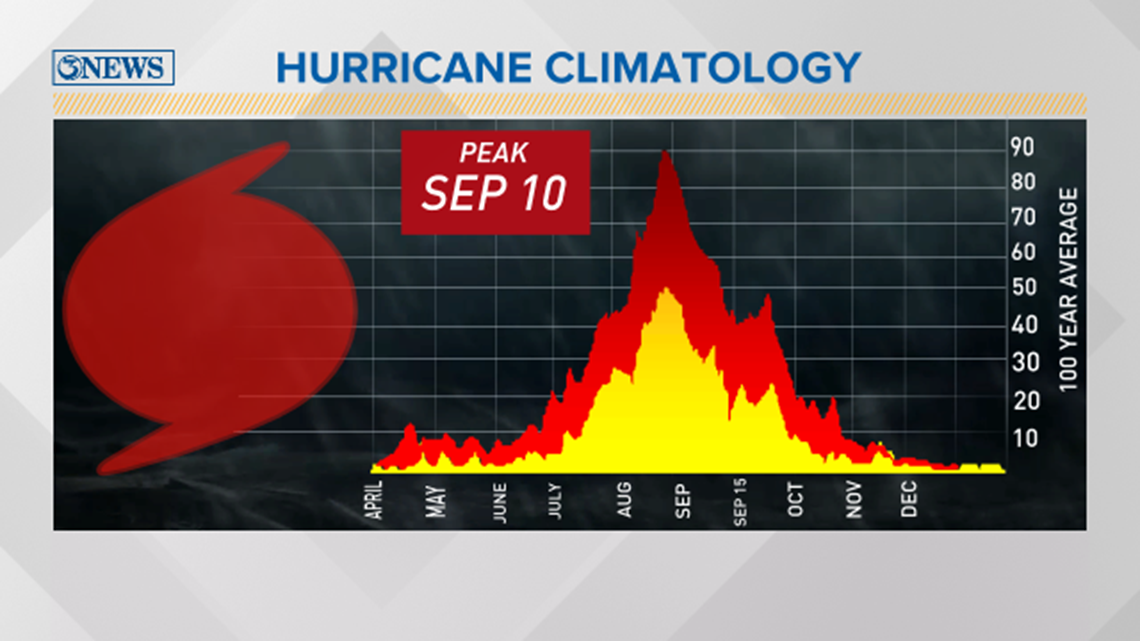
Needless to say, this year's hurricane season has been an active one. With Josephine expected to form soon, this would make the earliest 'J' storm on record.
The earliest 'J' storm was Jose forming on August 22, 2005.
If Josephine forms this week, which is extremely likely according to the National Hurricane Center, this would break a record which is incredible in itself.
This highlights how active this season has been. Based on tropical climatology and this year's forecast, we're going to see more storms form through September and potentially even October.

With that being said, it's important to keep up with the forecast and the National Hurricane Center. Moreover, as tropical waves form in the Atlantic, it's something to watch and not necessarily worry about. Follow the "Four A's".
Be........
• AWARE
• ATTENTIVE
• ALERT
• ACT
when the times comes.

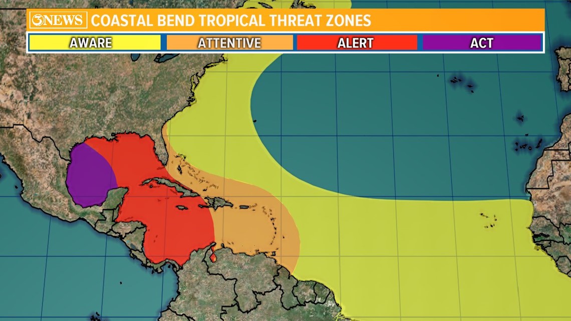
There's no need to 'worry' about a storm or hurricane in the Atlantic that is thousands of miles away. Be curious and be aware.
As a tropical system moves into the Caribbean, that's when you should start reviewing your hurricane plan. Have an idea where you would go and what you would do in the case of a hurricane moving into the Gulf of Mexico.
For example, Hurricane Hanna made landfall in late July south of Corpus Christi. We we're tracking that system 5-6 days out, as it was forming over Cuba.
That's probably the most time we would have to jump in front of a hurricane with confidence. That is when we should be concerned and prepared to act.
We'll post computer model trends and spaghetti plots to show the expected path of a tropical system days and even weeks out. The forecast cone will refine as the storm gets closer to land. At that point, this is when you focus in on what side of the storm you're located on.
The 'right side', eastern or northeastern side of the storm, typically means dangerous storm surge. Being on the 'left side', western or northwestern side of the storm means less storm surge. Tropical storm force winds and bands of rain will extend out from the center bringing flood provoking rain.
Bottom line, keep with the forecast here at 3 NEWS. Follow us on social media. We're constantly giving updates on new tropical waves, storms, hurricanes and their forecast track through open waters.
As of Wednesday morning, we have zero tropical threats in the Gulf of Mexico.