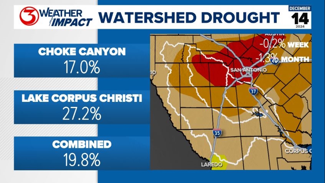
CORPUS CHRISTI, Texas — DROUGHT: Stage 3 Water Restrictions will be enacted at 11 am Monday. Once that happens, combined lake levels will need to rise to 30% to re-enter Stage 2.
We have a chance for around 0.1-0.25" of rain across the watershed over the next week. Unfortunately, this won't make much of a dent in the lake levels.

SATURDAY: Temperatures and humidity remain unseasonably high through the day today. Afternoon temps top out in the upper 70s to low 80s.

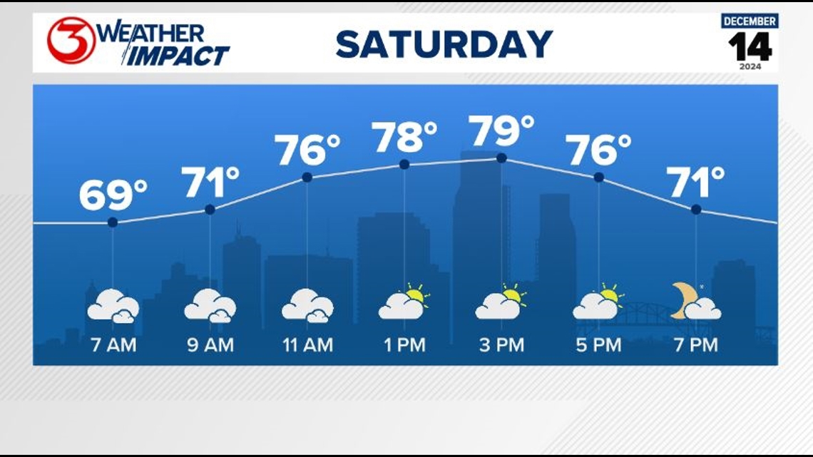
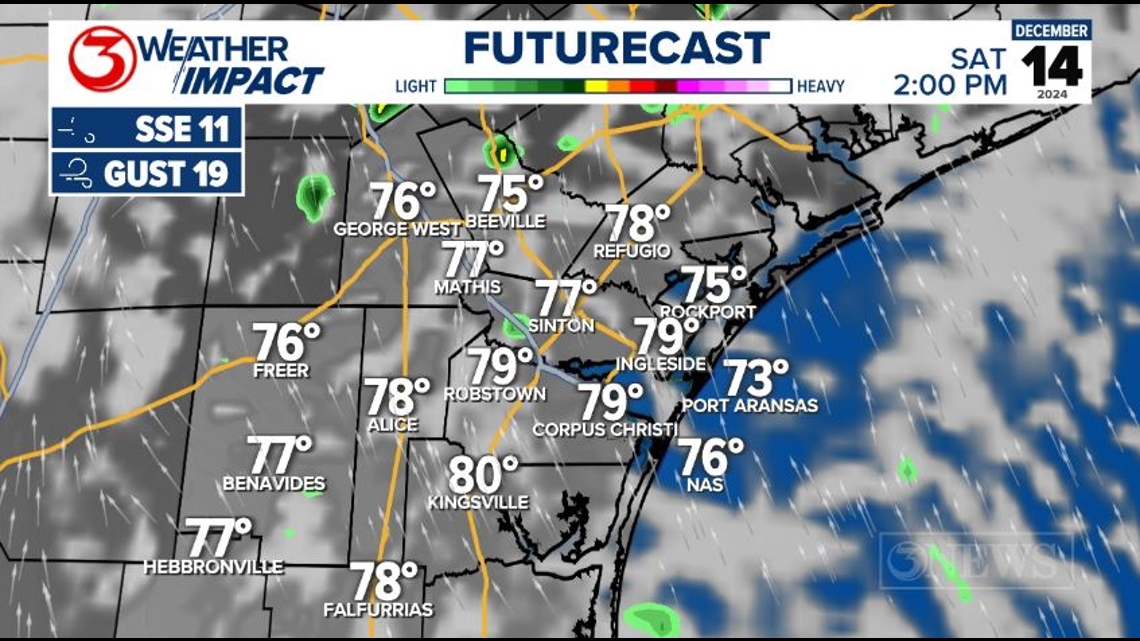
Skies will be cloudier in the morning with widely scattered light, drizzly showers. A decrease in clouds and rain chances is expected through the day.

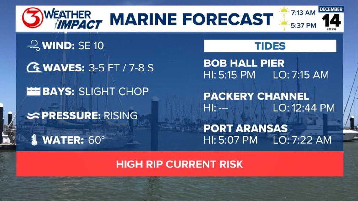
MARINE FORECAST: The rip current risk remains elevated for our coast. A Small Craft Advisory is in effect for the offshore waters until noon today.

SATURDAY NIGHT: We stay humid tonight, which will allow temperatures to only fall into the upper 60s again. Skies will be mostly cloudy again.

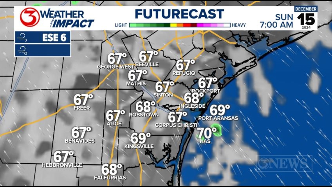
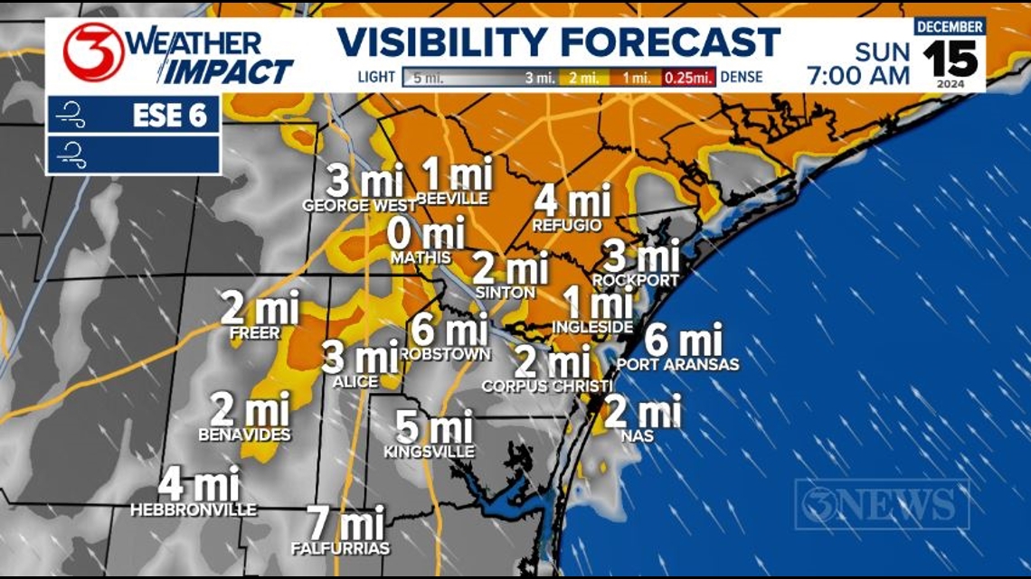
We saw a few areas of fog overnight into Saturday morning. We'll be dealing with a more widespread, thicker blanket of fog tonight.
This will likely start as sea fog along the coast in the late evening hours, and slowly spread to adjacent inland areas. Sea fog is usually thicker and lasts longer than regular radiational fog.
Sea fog forms when dew points are 10-15 degrees above sea surface temperatures. With dew points in the upper 60s and sea surface temperatures in the low 60s, there's a slimming chance as to how widespread the sea fog will be. Our northern coastal areas have the best chance of seeing sea fog tonight.

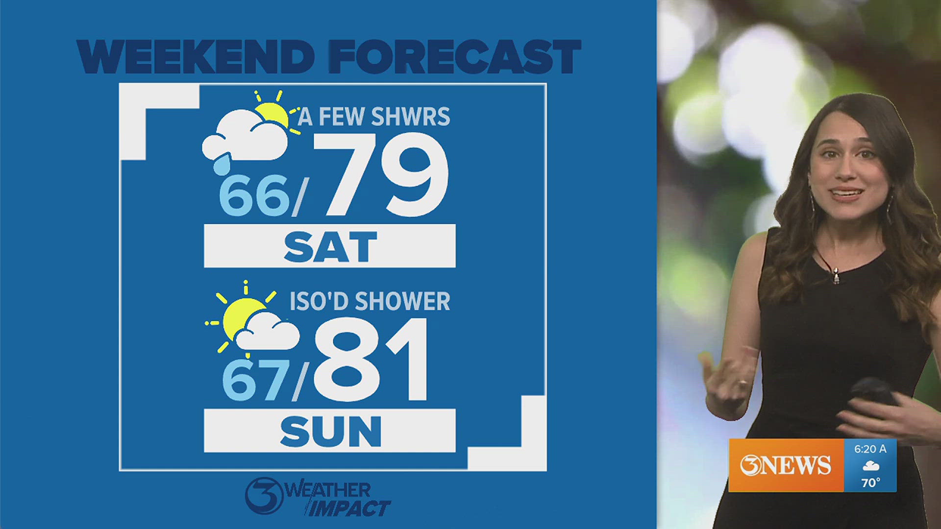
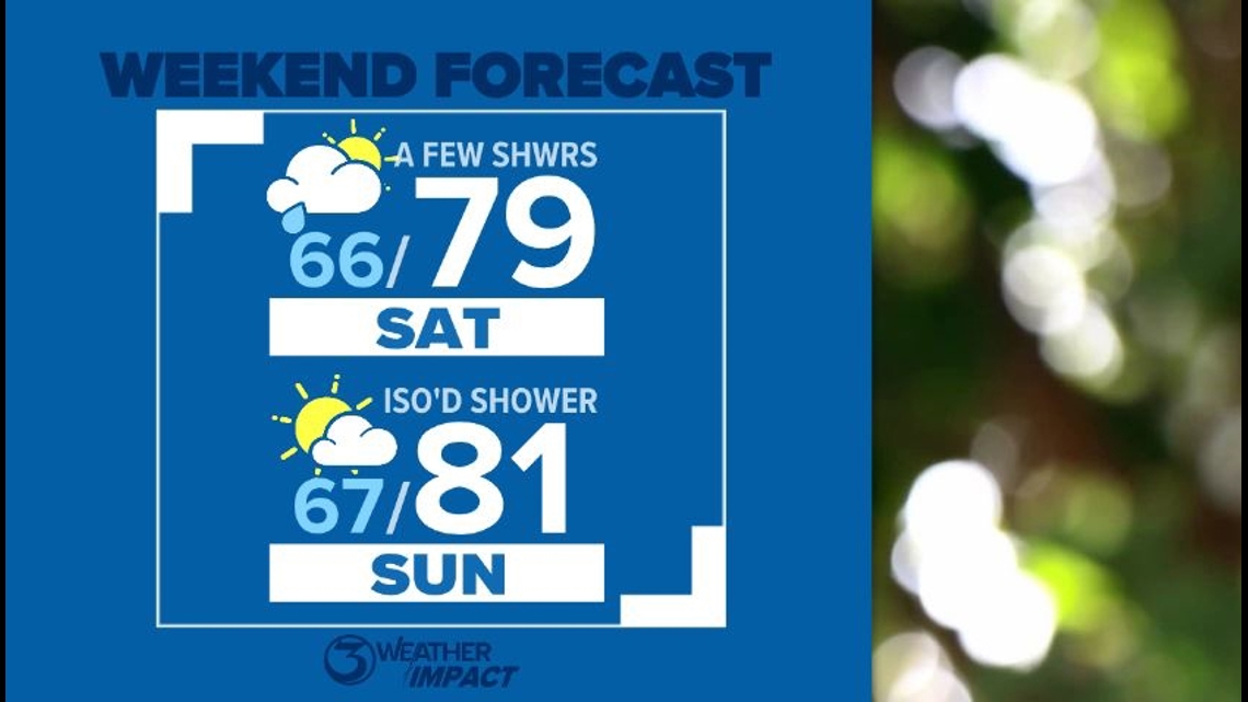
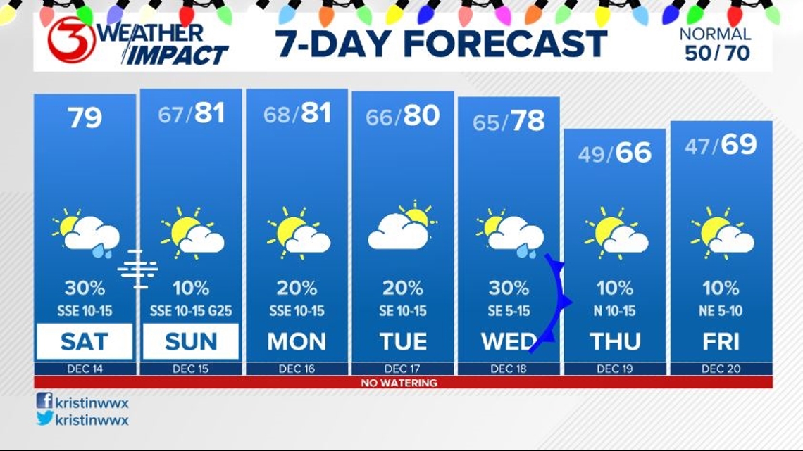
LOOKING AHEAD: We stay unseasonably warm and humid through the weekend, with afternoon highs near 80 each day. Sunday should see a bit more sunshine and lower rain chances.

A cold front previously thought to get a little closer to the Coastal Bend before stalling has said "no," and pumped the brakes. It'll stall in North/Central Texas, leaving us nice and humid. With the front no longer getting in our vicinity, I've lowered our rain chances for Monday night.

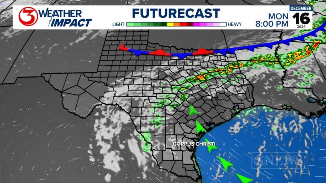
Another front is expected to actually move through the Coastal Bend sometime next Wednesday. Timing details are still blurry, but it does look to bring better rain chances and a nice cooldown back to seasonal normals.

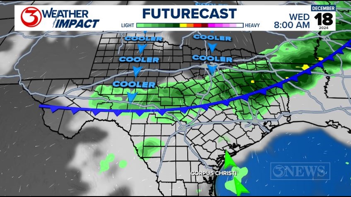
Past Wednesday's cold front, forecast models do a 180° from each other: one keeps us cloudy and rainy, and another clears us out with plentiful sunshine. We'll let you know what this is looking like once forecast models get it together.

Make sure you check out our 2024 Atlantic Hurricane Season Summary! It's filled with stats and records, along with most general storm info from this season.
Thanks & Gig 'Em.

