
SUNDAY NIGHT: Another very warm and humid night tonight, with lows in the mid-70s, mostly cloudy skies, and a stray shower chance. Some patchy fog is possible.

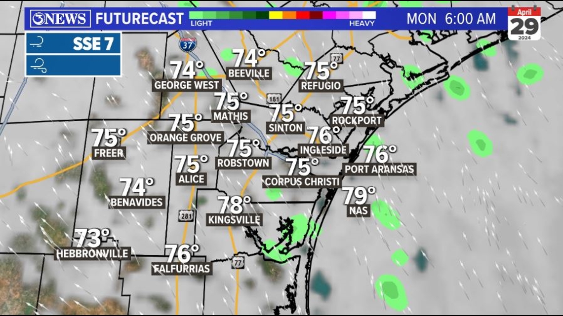
MONDAY: Expect mainly cloudy skies in the morning with isolated shower activity on your way out the door. We should see rain chances decreasing by midday, but a low chance will hang with us through the rest of the day.

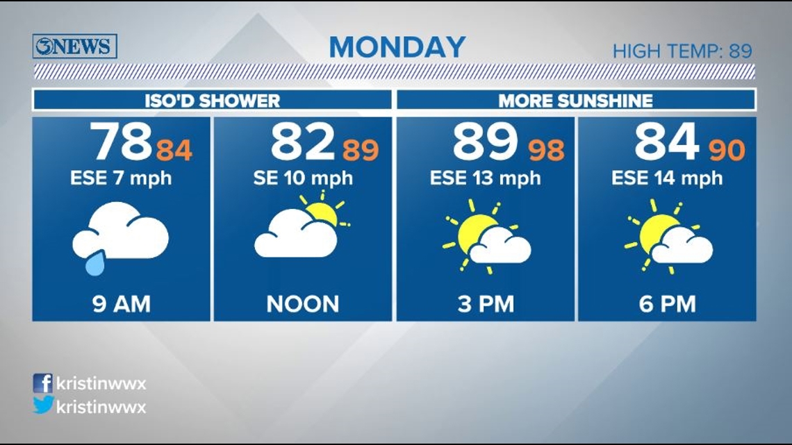
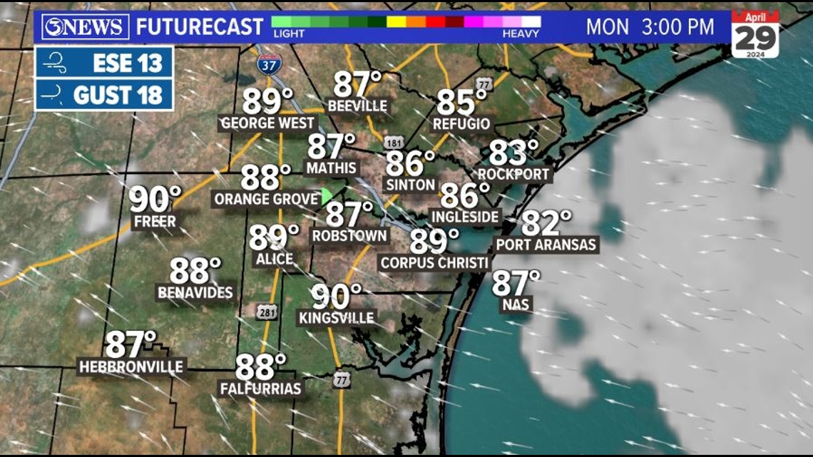
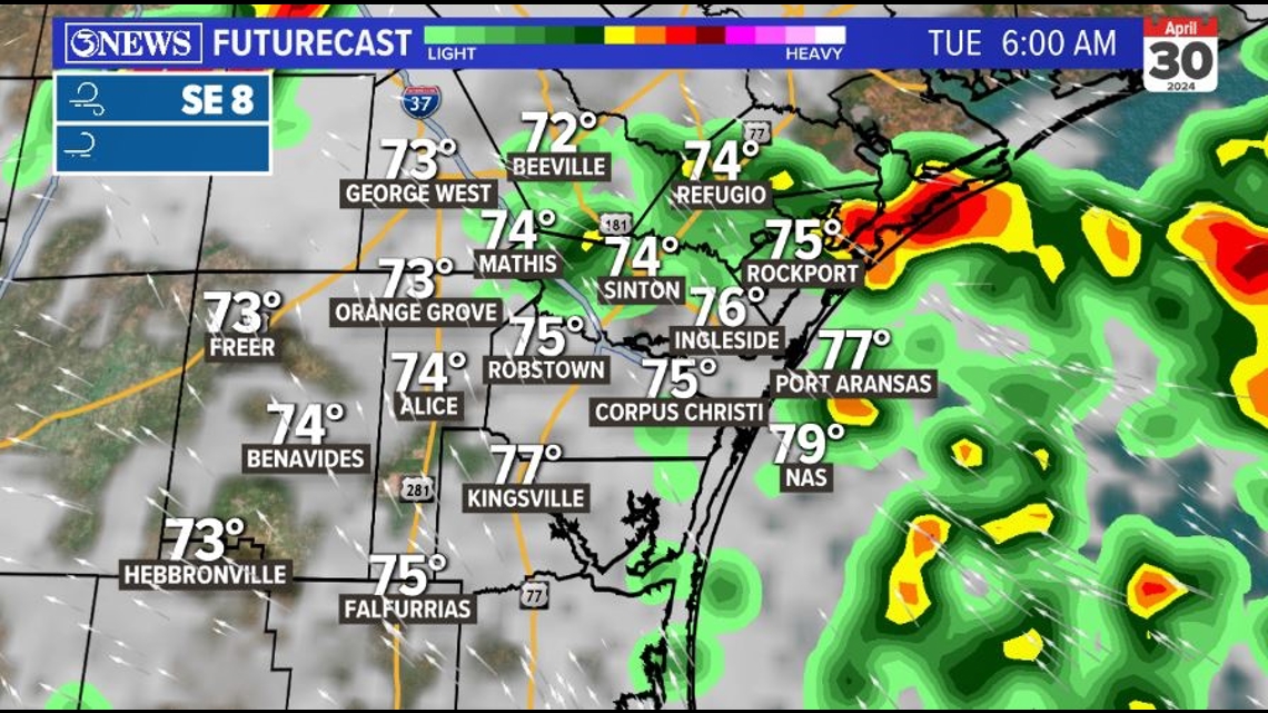
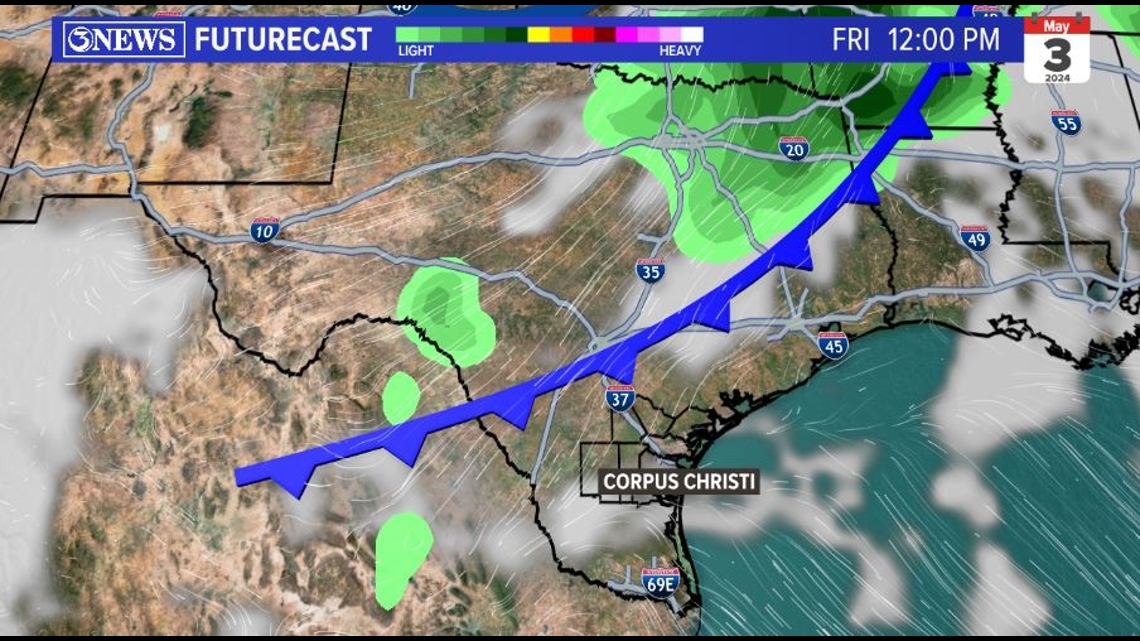
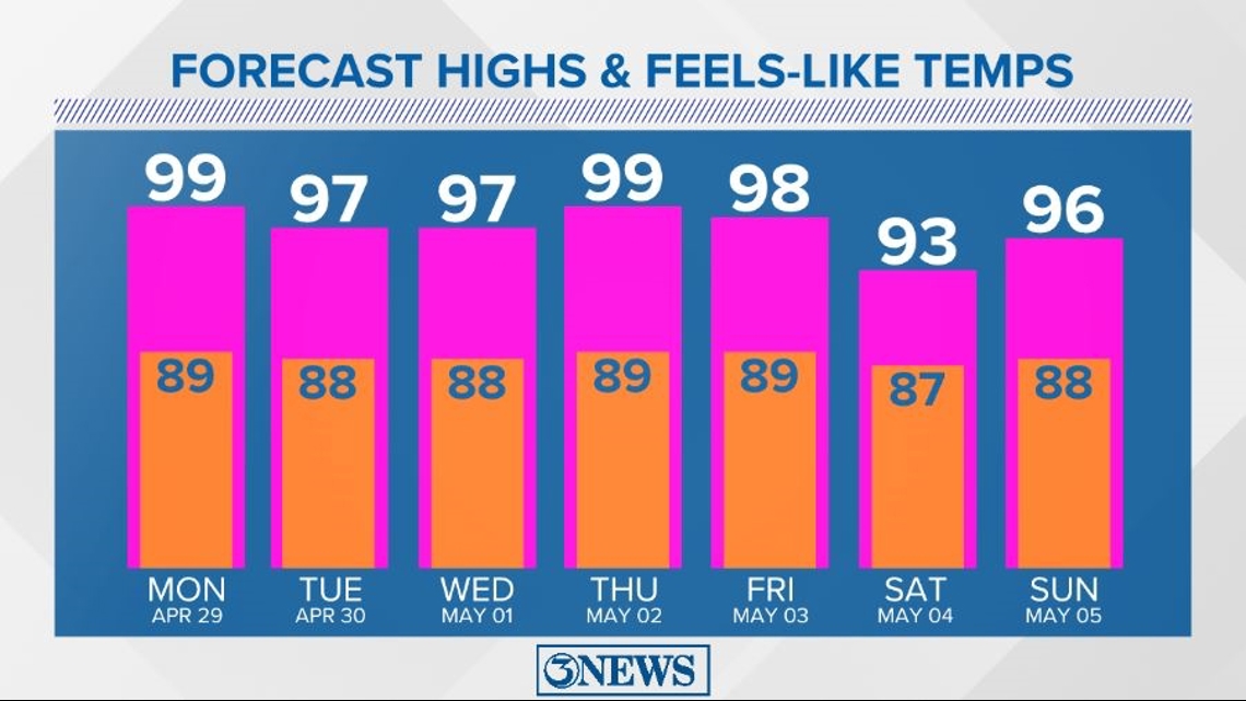
High temperatures tomorrow afternoon top out in the upper 80s to low 90s. Based on the last two afternoons, I don't think we'll see quite as much clearing as Futurecast is suggesting below, but I do think we'll see more sunshine in the afternoon compared to the morning.
Feels-like temperatures tomorrow afternoon will be very close to the triple-digit mark.

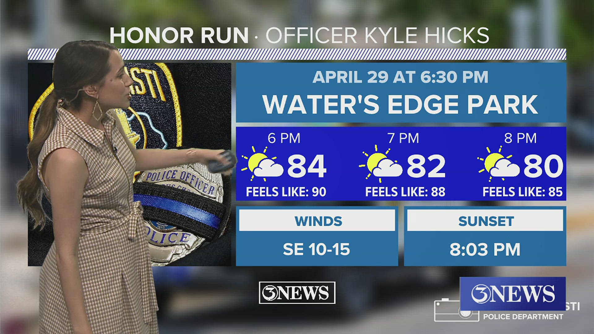
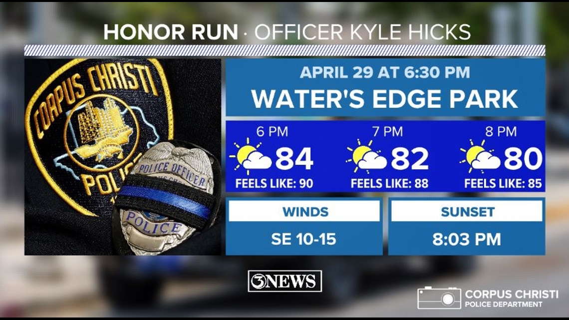
If you're heading out to the Honor Run for Officer Kyle Hicks tomorrow evening, make sure you're staying hydrated. The run kicks off at 6:30pm at Water's Edge Park. Temperatures will be in the mid-80s with a feels-like temperature closer to 90.

LOOKING AHEAD: Monday night into Tuesday morning, our rain chances increase. Forecast models are still a little wishy-washy, with one suggesting only a few showers and another suggesting widely scattered thunderstorms.
What happens will depend on activity to our north Monday evening. If there's a line of storms strong enough that it can push into South Texas, our chances go up.
Models have been pretty consistent with a line of storms in the Houston area moving southward Monday night. That could send an outflow boundary of rain-cooled air our way, which would act like a mini-front and promote localized storm development Tuesday morning.

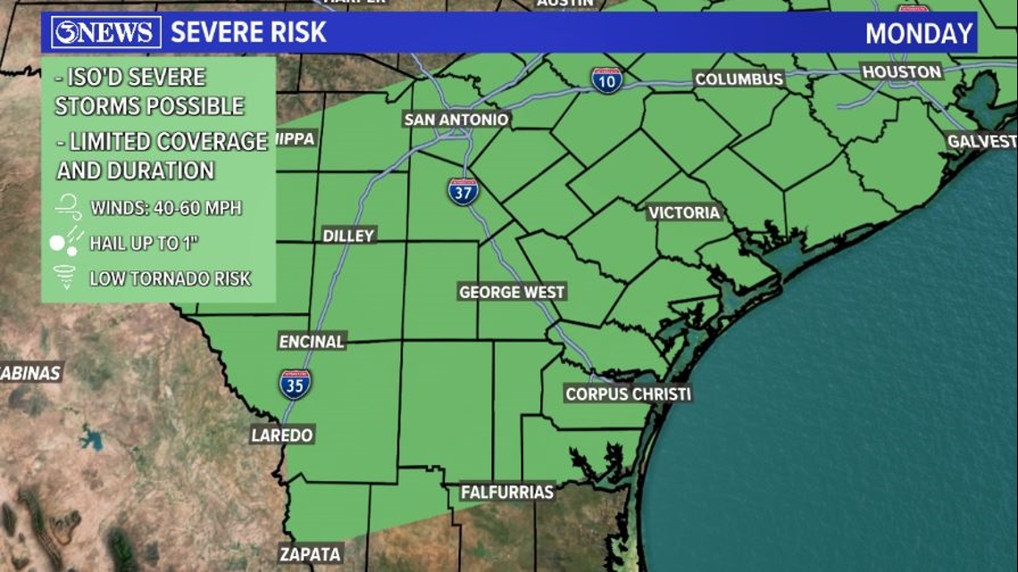
The main severe weather threats will be damaging winds and one-inch hail. This is a Marginal Risk (1 out of 5), which means we could see isolated severe storms.

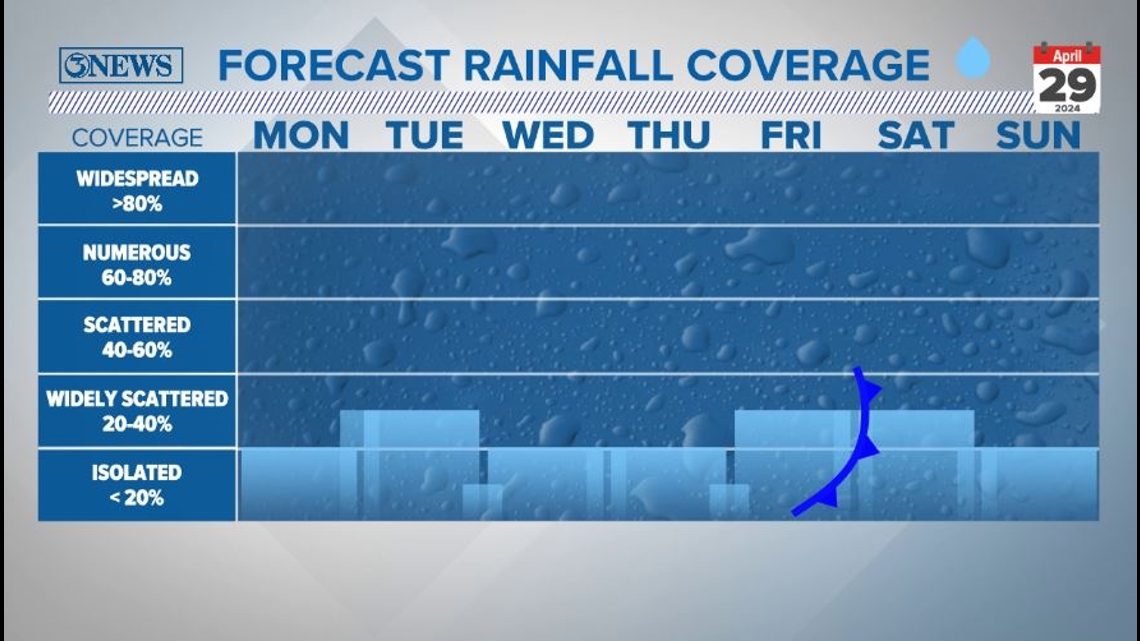
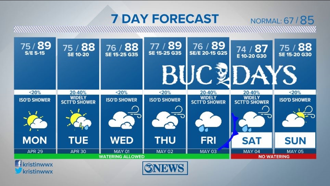
Tuesday morning will be our highest rain chance during the first half of the week. Heading through midweek, expect mainly isolated showers. By Friday and Saturday, we'll see another uptick in rain chances as a cold front approaches from the north.

I'm not totally sold on this front actually making it through the Coastal Bend. What looks more likely right now is it stalls either to our north or through the central Coastal Bend. This will at least turn our winds to a more easterly direction and give us the slim chance at slightly cooler air.
What's more likely than cooler air is that the front allows moisture to pool along the front, get lifted upwards, and promote widely scattered showers and thunderstorms heading into the weekend. (Thursday kicks off Buc Days, by the way.)

High temperatures this week will be very consistent - even with the potential front. Expect highs in the upper 80s each day and feels-like temperatures around 10 degrees hotter.

7 DAY: High humidity and warm afternoons combine for even higher heat indices this week, with a low rain chance each day. A low severe risk is in the forecast Monday night.

Thanks & Gig 'Em.