
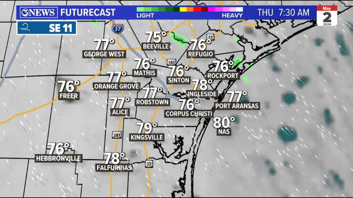
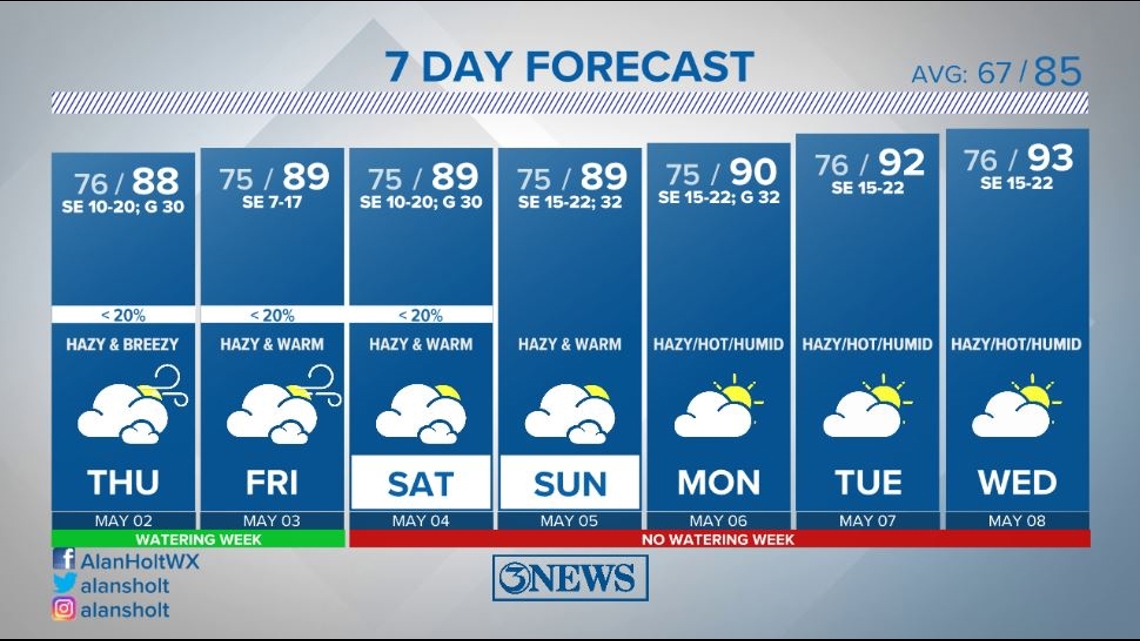
WEDNESDAY NIGHT: Passing clouds with overnight lows in the middle 70s. Very humid. A few isolated showers possible...but the bulk of any overnight showers and storms will be north of the Coastal Bend and into SE TX. Southeast breeze at 10-20 mph.

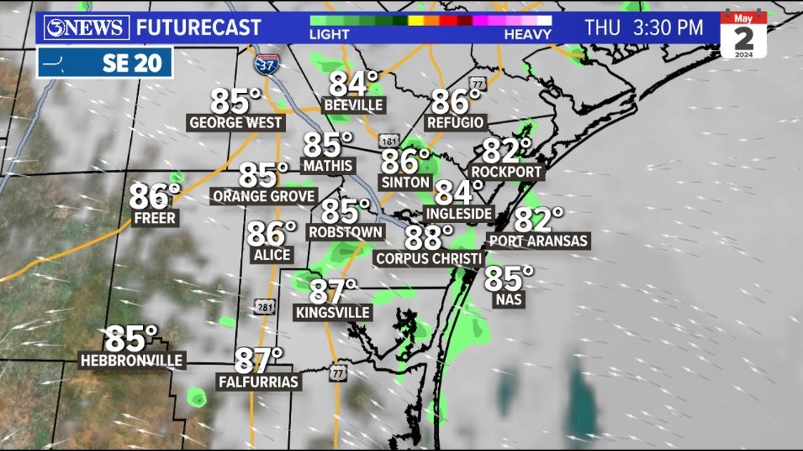
THURSDAY: Mostly cloudy and hazy with afternoon highs in the middle to upper 80s; heat index values in the middle to upper 90s. Southeasterly breeze at 10-20 mph, gusting up to around 30 mph at times. Low end chance at an isolated shower or storm - most don't receive rain. Humid.

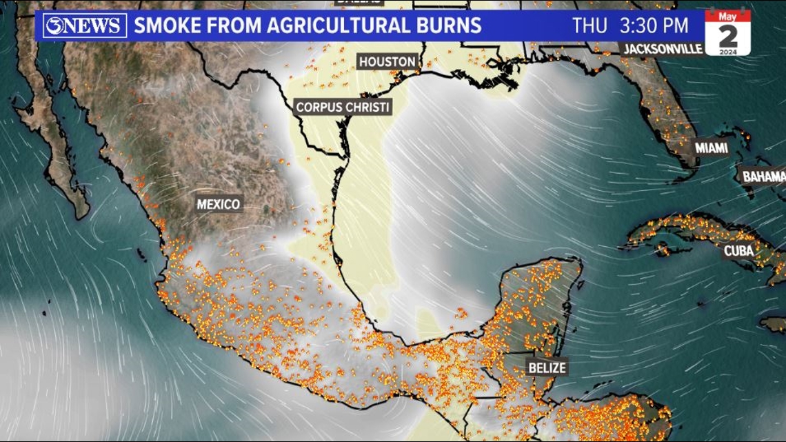
AGRICULTURAL BURNS: Smoke from agricultural burning in Mexico and Central America will continue to move into South Texas. This is why skies will be hazy & why air quality will be lower. Until the burning decreases or winds are coming from a direction other than the southeast, expect this to be in our atmosphere.

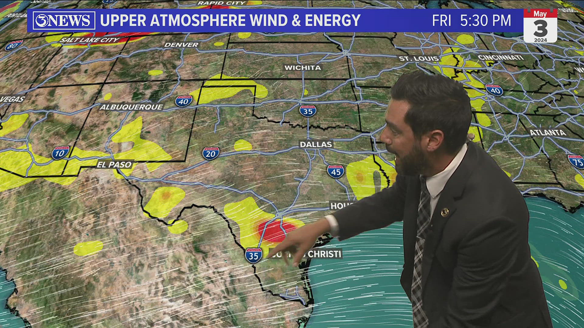
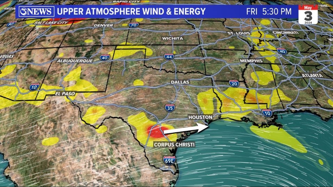
LOOKING AHEAD: Warmth with high humidity and mostly cloudy skies will continue Friday. On Friday evening, some energy in the upper levels of the atmosphere will be moving over South/Central Texas and could spark a slightly better chance for a few showers or storms to move in from the west. This chance doesn't look terribly high, but it'll be something to watch into Friday evening.

Something similar happens on Saturday evening, but again...overall, the rain chances do not look great in the Coastal Bend into and through the weekend.

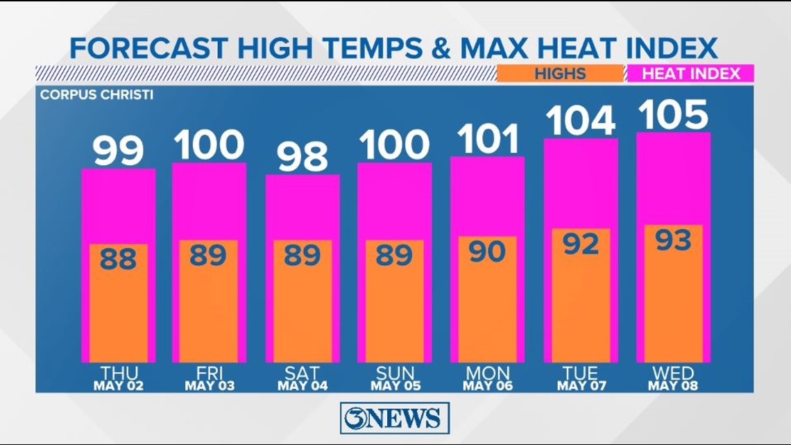
Into next week, the heat expands and we will be in the middle to lower 90s. Tack on the high humidity and heat index values will likely top out between 100 and 105 by next Tuesday and Wednesday. A bit early for this level of heat/humidity, in my opinion.

Holt out