

The wind is already sustained around 20 mph with gusts at 30 mph. This afternoon we will boost those numbers to a southeast wind sustained at 30 mph with gusts around 40 mph.

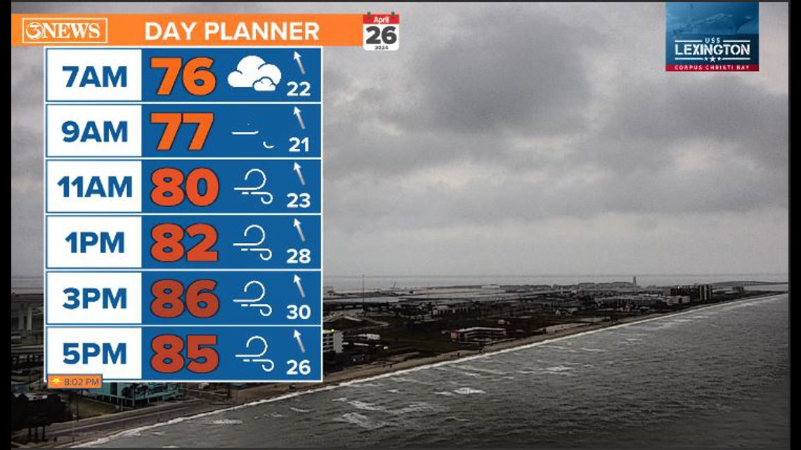
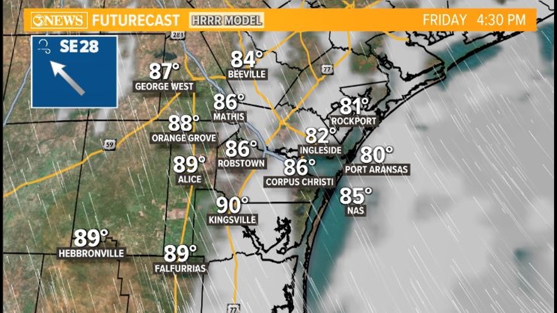
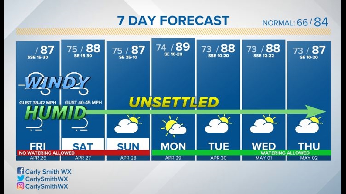
We are seeing a few isolated storms this morning. This afternoon we should see some sunshine break through with a very low-end chance for an isolated shower or storm. Highs are back in the upper 80s near 90.

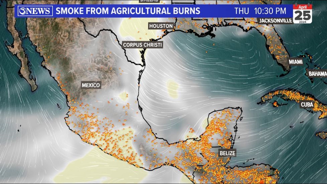
Every Spring, mid to late April/early May, we receive smoke from agricultural burns to our south in Mexico and Central America. This usually arrives when we catch persistent/strong southeasterly flow like we had Thursday and we will see into the weekend. The smoke reduces air quality and creates a hazier sky while it's here.

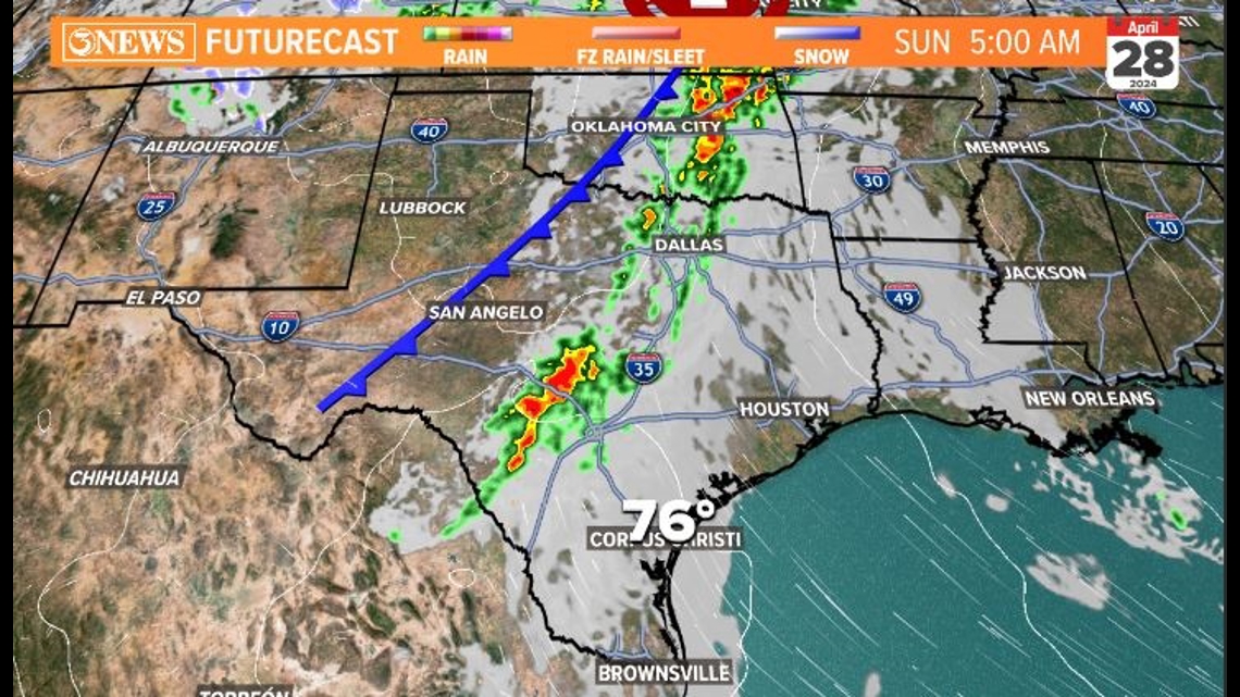
LOOKING AHEAD: We will stay windy through Sunday morning. This comes with a strong area of high pressure to our southeast and two passing storm systems moving off the Rockies. We set up in the moisture stream coming off the Gulf of Mexico thanks to the low-level jet that develops between the highs and the low pressure.

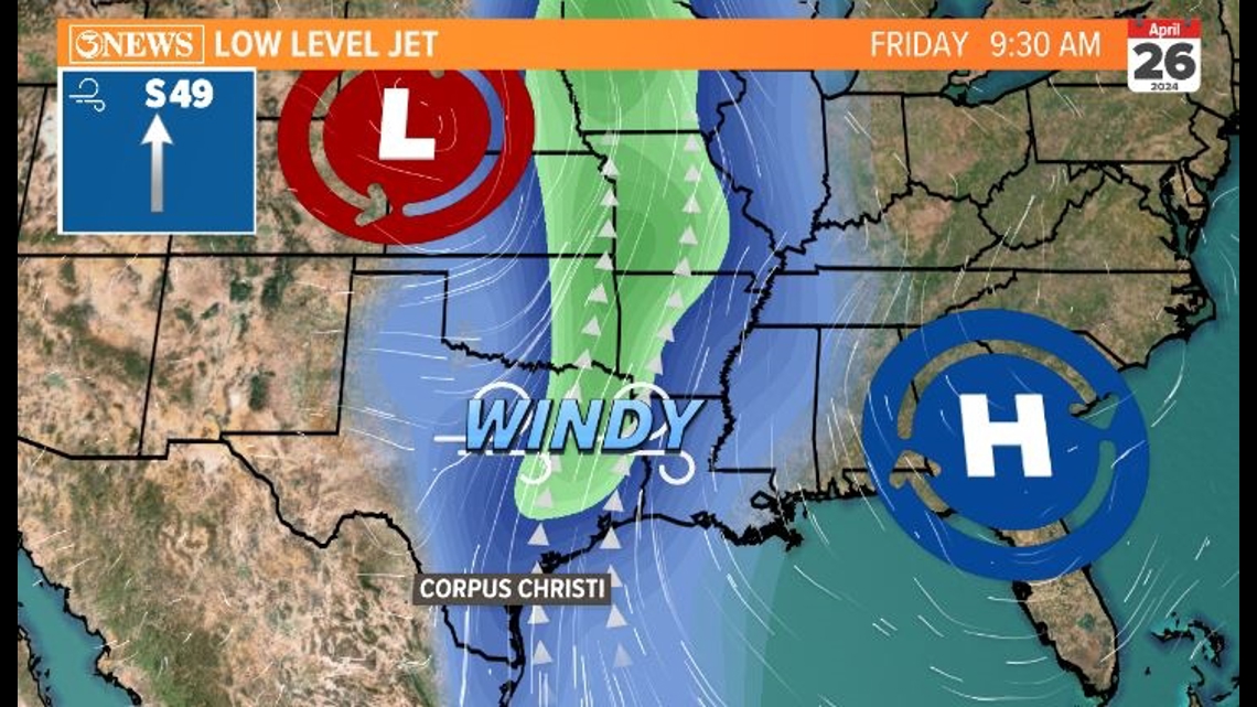
This boosts our wind so it can help carry moisture to fuel the strong to severe thunderstorms to our north.

Gusts will be 40-45 mph into early Sunday morning. By Sunday afternoon we should be closer to 10 mph. There is a chance for a few showers through the weekend, with the best chance on Sunday. That will still be low with around 0.1" of accumulation with the spotty activity.

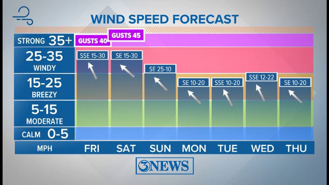
We stay a little unsettled with the front stalling a bit to our north next week. Overall it remains humid, warm, and breezy. Not much change in the extended forecast.

Have a great weekend!
Carly