The 2023 Atlantic Hurricane Season came to an end on November 30th.
Leading up to the season, pre-season forecasts were looking at two main factors for the expected amount of tropical activity in the Atlantic Basin:
1) A developing El Niño, which tends to lower the amount of tropical activity in the Atlantic, and
2) Warmer than normal sea surface temperatures in the Atlantic Basin, which are better for tropical development.
So, two competing factors.
The KIII pre-season forecast leaned toward the El Niño influence for a less active season. Our outlook was for 13 named storms, 6 hurricanes, and 2 major hurricanes. NOAA's pre-season forecast was for 12-17 named storms, 5-9 hurricanes, and 1-4 major hurricanes.
Both outlooks underestimated this season's tropical activity - the abnormally warm sea surface temperatures managed to overcome the unfavorable upper-level wind pattern resulting from El Niño.

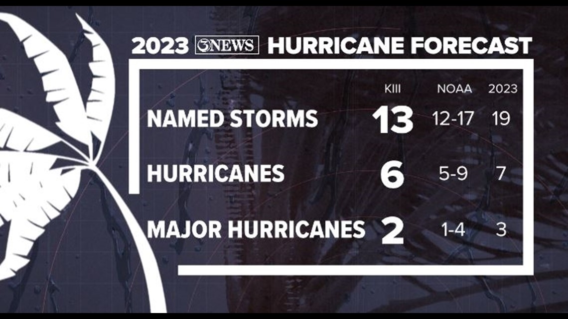
On average, there are 14 named storms, 7 hurricanes, and 3 major hurricanes (Category 3+) during the Atlantic Hurricane Season, which runs from June 1 - November 30. "Average" is based on 1991-2020 climatology.
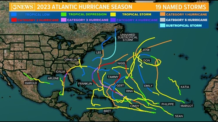
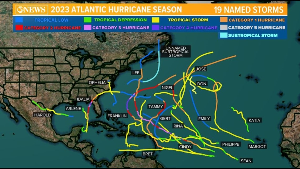
This year there were 19 named storms, 7 hurricanes, and 3 major hurricanes.
An ongoing El Niño was officially declared on June 8, a week into hurricane season. The transition to El Niño over the summer led us to believe that the Western Gulf of Mexico would be quiet, even if things became active in the Atlantic. This is because El Niño tends to deliver a lot more wind shear over the Western Gulf, which helps inhibit big storms from developing.
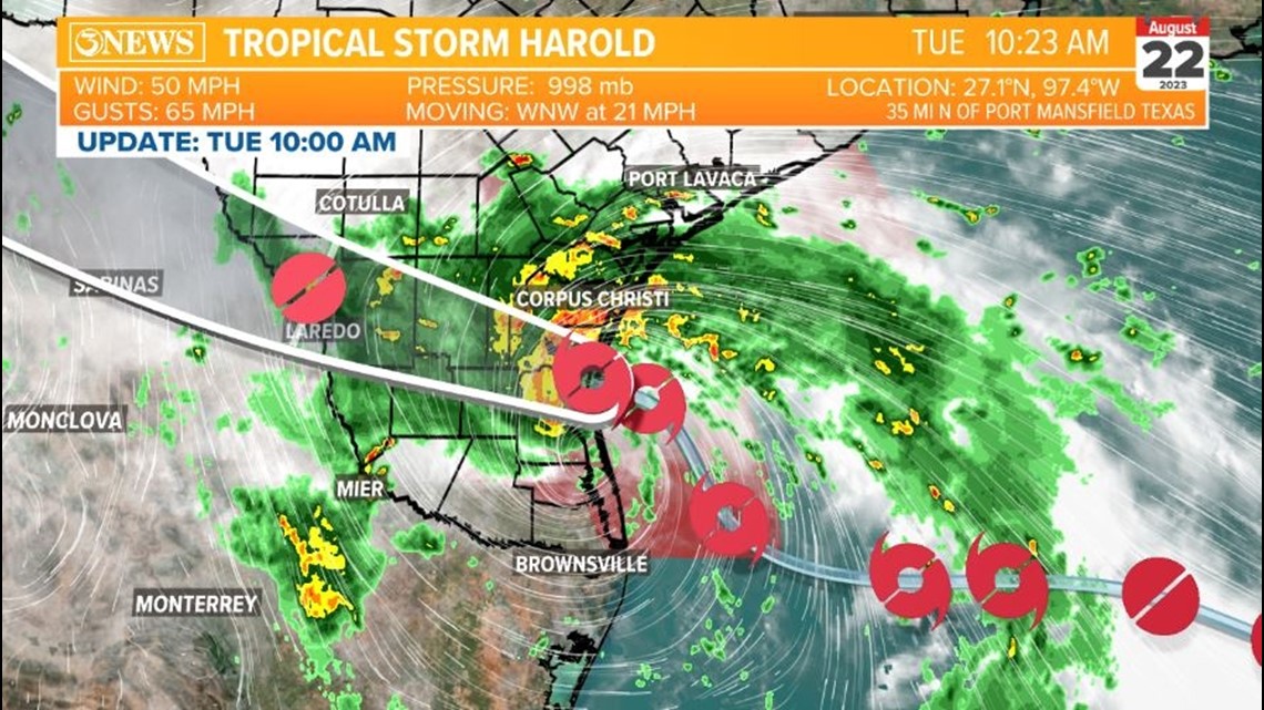
While the season wound up being a bit more active than average, the Western Gulf of Mexico did manage to avoid any big storms. However, we did receive Tropical Storm Harold along the South Texas Gulf Coast on August 22.

Initially dubbed "Potential Tropical Cyclone Nine" on August 21, Tropical Storm Harold was named at 1:00am August 22 - less than 9 hours before landfall. Harold's formation marked the fourth Atlantic storm to form within 39 hours, breaking a previous record of 48 hours set in both 1893 and 1980.
Harold made landfall as a 50 mph tropical storm on Padre Island in northern Kenedy County at 9:50am on August 22. This was the first named storm to make landfall in Texas since Hurricane Nicholas in September 2021.
Peak wind gusts topped out at 67 mph on Loyola Beach in Kleberg County. Corpus Christi recorded a 48 mph sustained wind and a 59 mph wind gust.


Hours before landfall, the center of Harold reformed and jumped northward, forcing the National Hurricane Center to adjust their forecast cone.
Sometimes when a weak tropical system is in the process of strengthening and there's not yet a well-defined eye, the center of a developing storm can jump around. This also happened several times with Nicholas.
Harold ended up making landfall 50 miles south of Corpus Christi and 35 miles north of Port Mansfield, where it was expected to make landfall before the center jumped northward.

The path of Harold brought some much-needed rain to the Coastal Bend and to both watersheds. Most locations picked up two to four inches of rainfall. The highest reported rainfall from Tropical Storm Harold was 6.11" in Calallen.
Corpus Christi International Airport picked up 4.74" of rain, setting the August 22 daily rainfall record. This broke the previous record of 4.56", set in 1999 when Hurricane Bret hit Kenedy County in a similar spot.
Click here to view a post from Meteorologist Kristin Walla that shows rainfall for all reporting locations around the Coastal Bend.

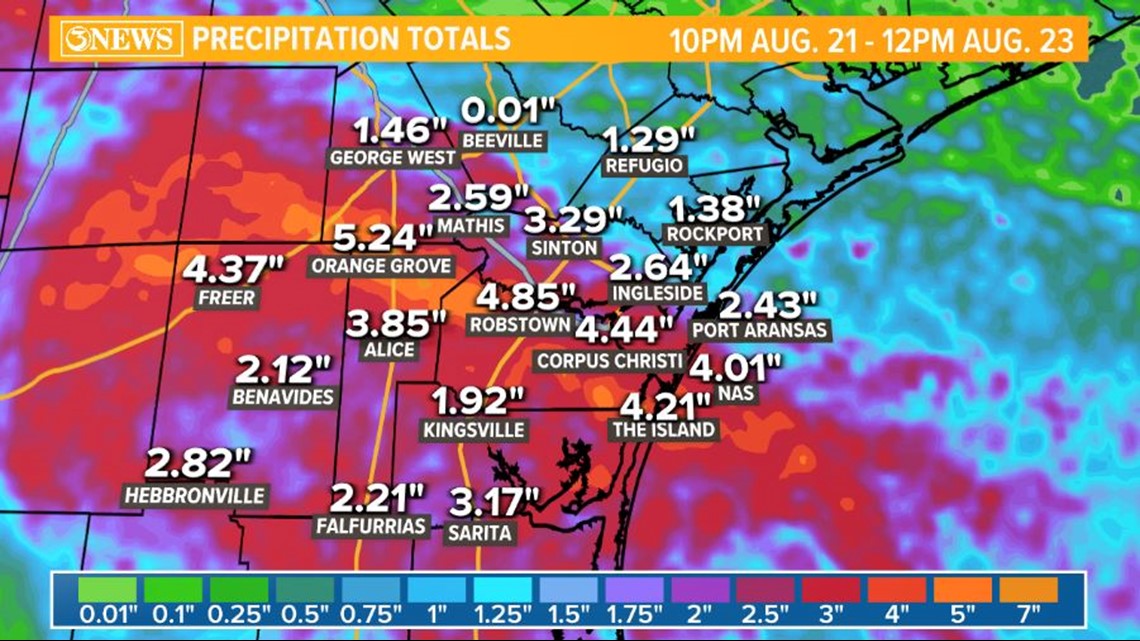
Most of our rainfall this summer came from Tropical Storm Harold. From June 1 through August 21 we'd received a measly 1.19" of rain, putting us as the eighth driest year on record for that timeframe. Harold dropped 5.04" of rain over August 22 and 23, bringing our total for the summer to 6.23".
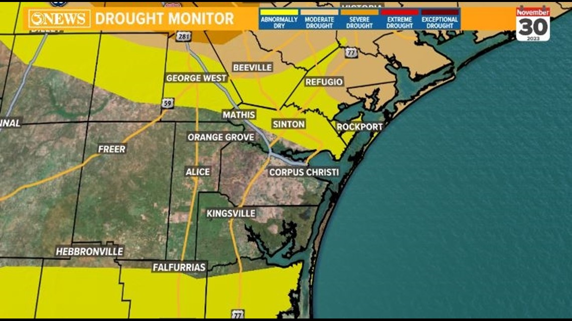
Harold brought much of the Coastal Bend out of drought, and El Niño has helped push out drought with more rain this Fall. However, not much rain has fallen in the watershed. Current combined lake levels as of November 30 are at 31.9% full.

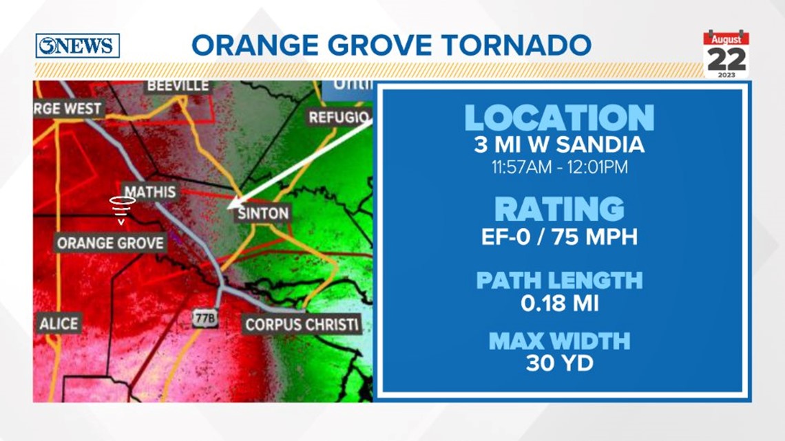
While we all received beneficial rainfall, some folks around the Coastal Bend had to deal with tornadoes, which typically spin up in the outer bands of a tropical storm. We had multiple tornado warnings but only two confirmed tornadoes. The first touched down south of George West.

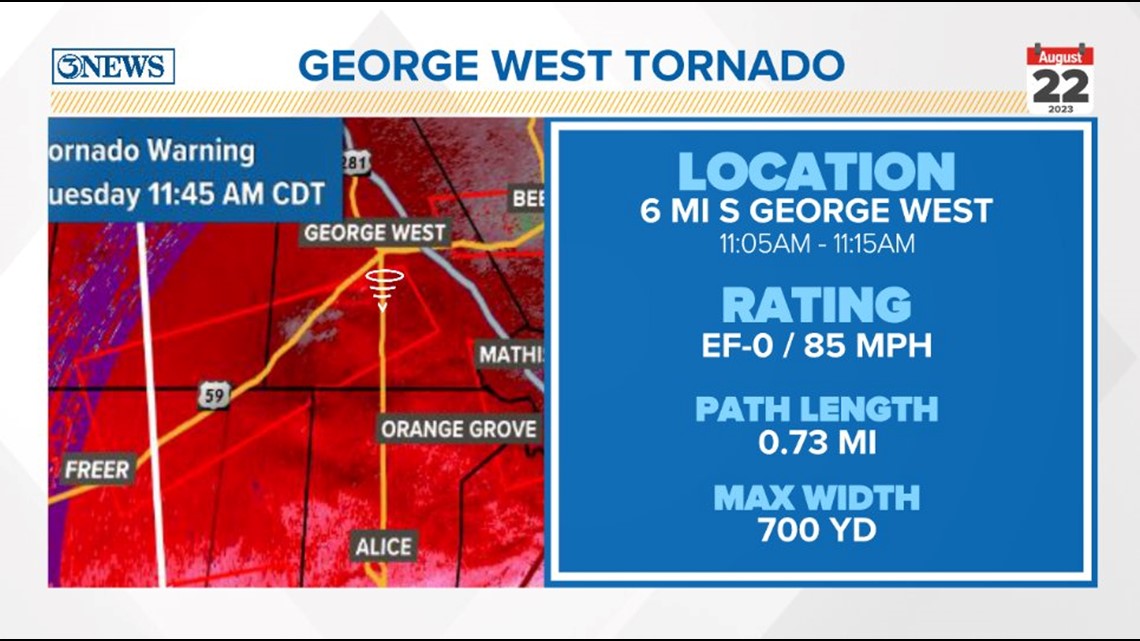
The second confirmed tornado touched down west of Sandia, or north of Orange Grove. Both tornadoes were given an EF-0 rating.

Now that we've covered what Hurricane Season looked like in the Coastal Bend, here's what went down in the rest of the Atlantic.
According to NOAA, 2023 ranks fourth for the most named storms in a hurricane season. This season also ranks as the most named storms during an El Niño on record.
There were 19 named storms this year, but there were actually 20 storms in total. How is that even possible?

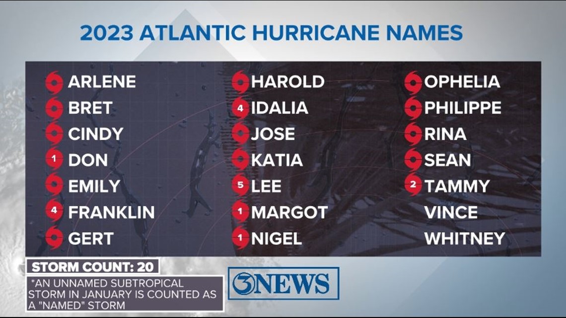
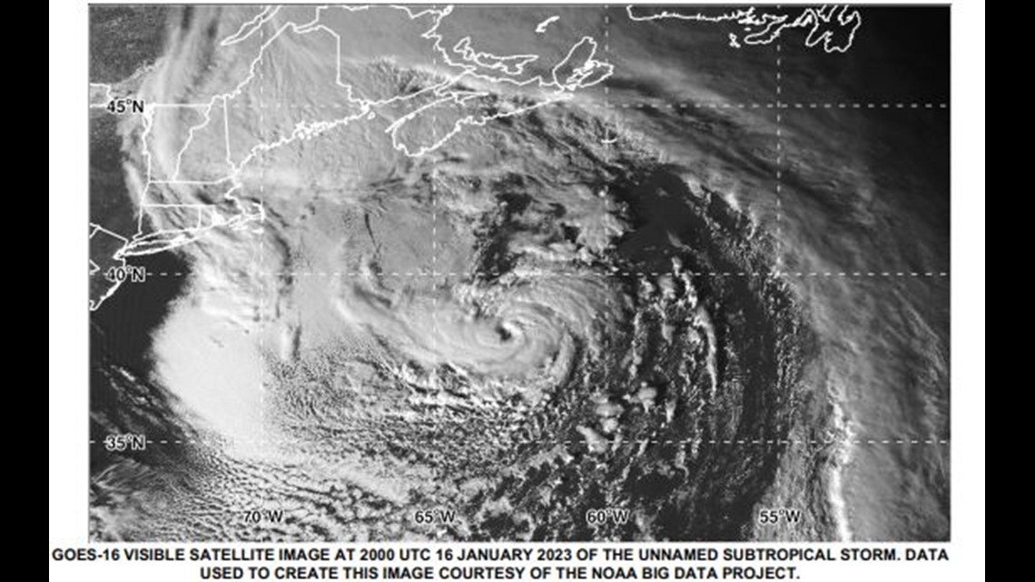
A subtropical storm from early January met the requirements of a named storm and had tropical storm-force winds. However, this was realized retroactively because of its location in the subtropics (rather than the tropics). The storm ended up not getting a name.
If the National Hurricane Center had jumped on the storm and given it a name in January, it would have been Subtropical Storm Arlene.
Instead, actual Tropical Storm Arlene formed in the Eastern Gulf of Mexico on June 2 - the second storm of the 2023 Atlantic Hurricane Season. Arlene was a brief storm, lasting only one day.

The first hurricane of the season was Hurricane Don, which, funnily enough, initially formed as a subtropical storm on July 14. Don finally achieved hurricane status on July 22. Based on climatology, the average first hurricane forms on August 11.
A little over a month later (around the time we were dealing with Harold), Hurricane Franklin formed and crossed Hispaniola as a tropical storm. Franklin underwent a period of rapid intensification, strengthening 45 mph in 10 hours, before passing between the East Coast and Bermuda. It became the first major hurricane of the season with maximum sustained winds of 150 mph.
Four storms made landfall in the US this year: Harold, Idalia, Lee, and Ophelia.
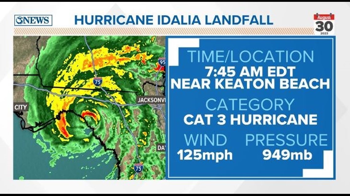
Hurricane Idalia was the only US-landfalling hurricane this hurricane season. Idalia was a Category 4 hurricane at its strongest, with winds of 130 mph. It slightly weakened just before making landfall in the Big Bend of Florida as Category 3 hurricane just over a week after Harold made landfall in the Coastal Bend.
Idalia's landfall was a bit of uncharted territory: The strongest hurricane to make landfall in this area of Florida prior was the the Cedar Keys hurricane in 1896, with winds of 125 mph. Hurricane Michael (2018) had winds of 155-160 mph but made landfall west of this area.
Idalia caused $2.5 billion in damage.

Then came Lee. Hurricane Lee was the strongest storm and only Category 5 hurricane of the 2023 Hurricane Season. While over the open Atlantic, Lee packed sustained winds of 165 mph and gusts up to 200 mph (EF-5 strength in tornado terms). Lee was the eighth Category 5 hurricane since 2016.
Like Franklin, Hurricane Lee also underwent an impressive rapid intensification, gaining strength from an 80 mph Category 1 on September 6 to a 165 mph Category 5 on September 7.
For more info on Category 5 hurricanes, check out this weather blog, written around the time Lee was an active storm.
Lee was primarily an open-ocean Atlantic storm that turned north and headed toward New England. By the time it made landfall, Lee had weakened to a post-tropical low with 70 mph winds - strong tropical storm-force. It in made landfall in Nova Scotia, Canada.

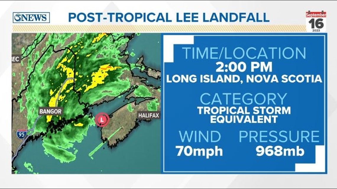
An interesting tidbit resulting from Lee this year: the state of Maine spent the most time in an NHC forecast cone than any other state. We spent around 30 hours within a forecast cone here in South Texas. Parts of Eastern Maine spent over 96 hours (four days) within a forecast cone.
Lee also spent six days as a major hurricane - that's more "major hurricane days" than the entire 2022 Hurricane Season produced.


By the time Hurricane Margot came around in early September, we had 56 "named storm days" - also surpassing the total amount from the 2022 Hurricane Season. We also surpassed another 2022 season total with Margot - the amount of "ACE" we accumulated.
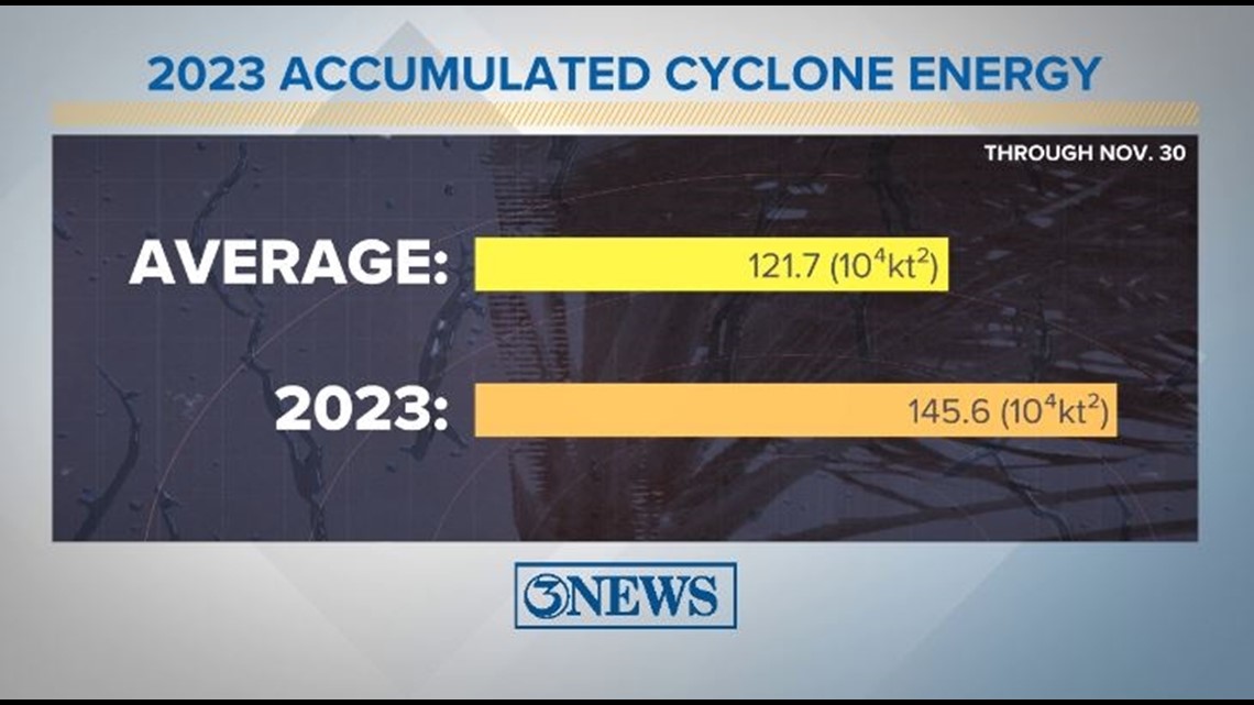
Through the season, we monitor a parameter called "accumulated cyclone energy," or "ACE." This is an integrated metric accounting for storm frequency, intensity, and duration. Basically, it's a putting a number to the amount of energy released by tropical cyclones during a season. It helps us identify how active a given hurricane season is or is not.
If you have a season with a lot of named storms but the ACE is lacking, then you know a lot of the storms were weaker.
This season the ACE was above average for the Atlantic Basin, which jives with the higher than normal storm count. The average ACE for a given tropical season is 121.7. The 2023 Hurricane Season observed an ACE of 145.6.

In addition to the 19 named storms and unnamed subtropical storm, there was also a short-lived tropical depression and a potential tropical cyclone towards the end of the season - both in the Caribbean.
Before the season started, we keyed in on a stat that still holds true after the 2023 season: There is no record of a Texas landfalling hurricane during an El Niño year.
Cheers to making it through another hurricane season along the South Texas Gulf Coast. Hope you enjoy the cooler months ahead!