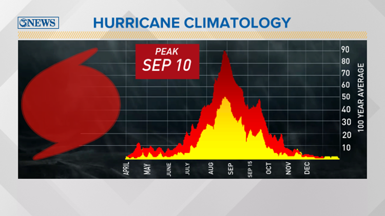
Today marks the statistical peak of hurricane season. If you’re wondering why today, it’s a combination of mainly two factors. First and foremost, it’s the end of summer. The heat of summer warms the ocean waters which is fuel for tropical systems in the northern hemisphere. Hurricanes, in fact, need water temperatures above 80 degrees Fahrenheit to sustain tropical development. Typically, deep ocean waters are either at this temperature or well above it in the summer time within the dates of hurricane season. This is from June 1 to November 30. The other side to this coin is wind shear. Wind shear is the increasing of wind speed with height. Hurricanes need calm winds from the surface up to strengthen. Typically, wind shear is weak through August and September and it reaches a minimum. This will aid in more tropical growth along the equator. A phenomena that can impact these factors is ENSO. This is the El Nino Southern Oscillation. Depending on whether El Nino or La Nina is strong, weak or neutral, this will impact wind shear and sea surface temperatures of the Atlantic and Pacific Ocean.
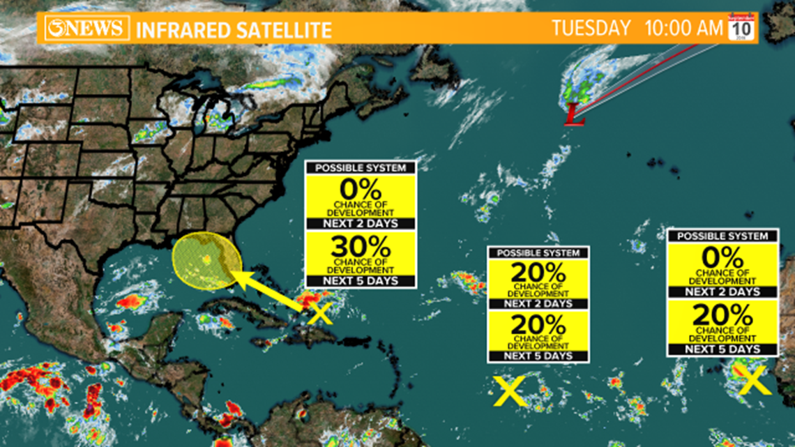
A lack of wind shear and warm ocean water is a recipe for destruction for easterly waves working off the coast of Africa. We have a few disturbances that bear watching. In fact, the National Hurricane Center is watching one off the coast of Africa. At the moment, it only has a 20% chance of development. This could change over the next few days due to a lack of wind shear. Farther west, there is another area of interest. This has similar odds at development as it moves west into the Caribbean Sea.
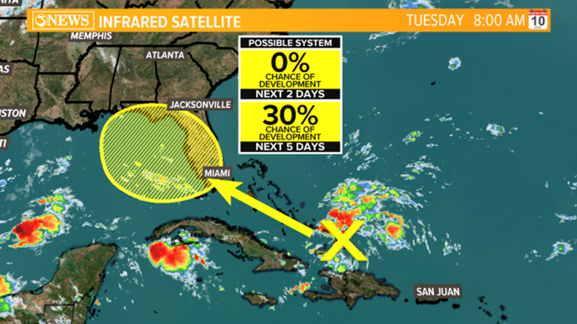
The one that has social media buzzing is a disturbance that is southeast of the Bahamas that is expected to drift into the eastern Gulf of Mexico. At the moment, it has a 30% chance at developing into our next named system. This will be interesting to watch through the weekend. This potential system will provide rain for the southeast gulf. Also, this will have to move through a slightly unfavorable environment this week.