
CORPUS CHRISTI, Texas — Updates on this section of our webpage will end with the 4pm Harold update
AUG 22 4PM UPDATE
Harold is now a tropical depression with 35 mph winds, moving west/northwest at 21 mph. It is still dragging in feeder bands from the gulf across the Coastal Bend. Some of these rain bands are still dropping heavy rains.


As Harold continues inland, rain chances will trend down and coverage will decrease. Still, tropical feeder bands will remain possible this evening, overnight, and into Wednesday morning before Harold completely falls apart near the Big Bend area of Texas early Wednesday.


--------------------------------------------------------------------------
Tropical Storm Harold will move into South Texas on Tuesday morning.
The greatest impacts will be Tuesday morning 5 a.m. - noon.
4AM UPDATE:
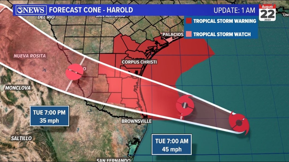
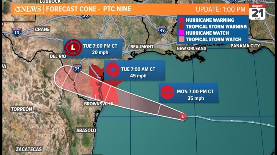
The forecast for Tropical Storm Harold has shifted south this morning. Landfall is still south of Baffin Bay, but closer to the Valley.

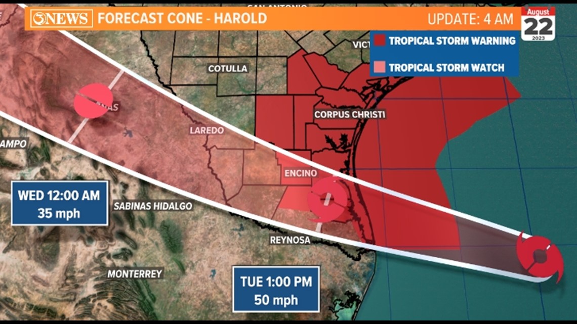
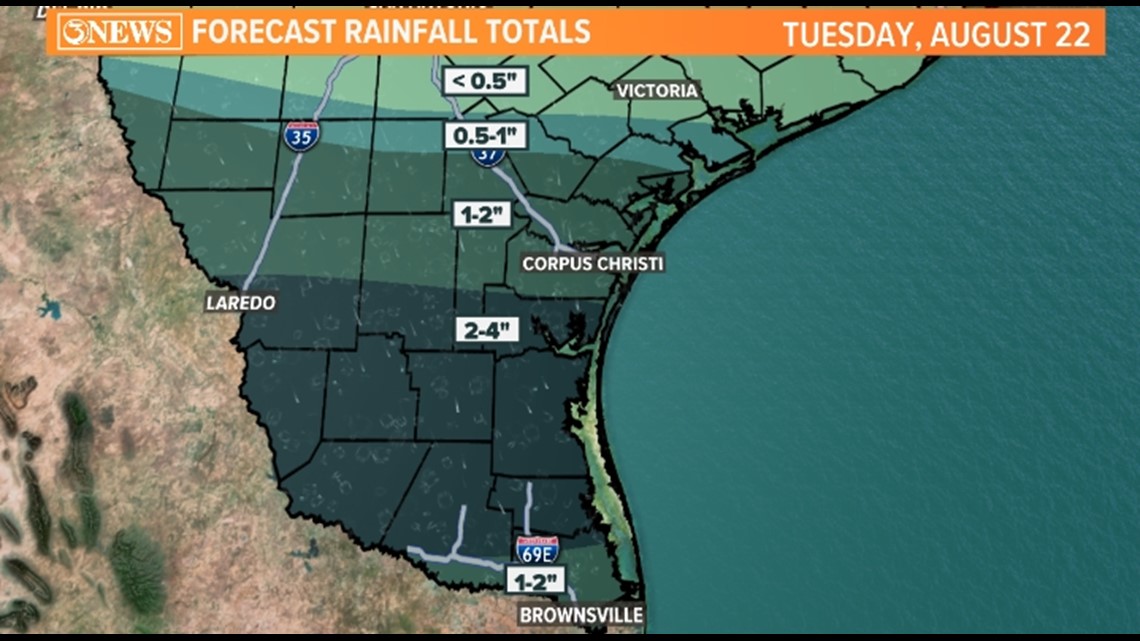
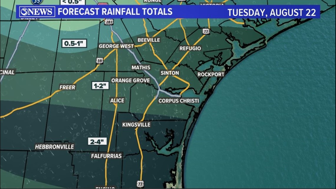
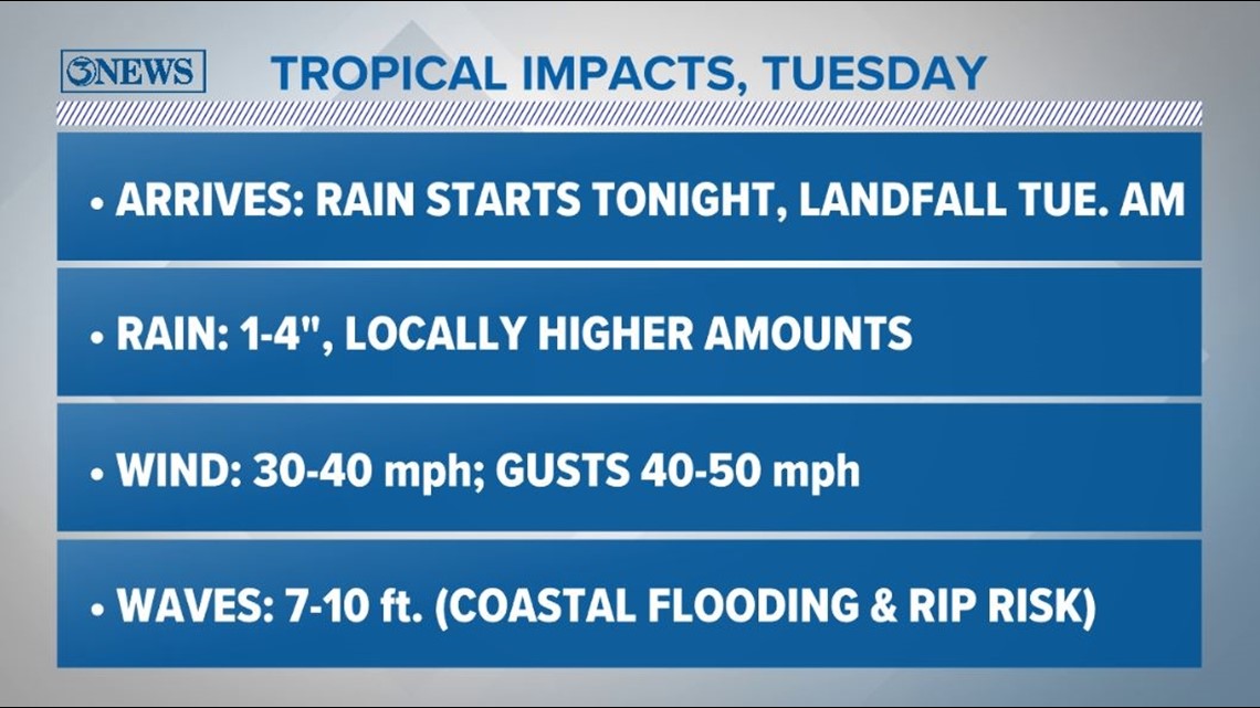
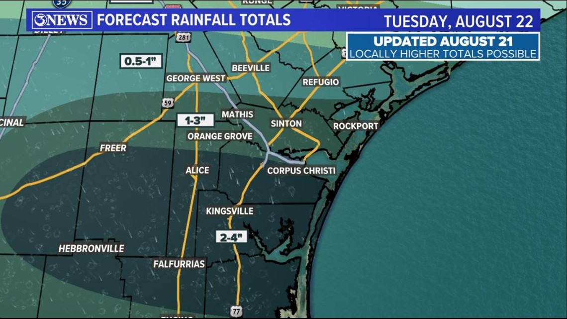
Impacts are still very similar for the Coastal Bend. Even though we are outside of the cone, tropical storm conditions are still possible. We are still expecting 1-4 inches of rain for most of the area with 2-4 mostly Kingsville and south of there.

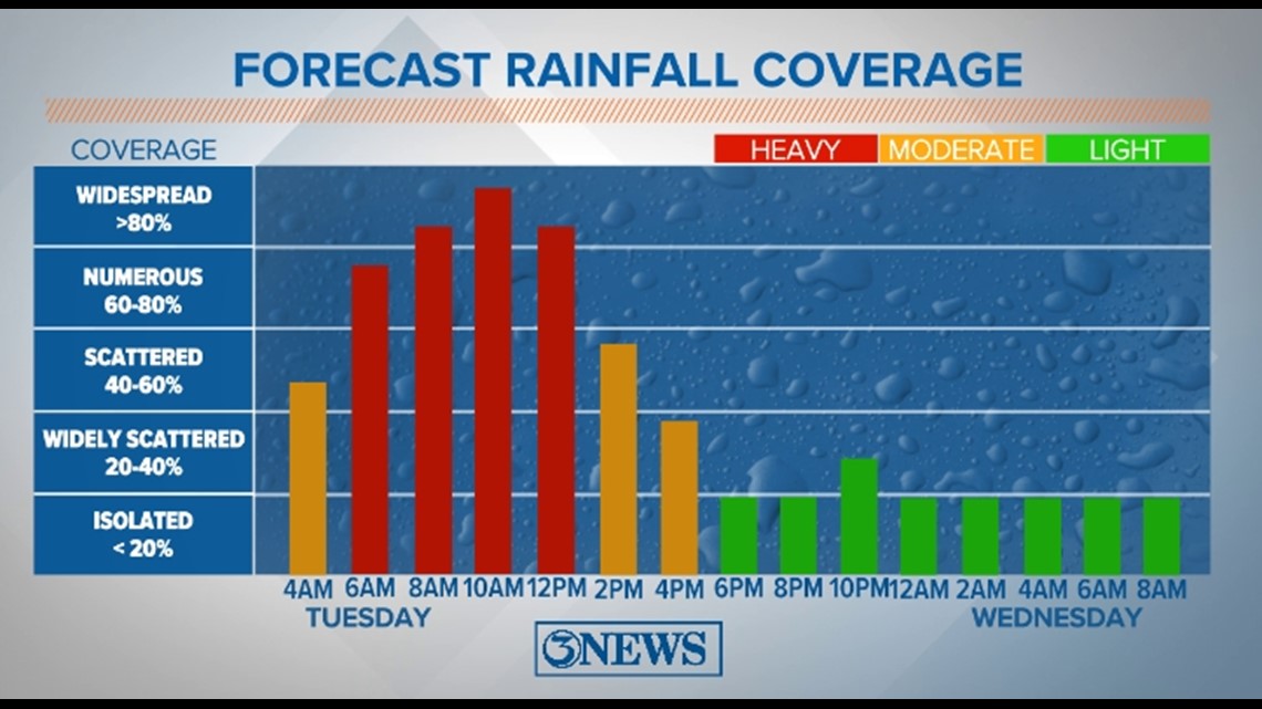
The heaviest rain will be between now and 11 a.m.

The highest wind gusts will be in Southern Baffin Bay closer to the center of the storm. Some higher wind gusts will be possible farther north especially with a risk of tornadoes in the outer bands.


1AM UPDATE:
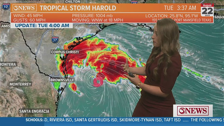
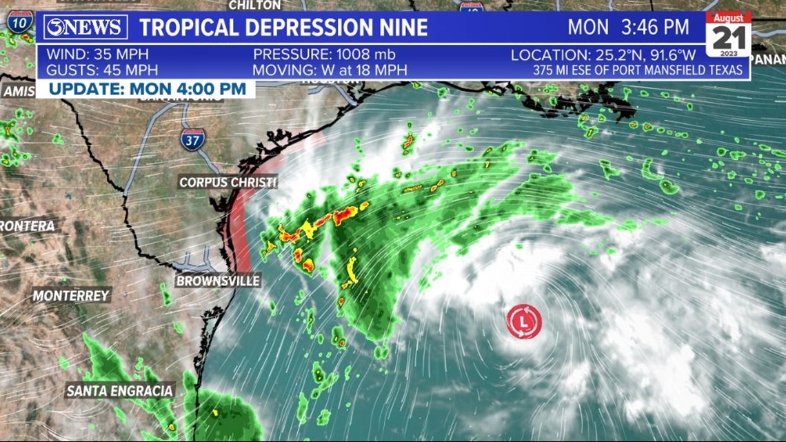
Tropical Storm Harold has developed in the Western Gulf of Mexico. It has 45 mph winds and is moving WNW at 18 mph. It's inside 200 miles from the Texas Gulf Coast.

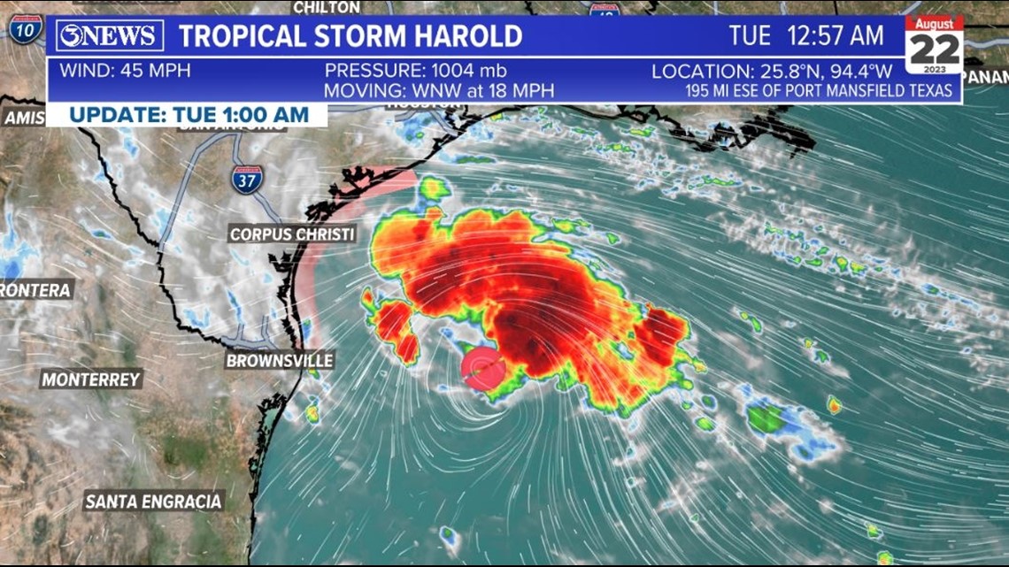
While this is now a tropical storm, the forecast details remain the same. We are anticipating Harold to move in to South Texas between the Valley and Baffin Bay on Tuesday morning as a tropical storm.

The forecast information from the 10pm update below remains unchanged.
10PM UPDATE:
Our tropical system remains a tropical depression with 35 mph winds in the Gulf of Mexico. Moving west at near 20 mph. It's that fast forward movement/lack of time in the gulf that will limit how much this storm can strengthen.

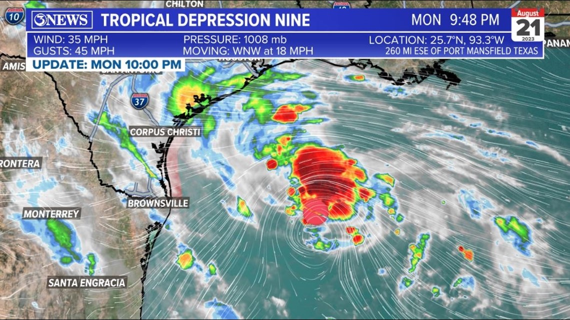
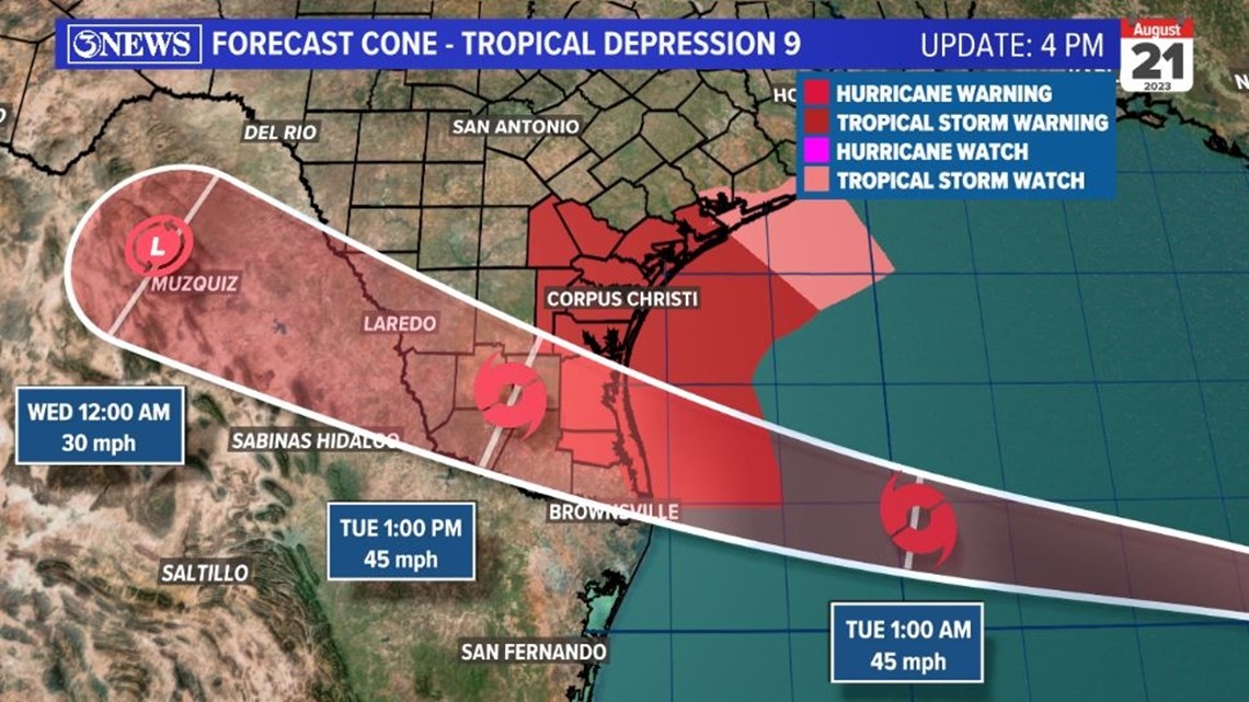
The National Hurricane Center's forecast cone remains relatively unchanged. A slight nudge northward from the 4pm update, but this update offers no significant changes to the outlook, Tuesday. Into South Texas Tuesday morning as a tropical storm; likely Harold. Tropical Storm Warnings in effect for areas shaded in dark red.

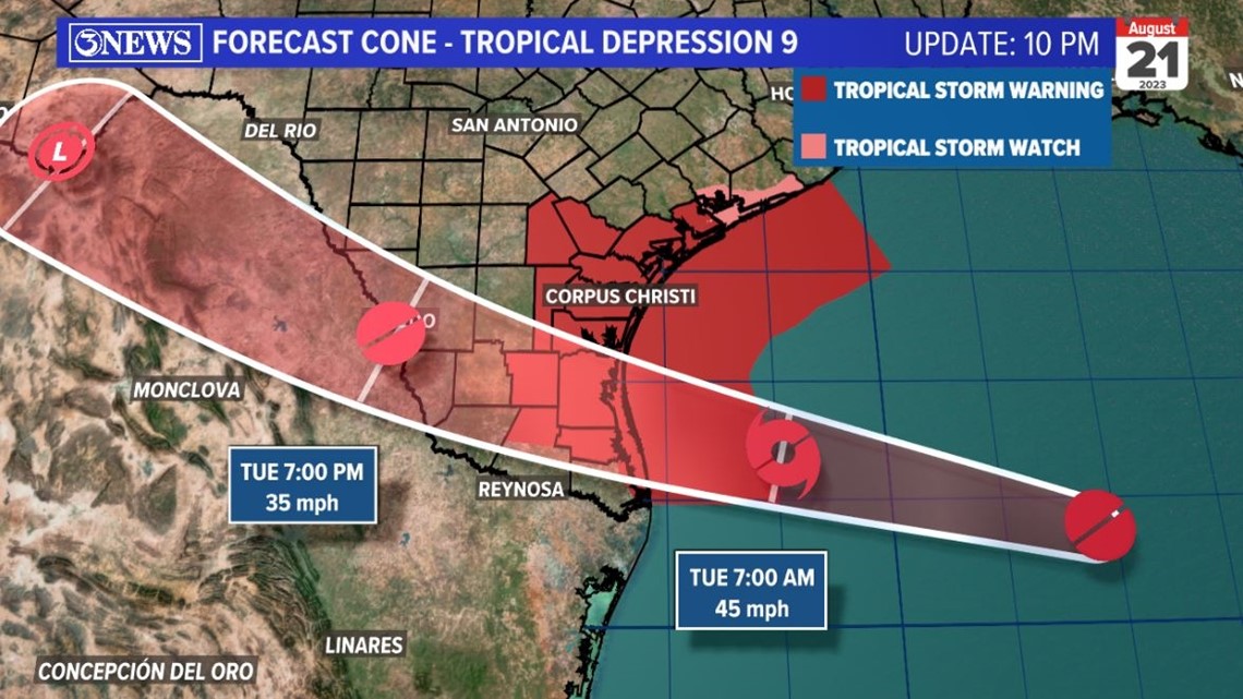
There will be tropical storm force conditions in parts of the Coastal Bend. Tropical storm force is 39-73 mph winds...we will be on the lower end of that scale. Still, it's enough wind to cause minor damage and isolated power outages. If a branch snaps and falls on to a power line, it could easily create an outage. Strongest winds will remain close to the center of where the storm moves in.


Rainfall will be between 1-4" throughout the Coastal Bend. High values closer to and north of the storm's center. Highest values will likely be south of HWY 44.

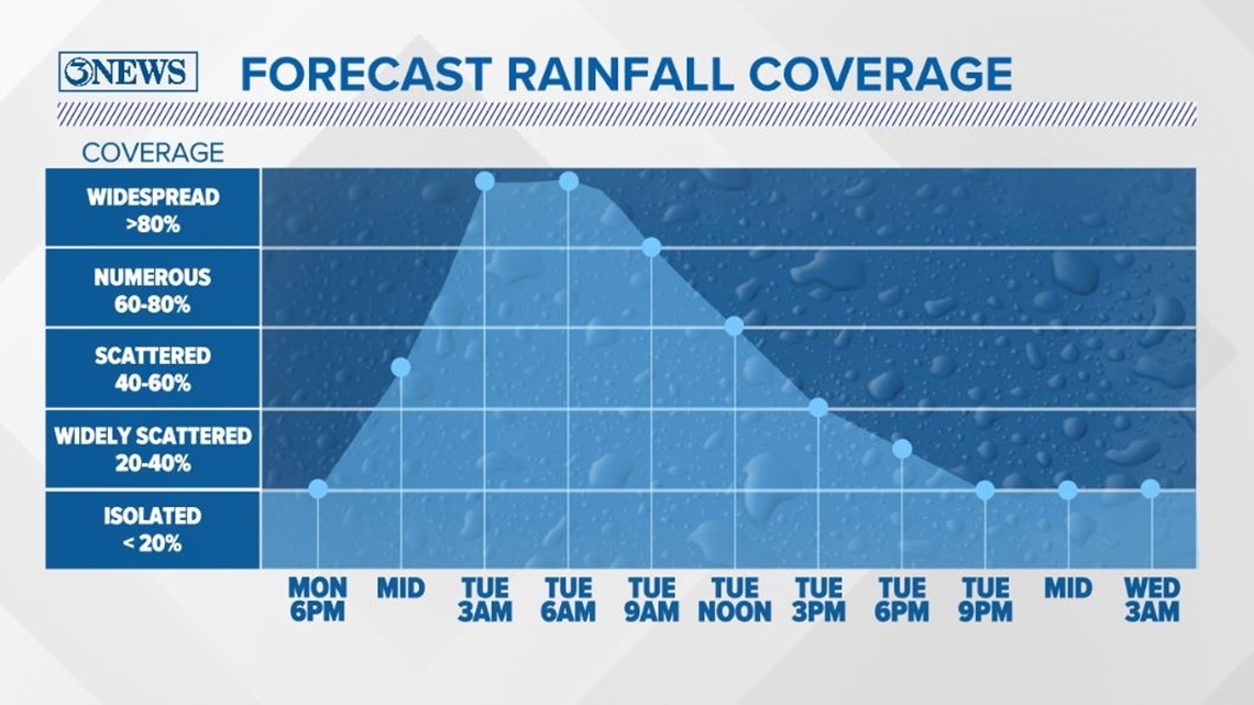
The time for the most rainfall coverage will be between 4am and 10am in the Coastal Bend.

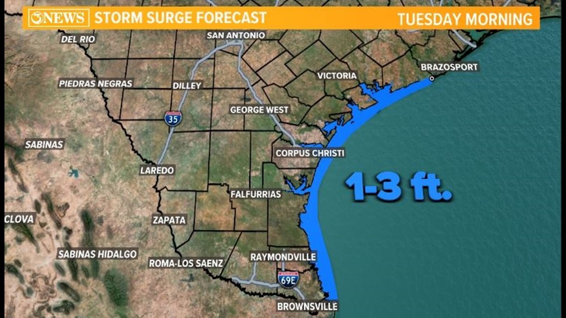
1-3 ft. storm surge expected on area beached/coastal areas. For perspective, Hurricane Hanna brought a 3-6 ft. surge to our area. So, this will not be bringing a rise that high. High rip current risk on area beaches and coastal flooding expected, Tuesday.

Quick forecast notes on Coastal Bend impacts, Tuesday.

4PM UPDATE:

Tropical Depression 9 is forecast to move into the South Texas Gulf Coast on Tuesday morning around 8 am as a tropical storm.

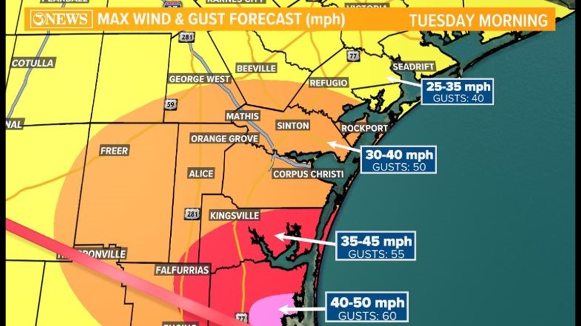
The strongest winds with this system will be close to where the center moves in, which is right now forecast to be south of Baffin Bay in Kenedy County. 40-50 mph winds with gusts up to 60mph near the center of this storm. Corpus Christi should be prepared for 30-40 mph winds; gusts up to 50 mph.

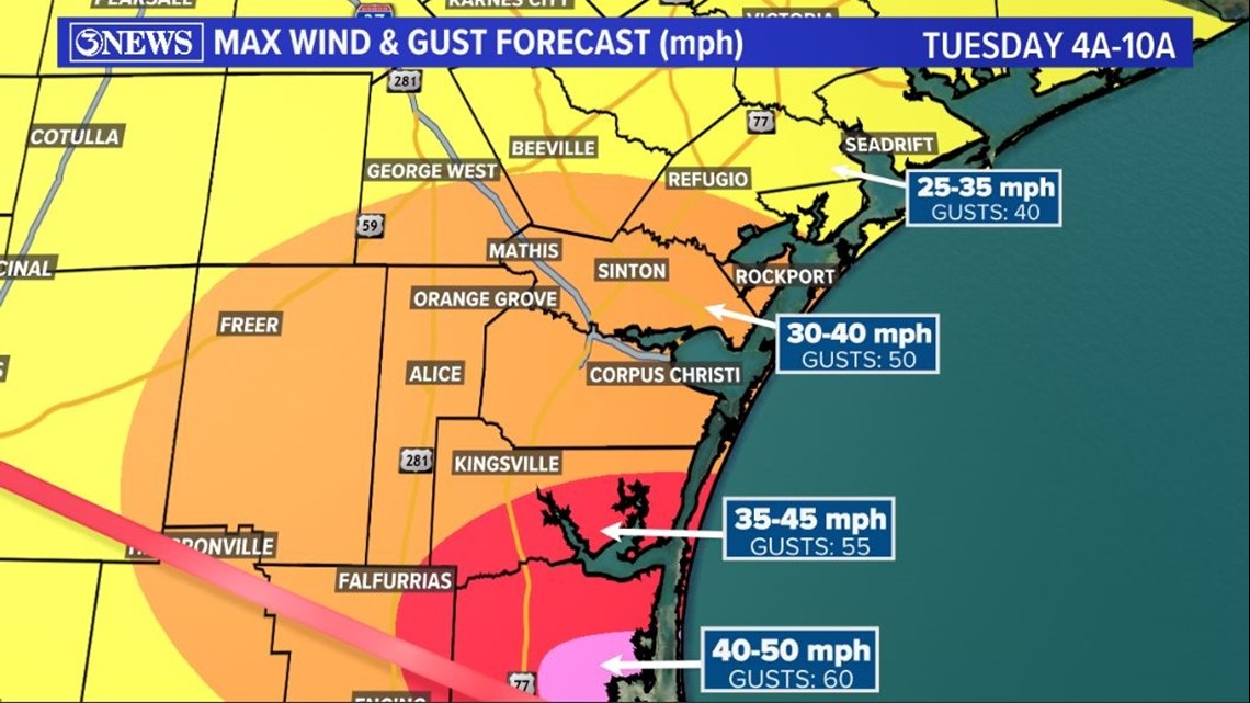
Power outages will be possible on Tuesday morning. Something to consider in your preps. Also, clean up loose items around your homes or apartment balconies.


We aren't expecting a massive amount of rain with this system, in part because of it's fast forward movement. The best chance for heavy rains will be between 4am and 10am, Tuesday. 2-4" for much of the Coastal Bend with isolated higher totals possible. The highest rainfall totals will be north of the storms center.

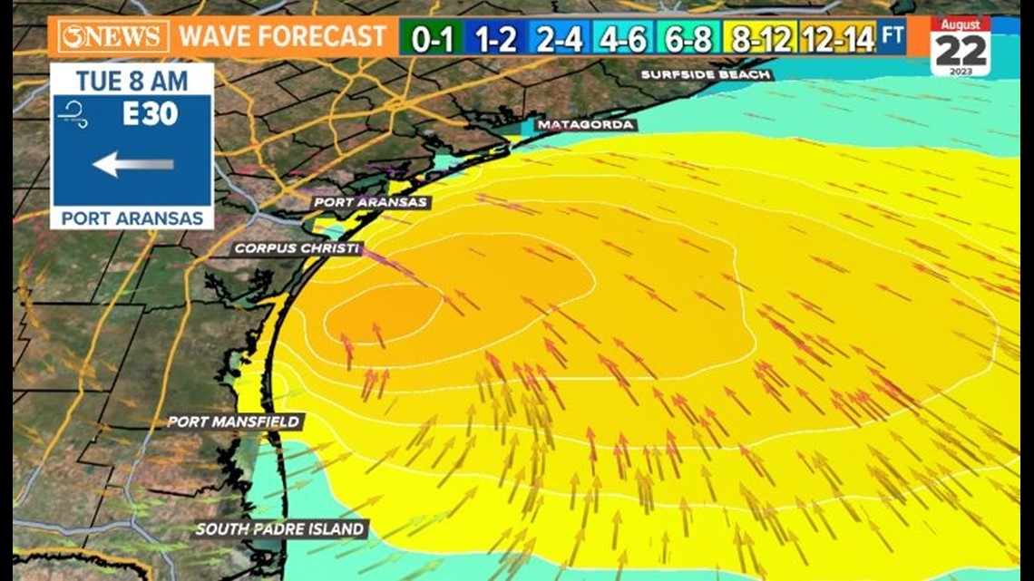
On area beaches, 7-10 ft. waves will be in the near-shore gulf waters. That will lead to coastal flooding and a high rip current risk. 1-3 ft. storm surge will also be possible. For perspective, Hurricane Hanna in 2020 brought a 3.73' surge to the Texas State Aquarium and nearly a 6' surge to the Bob Hall Pier area. I don't see this system bringing surge that high.
Holt out
------------------------------------
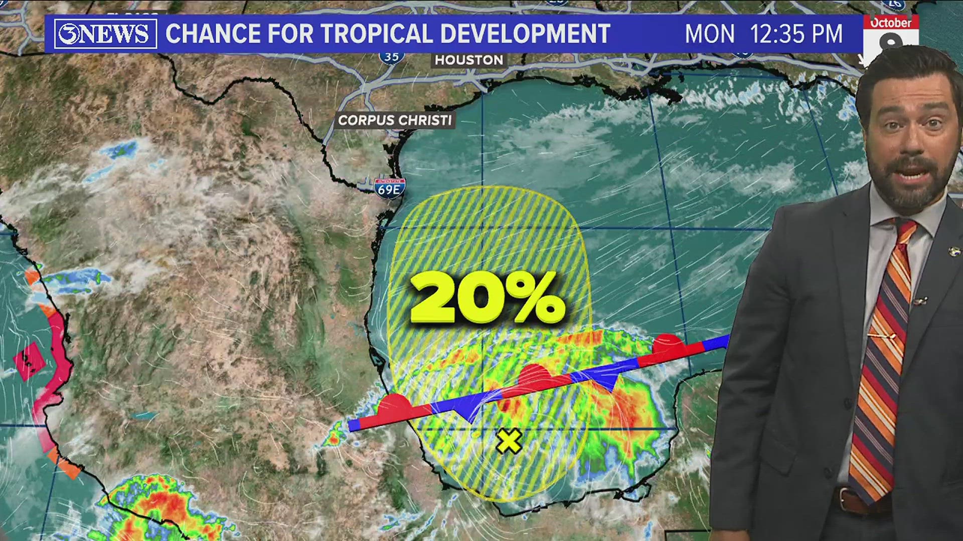
1 PM UPDATE: The National Hurricane Center has now labeled the disturbance in the Gulf of Mexico as Potential Tropical Cyclone Nine.

Expect, minor wind damage, power outages, localized flooding from heavy rainfall, 1-3 ft storm surge along the coast, and coastal flooding.
A tropical depression is likely in the Gulf of Mexico this evening. The system will have to battle wind shear in the Western Gulf, but overall the conditions are conducive to developing into Tropical Storm Harold just before landfall Tuesday morning.
A tropical storm warning is issued for all of the Coastal Bend Counties over the next 36 hours.


Tropical Storm Force winds will be possible mostly in Kenedy County early Tuesday morning. The strongest wind will be 3 AM - Noon. Winds will be 30-40 mph across the Coastal Bend with gusts up to 60 mph along the coast mostly in Kenedy County.

Rainfall coverage will increase overnight. Heavy downpours will lead to flooding. The timing of this system is right during the morning commute. Plans may need to be made to stay home or leave late. School cancelations or delays will be likely.


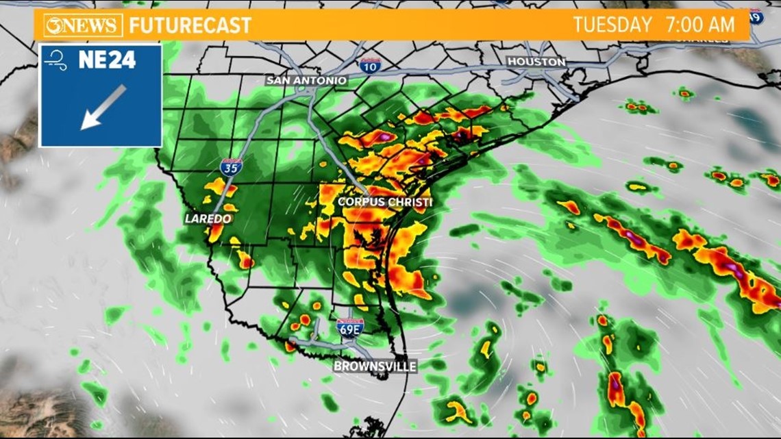
The highest rainfall totals will be across our southern counties with 2-4 inches likely. Isolated areas will receive higher rainfall totals where feeder bands set up. Flash flooding will be a concern. The ground will soak up a lot of the rain, however with it being so dry it may run-off fast at the beginning before it is able to soak up. Here is an idea of what the radar may look like Tuesday morning during the commute for school and work.

Areas along the coast should prepare for 1-3 ft storm surge. Coastal flood warnings are in place. Water will likely cover the beach and may reach property near the beach. Waves will be strong and dangerous around 10 ft as the storm is moving in Tuesday morning around 6 AM - 10 AM. Shoreline erosion will be possible with dangerous rip current. A Coastal Flood Warning is in place Monday 7 PM - Tuesday 7 PM.