


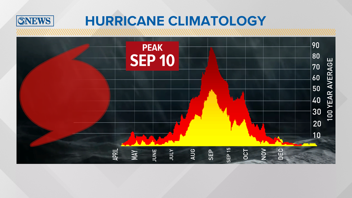
On average, the peak of hurricane season is September 10th for the Atlantic.

Within the season, numerous agencies and universities release their forecast at different times. Moreover, some update their forecast through the season based on changes in water temperatures, enhanced monsoons, the change between El Niño and La Niña. Many factors influence our hurricane season.
With that being said, Colorado State University recently updated their 2020 hurricane outlook. CSU is a renown university that focuses on tropical forecasting. Additionally, they’ve added more storms to their forecast through November.
When looking at these numbers, keep in mind, the 9 tropical systems we’ve already seen is included in their forecast.
Colorado State University updated outlook is below.

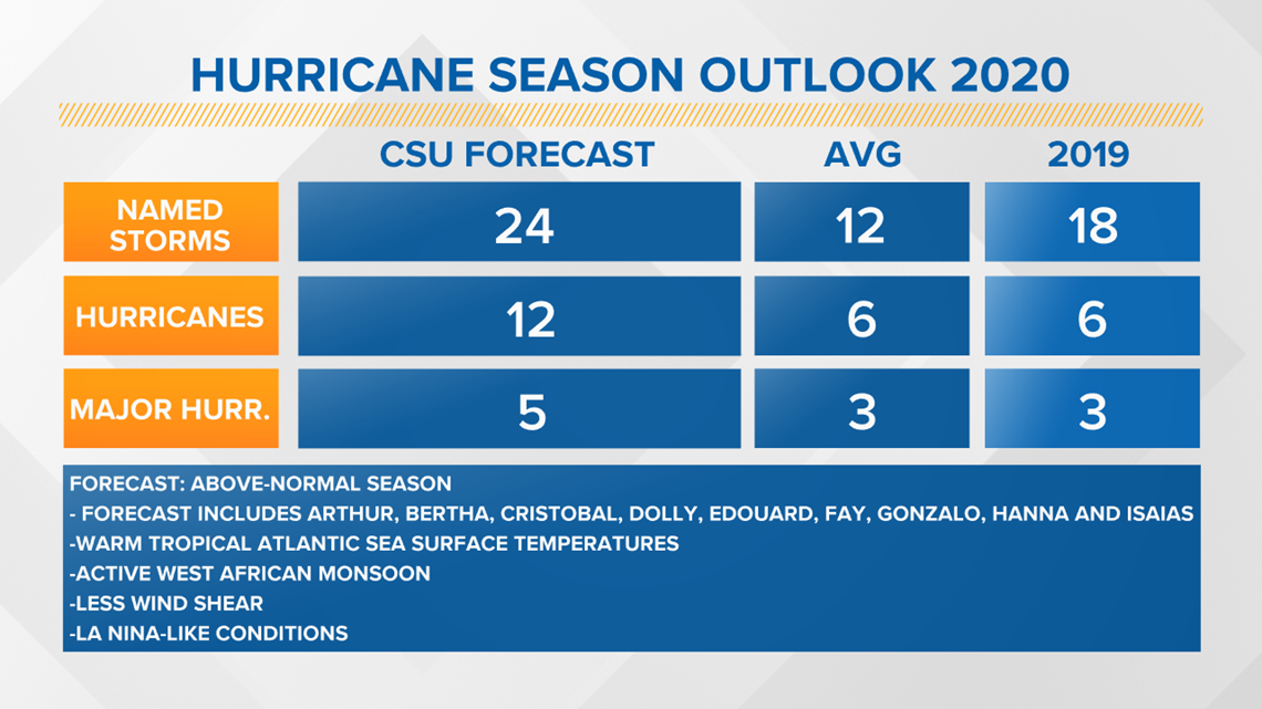
CSU is calling for 24 named storms. Again, keep in mind, we’ve seen 9 already and 2 of those were hurricanes. Hanna and Isaias so you can subtract that from the total. Leaving potentially 15 named storms left in the season and of those 15, 10 could be hurricanes and of those 10, 5 could be major.
Major hurricanes are Category 3 and above.
While this is extremely above average, it begs the question, what do we do when we run out of names?
To sum it up, we would resort to the Greek alphabet.
So after Wilfred, we go to Alpha, Beta, Gamma, Delta, etc.

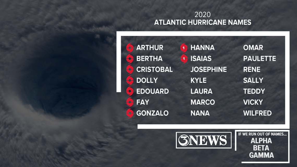
Last time this occurred was in the 2005 hurricane season which included hurricanes Katrina, Rita and Wilma.
Another question that will be asked, do we retire a “Greek” letter storm? From what I’ve read, the answer is no.
Despite a storm's potential damage to a location, "if" we went into the Greek alphabet, none of the tropical systems would be retired.
One of the reasons for this uptick in tropical activity is the absence of El Niño. Less wind shear allows for tropical waves to grow. In addition, warm tropical water and an increased African monsoon.
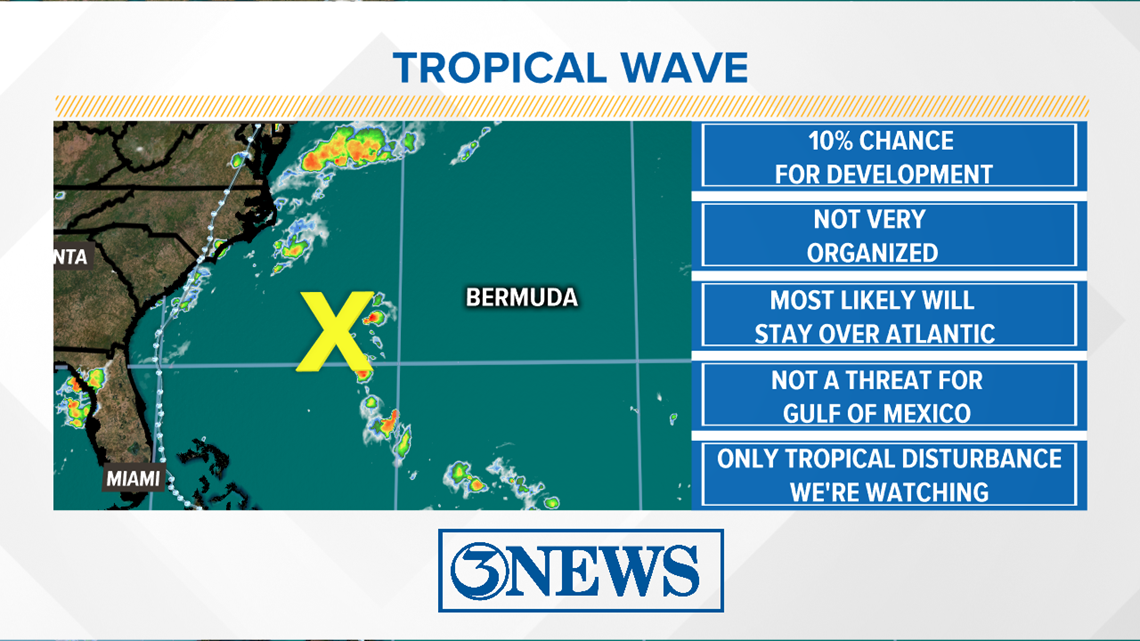
As of Thursday morning, only one tropical wave is being monitored. This wave is not a threat to land and will stay weak over the Atlantic Ocean.

Lastly, over the next couple months, you'll notice on social media snapshots of a 'hurricane moving into the gulf" or "a category 5 expected next month". These are only model runs. The accuracy of these forecast models decrease with time.

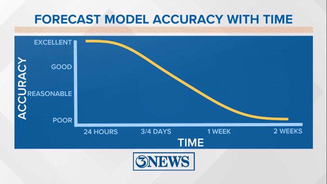
Take everything you see with a grain of salt and look at the time stamp. Some people on social media will post these model runs that are 2 weeks out.
Much can change in just a couple days.
The most reliable place to keep up with the forecast and tropics is here at 3 NEWS or at the National Hurricane Center's website.
Here's a link below to stay up to date on the tropics.
